To be honest, Mont Blanc wasn’t in my plans of peaks to tackle. After Kilimanjaro in 2014, it was a toss-up between it and Elbrus and I chose the latter, which I climbed in August 2016. But a friend of mine asked me to try it together for his birthday so we started making plans. I figured it was a good way to keep in shape for higher altitude mountains. Unfortunately, my buddy had to drop out a few months before the climb, but by that point I had already made up my mind so there was no going back 🙂
Mont Blanc (4,808m — though this varies depending on which year it was measured so you can often see it as 4,810m as well, for instance) is the highest mountain in the Alps and Europe, if you exclude Russia’s Caucus peaks where Elbrus reigns with its 5,642m. Unlike Elbrus, Mont Blanc is a slightly more technical peak and is beneficial if you’ve done other similar climbs and are used to alpine equipment like crampons, ice axes, walking in a rope team, etc. There is a also a fair bit of rock scrambling on the “normal” route. Of course, any guided tour will give you the basics, but coming prepared does help. “Fun” fact, just by sheer numbers it’s actually one of the deadliest mountains in the world — mostly because its accessibility lures ill prepared people in and if conditions worsen, they aren’t ready. So be smart.
There are a few routes up the mountain, with the standard one being the Goûter route which we took as well. Expected time for that is 2 or 3 days, excluding any prep ones. I signed up to climb with a Bulgarian group which was driving from Sofia and was planning on straight up going up the the morning after arrival. But I wanted to spend a couple of extra days higher up so I flew in earlier and had that time to do some acclimatization treks, which I think certainly helped. Plus, the Chamonix area is gorgeous and it’s worth taking in the beauty and might of nature around you. Even if you’re not going to attempt Mont Blanc, I recommend spending some time — you can thank me later.
Overall I found it to be a much easier climb than Elbrus. For one, I was better prepared physically (have been doing workouts 5-6 times a week plus treks at least 2 or 3 times a month around Bulgaria for a while now), but also have more experience with these high altitudes and am better able to react in different situations. Also, I’ve built up my equipment and know how to use it. These things add up.
I’ve broken down the post into days to make it easier to follow and make it useful if you do want to go up.
Hope you enjoy it!
*****
Day 1: Trekking above Chamonix, up to ~2,500m
We arrived on a Friday afternoon and just chilled in Chamonix, looking up at the glorious views around us and making plans of what to do the next day. On Saturday morning the weather was largely great — a few low hanging clouds would every once in a while catch up with us, but overall it was perfect for hiking.
We decided to stick to around 2,500m, summiting Le Brévent (just above that altitude) and seeing a few lakes in the area. The whole Chamonix valley hillside is riddled with nice footpaths that give you plenty of opportunities for casual hikes, training walks / runs, or even some more serious treks (not to mention great rock climbing!).
The highest summits around us were often obscured by clouds, but every once in a while they would disperse briefly and we’d get glimpses of 4,000m+ peaks around us. This reminds me of some of the views in Nepal.
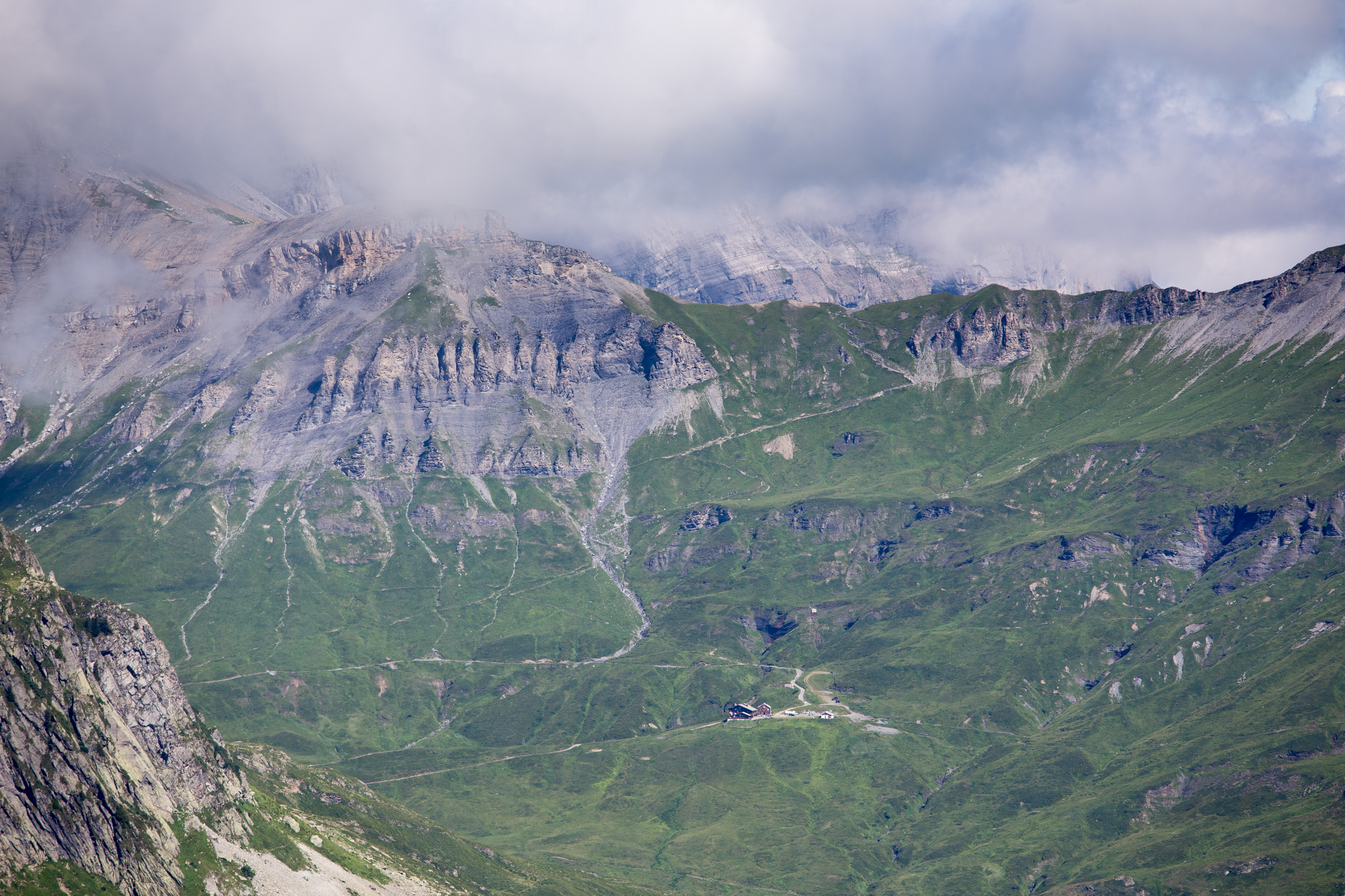
Mont Blanc itself was almost entirely covered in this silky-looking cloud the whole day. And it didn’t seem to want to move.

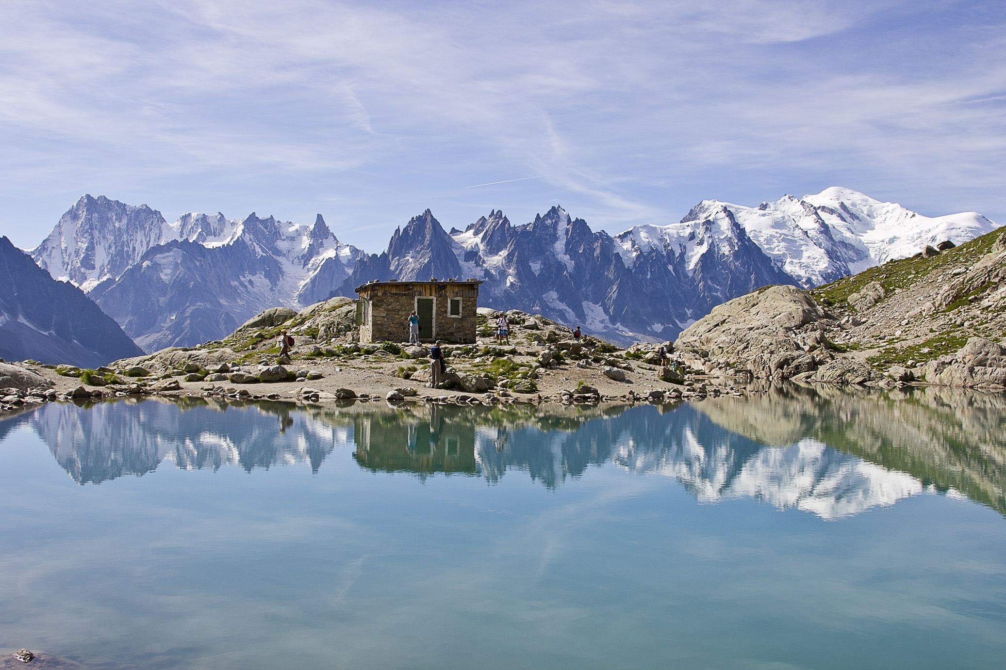
Lac Cornu, quite picturesque.

We’re at 2,400m here, overlooking other trekkers and Mont Blanc in the far distance.

Aiguille Verte (4,122m) and Chamonix down at the bottom.

At one point we heard a helicopter fly by really closely (normally they stay way above us) and saw it attend to someone who was probably injured. What piloting skills to get this thing so close to the ground! Notice the scale of the rock face here, crazy.
We finished our trek at Lac Blanc, but the weather wasn’t on our side so no photos from there. The below one I took back in 2012 (more shots from then here) when the conditions were perfect, just look at those colors! Overall a great warm up day.
Day 2: Aiguille du Midi, 3842m
The following morning (Sunday) I got up around 6am to catch the first gondola up to Aiguille du Midi so I can avoid the crowds and breathe some thin air. The day before the infamous peak was often covered, but this early in the morning the clouds hadn’t rolled in just yet.

Dawn in the valleys around Chamonix.

The cloud patterns continued to impress me.

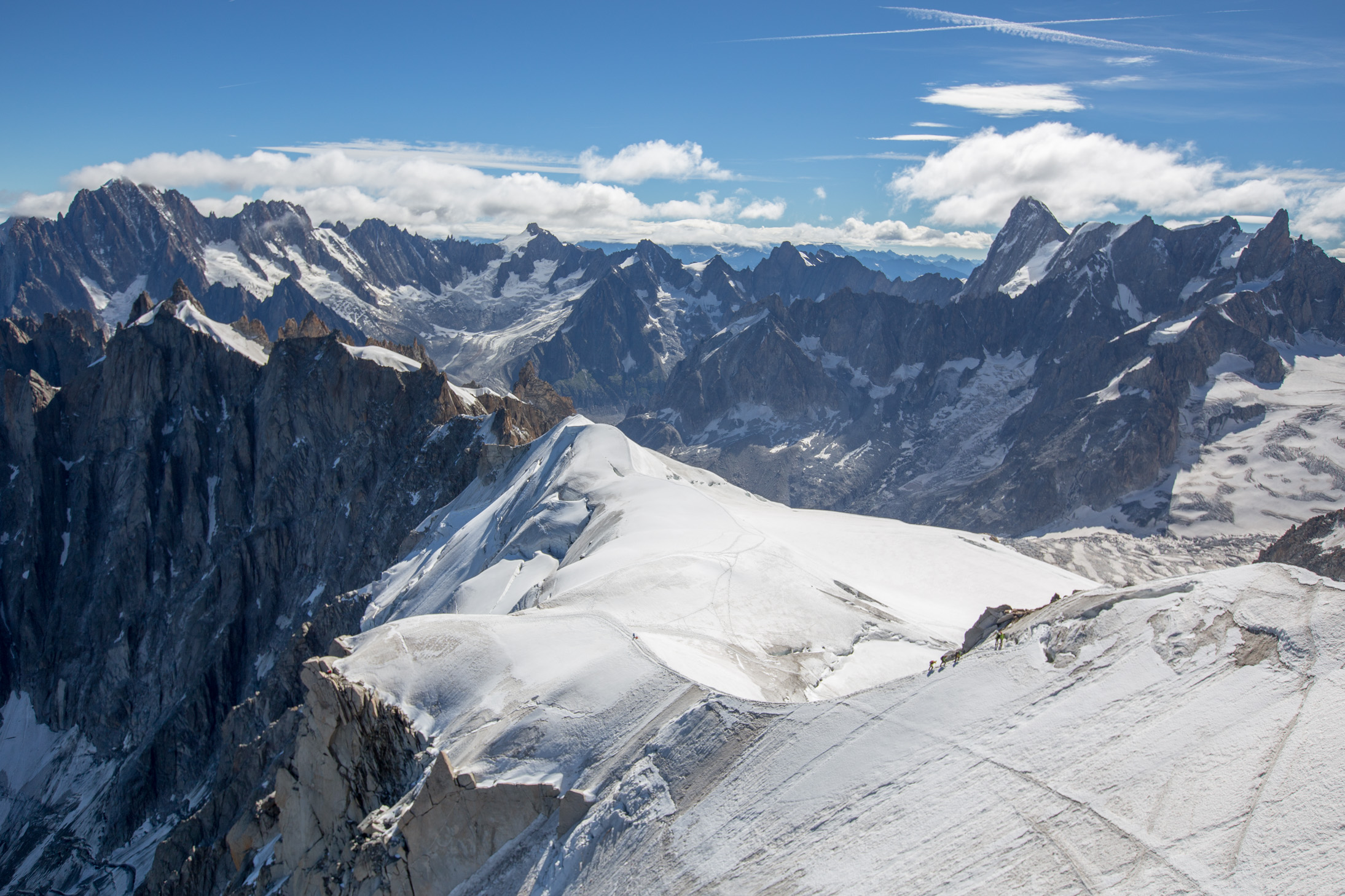
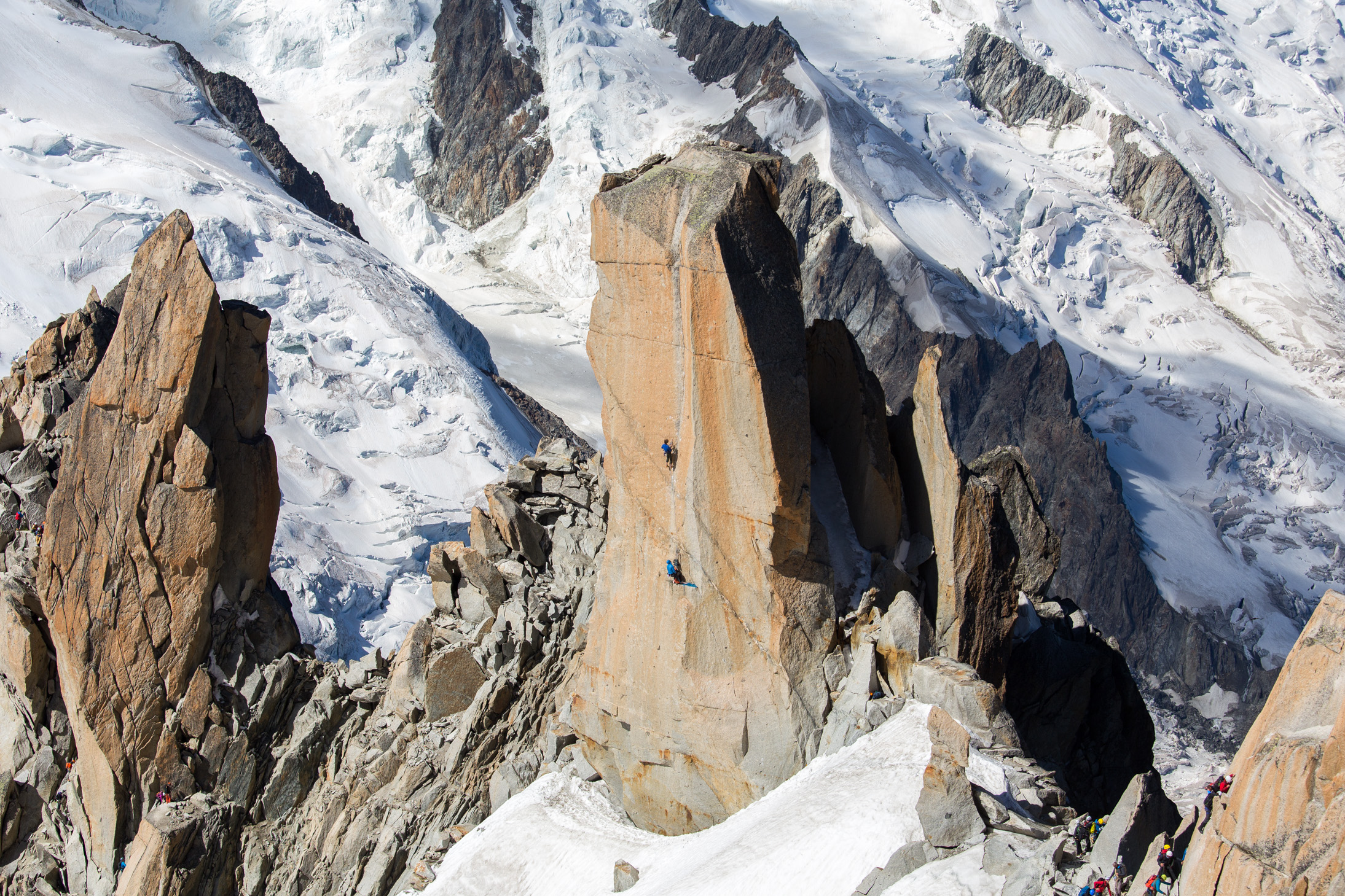
When you get high up (we’re at 3,842m here), you are much closer to the ice and the photos just show you the grandeur of nature. You can see the tiny dots that are people crawling up on their way to Mont Blanc — the route from Aiguille du Midi is far, far more technical than the one I took. And a lot more dangerous, just look at what these guys are doing!

Looking in the other direction, one gets to admire the what from this vantage point seem not really high peaks. The one in the foreground is Le Brévent which we had climbed the day before.

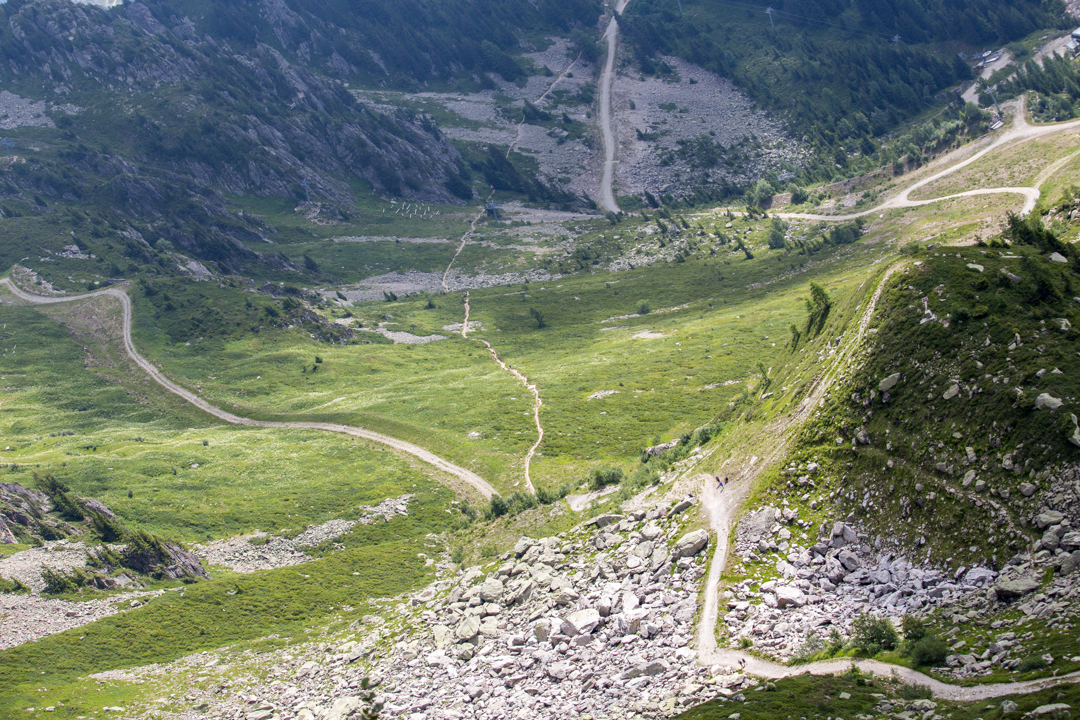
The Chamonix valley and the many paths that riddle the hills.

A lot of people (and pretty much all local guide companies) use Aiguille du Midi as a testing ground, putting on ice climbing equipment and walking around, as you can see here. Pretty great view of some 3,500m+ peaks in the background.
Glaciers.

I just love this shot. It’s quite humbling to see how small we are compared to nature.
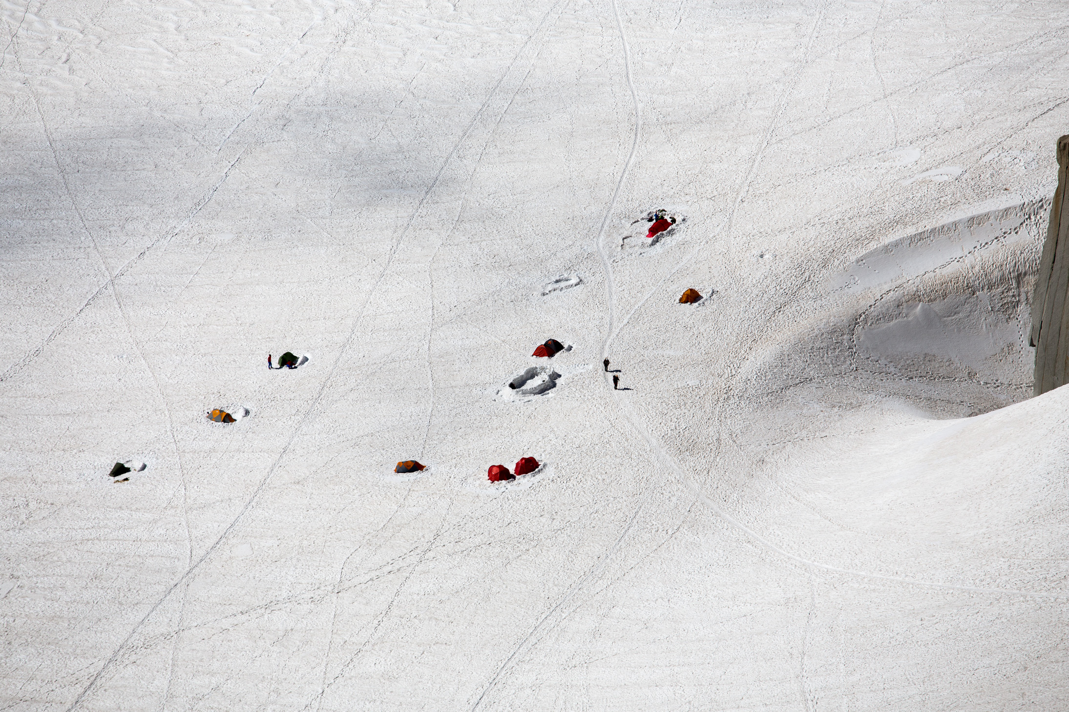
The camp below Aiguille du Midi.
The area is a rock climber’s paradise, essentially.
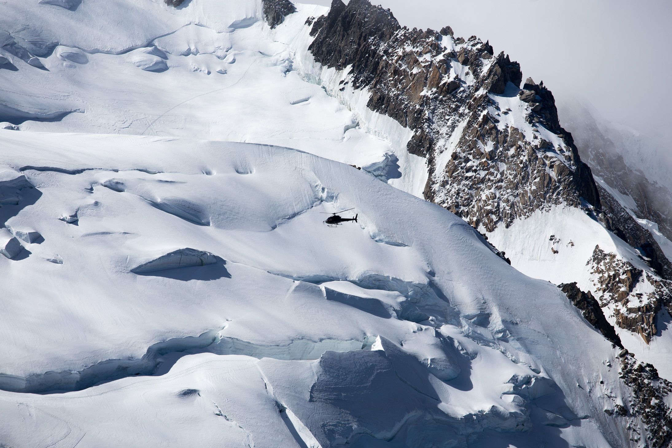
When you’re so high up, you see helicopters fly by often — it’s quite reassuring, actually, knowing that they can quickly pick you up.
After about 4 hours of hanging around at this altitude, I felt acclimatized enough to call it a day
Day 3: Climb up to Refuge du Goûter, 3835m
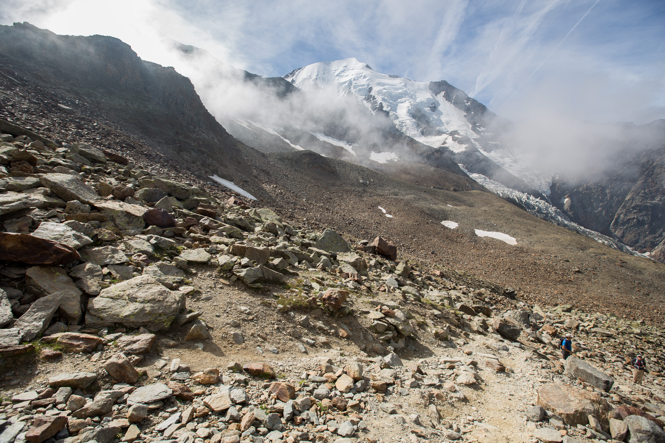
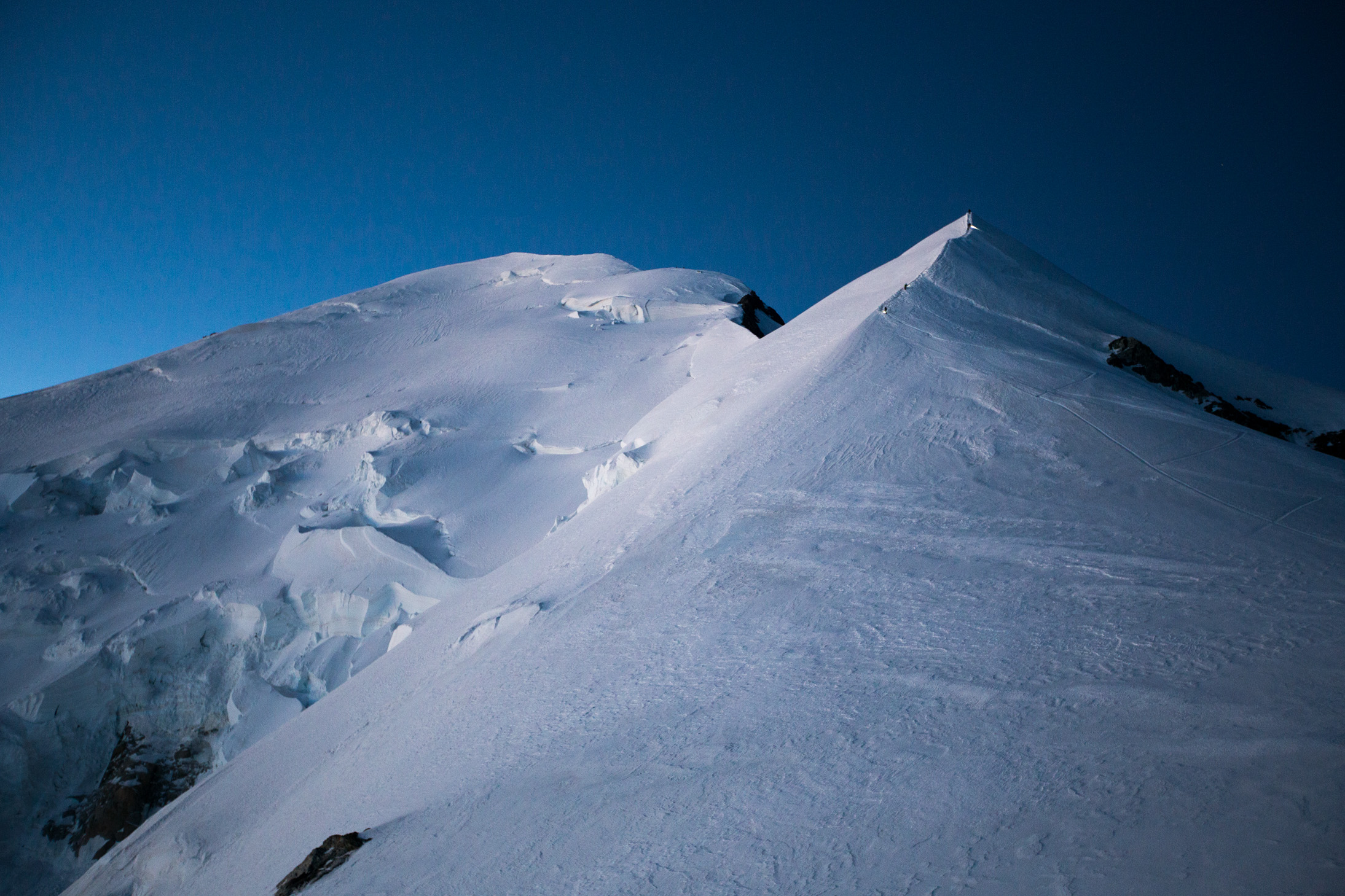
The following morning (Monday) at around 7am the weather was clear again. This is Dôme du Goûter that you have to traverse on the way to the summit. If you look carefully on the left, just at that lowest point in the ridge line, you can see the Vallot shelter — the final sheltered stop before the summit, sitting at 4,362m.

After getting dropped off at around 2,200m by a tram (and a cablecar before that), we started trekking up. Along the paths you see many of these fellas that were not the least bit intimidated by us, guess they are used to many tourists.

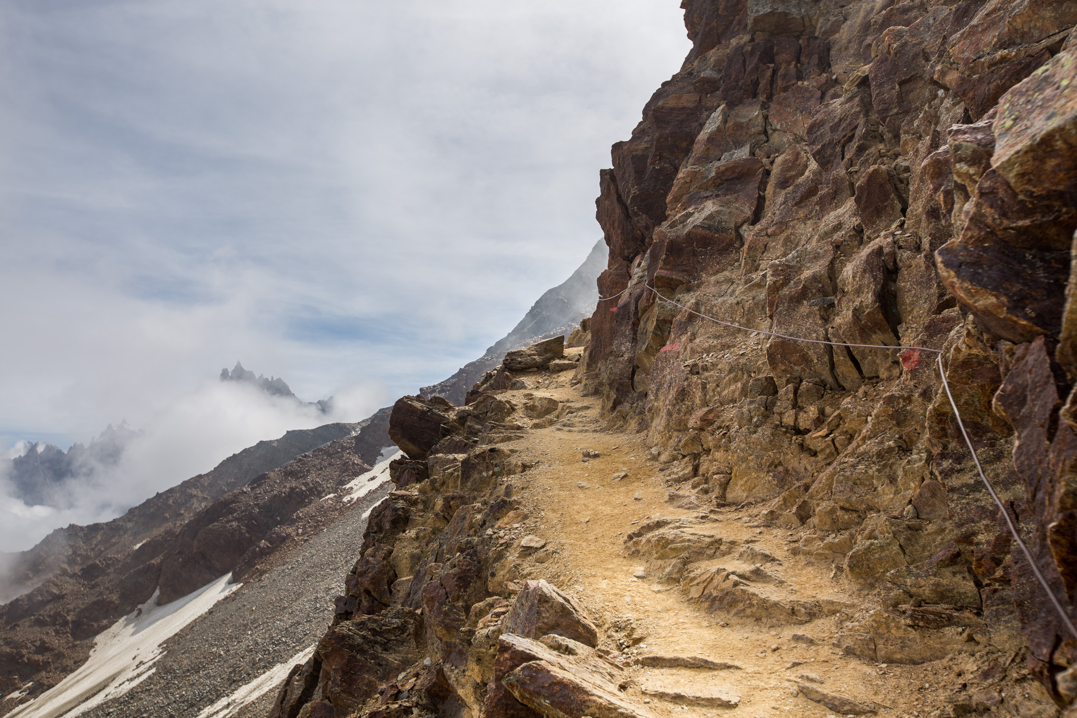
The first day of trekking is almost entirely made up of walking on rocky paths. We were lucky that there was some cloud cover so it wasn’t blistering hot or it would have been a bit too much with the heavy backpacks on.
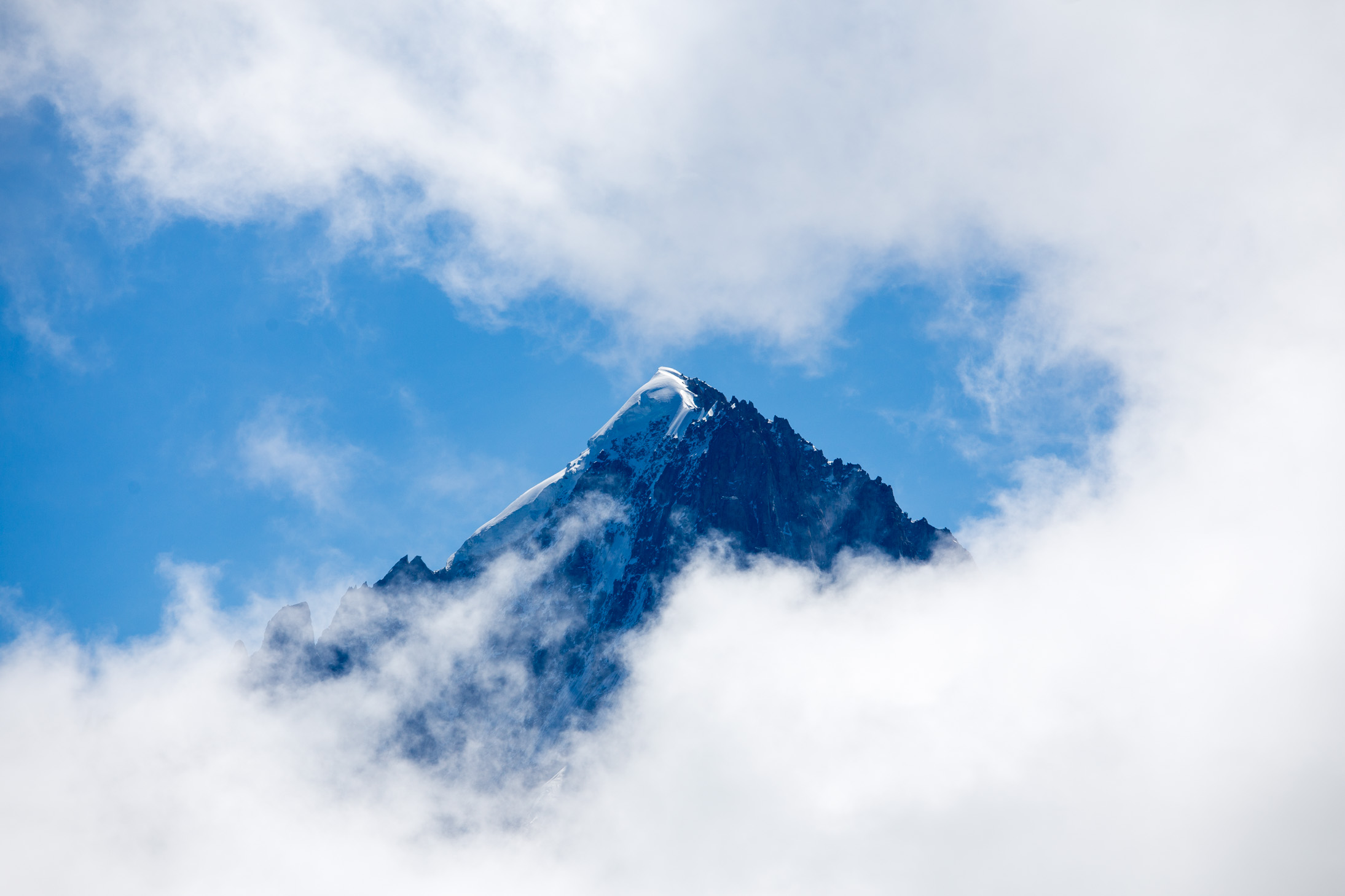
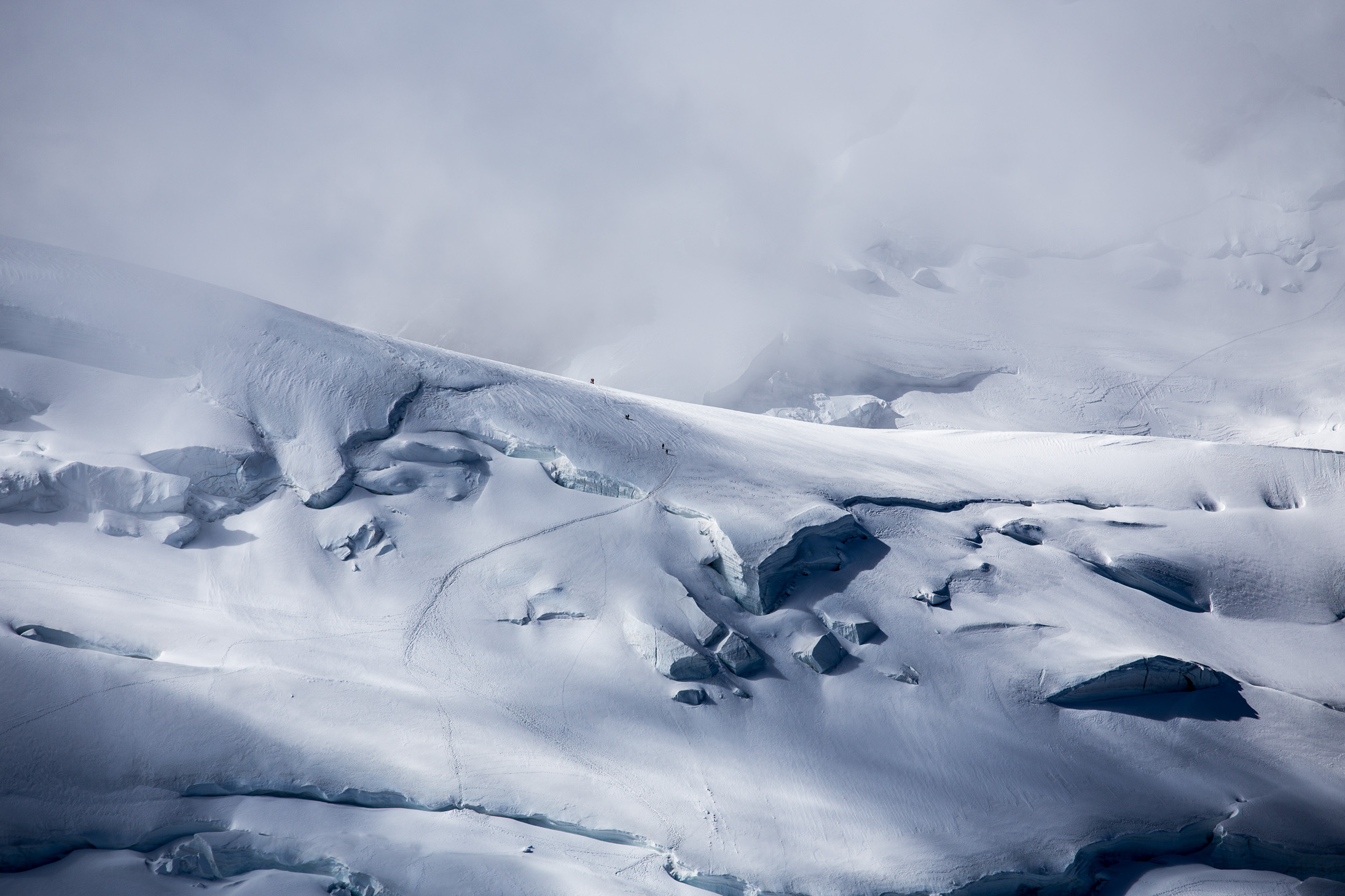
Every once in a while, the clouds would disperse briefly and we’d get a glimpse of some distant peak.
After a couple of hours, we reached the Tête Rousse refuge, which is located right next to a Glacier with the same name at an altitude of 3,167 m. One way to reach the top is to start from here, but the lower altitude means the summit day would be a much bigger push.
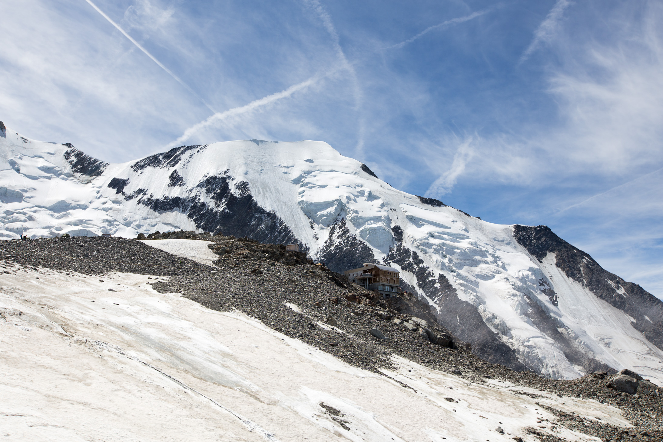
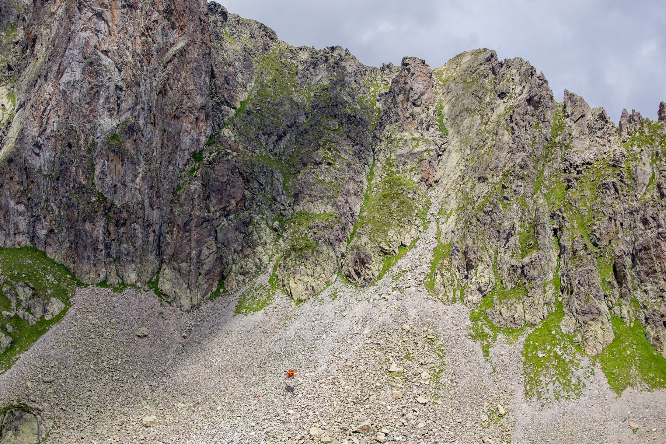
What lies ahead is this “little” climb — almost 700m of sometimes near vertical rock scrambling to get to Refuge du Goûter that you can see perched on the top there. I can’t believe some guys do this in the middle of the night on their way to the peak (if they’ve started off from here)… nuts. But first, crossing the glacier.

Just as a sense of perspective, here’s an extreme close up of that rock face so you can see how tiny people are.

Mid way through, you’re already above the clouds. Quite a view from here. That on the right, btw, is the Goûter couloir that has to be crossed — something that is often referred to as a game of Russian roulette. It is not uncommon for rocks (from single ones to massive rockfalls) to become loose from the top and start flying down at immense speeds. People have lost their lives here so you have to be quite careful to listen for any activity before quickly darting across.

At long last, we’re at the refuge! It is quite a nice sight, to be honest.
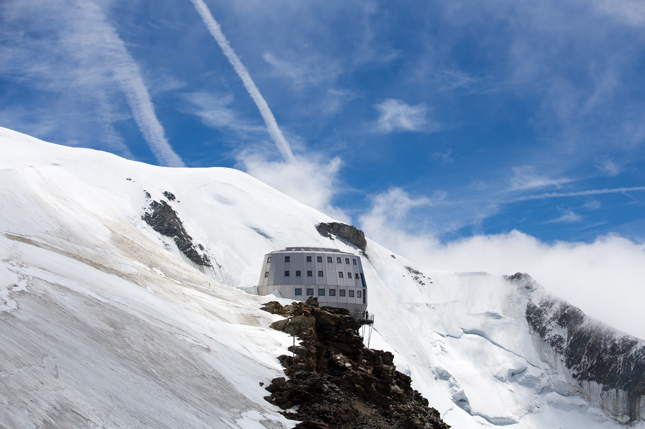
The Goûter refuge is probably one of the most modern huts I’ve been in — it was completed in 2012 and is well maintained. Comfy beds, clean sheets, quite warm. It’s very eco friendly with solar and wind powered electricity, recycled water, and so forth which is a nice nod to climbers (up to 120 can sleep here) to be respective of the environment. Getting bookings is quite difficult though, especially in peak season, so going through a mountain guide company is usually the best way. The only thing I didn’t like was the food actually — for what we paid, it was quite disappointing. Can’t have it all I guess 🙂
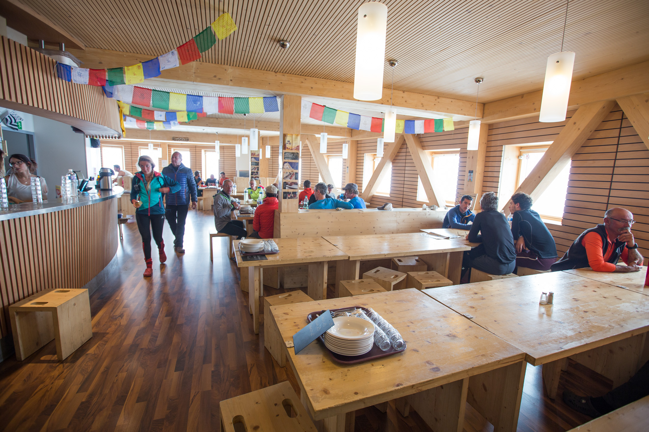
Phone reception isn’t good in the area so people are ready to do anything to find signal 😉 Shot with an iPhone, btw!
Day 4: Summit day, 4808m
Around 3.30am the following morning (Tuesday) we geared up and left for the peak. Unlike on Elbrus where we had almost a full moon, it was quite dark here so no night photos. The weather was clear though and not cold at all so we progressed well. Around 5.30am, we were at the Vallot shelter (4,362m) where this photo was taken, looking up at what’s ahead of us. You can clearly see the path right on the ridge and people walking up.
At 5.50am, the sun was about to burst through the clouds on the horizon. What a sight! Shot with an iPhone, btw, couldn’t be bothered to take out my big camera again as it was actually quite cold by that point. Continuously amazed at the quality.

My rope party — in high spirits, the peak isn’t too far away now! It was actually quite nice with the moon in the background, but the image can’t do the moment justice.

At 6.10am, Mont Blanc lit up and was bathed in the golden rays. We could now easily make out the top. Absolutely gorgeous view 🙂

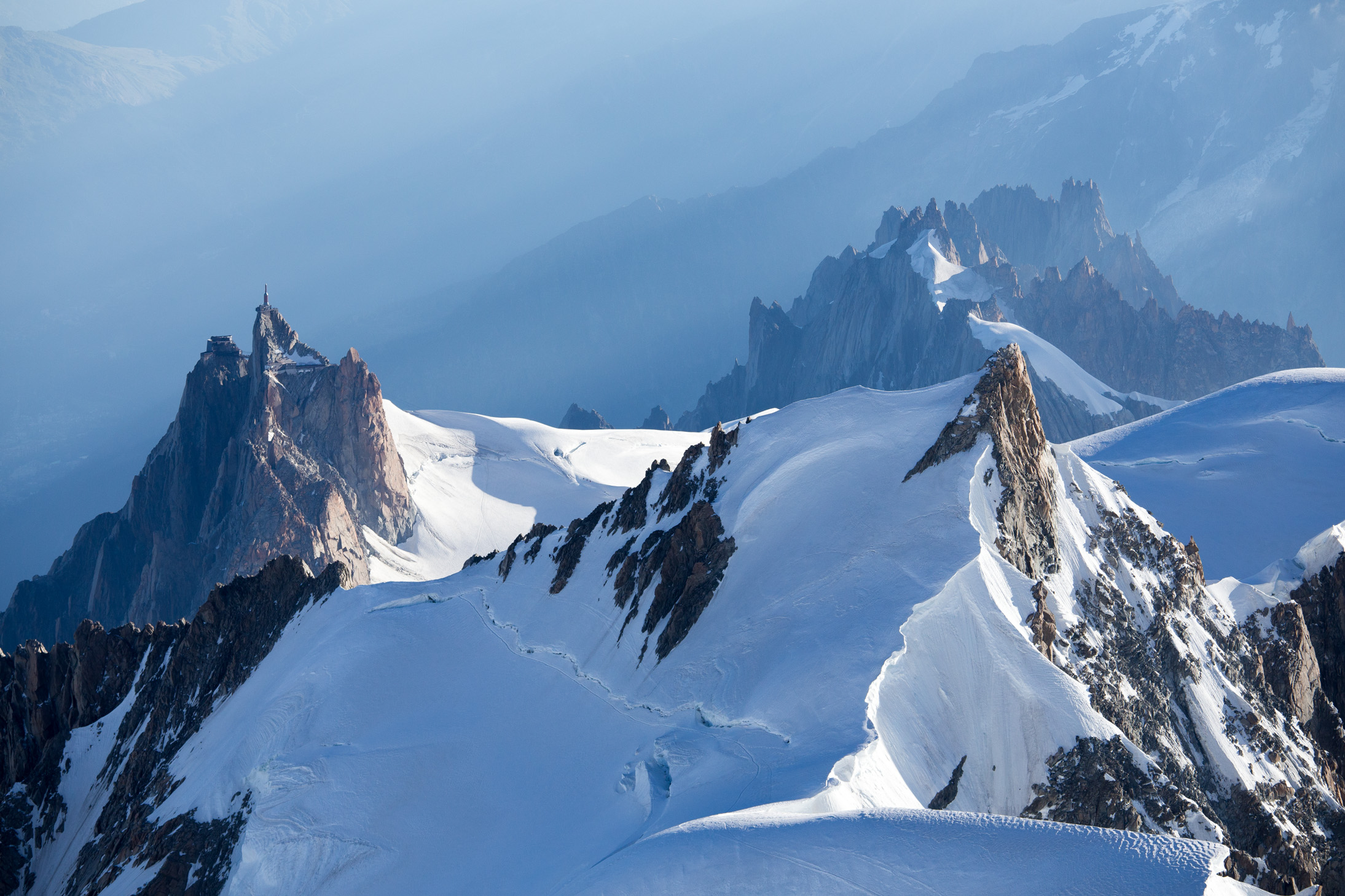
Aiguille du Midi from up high.
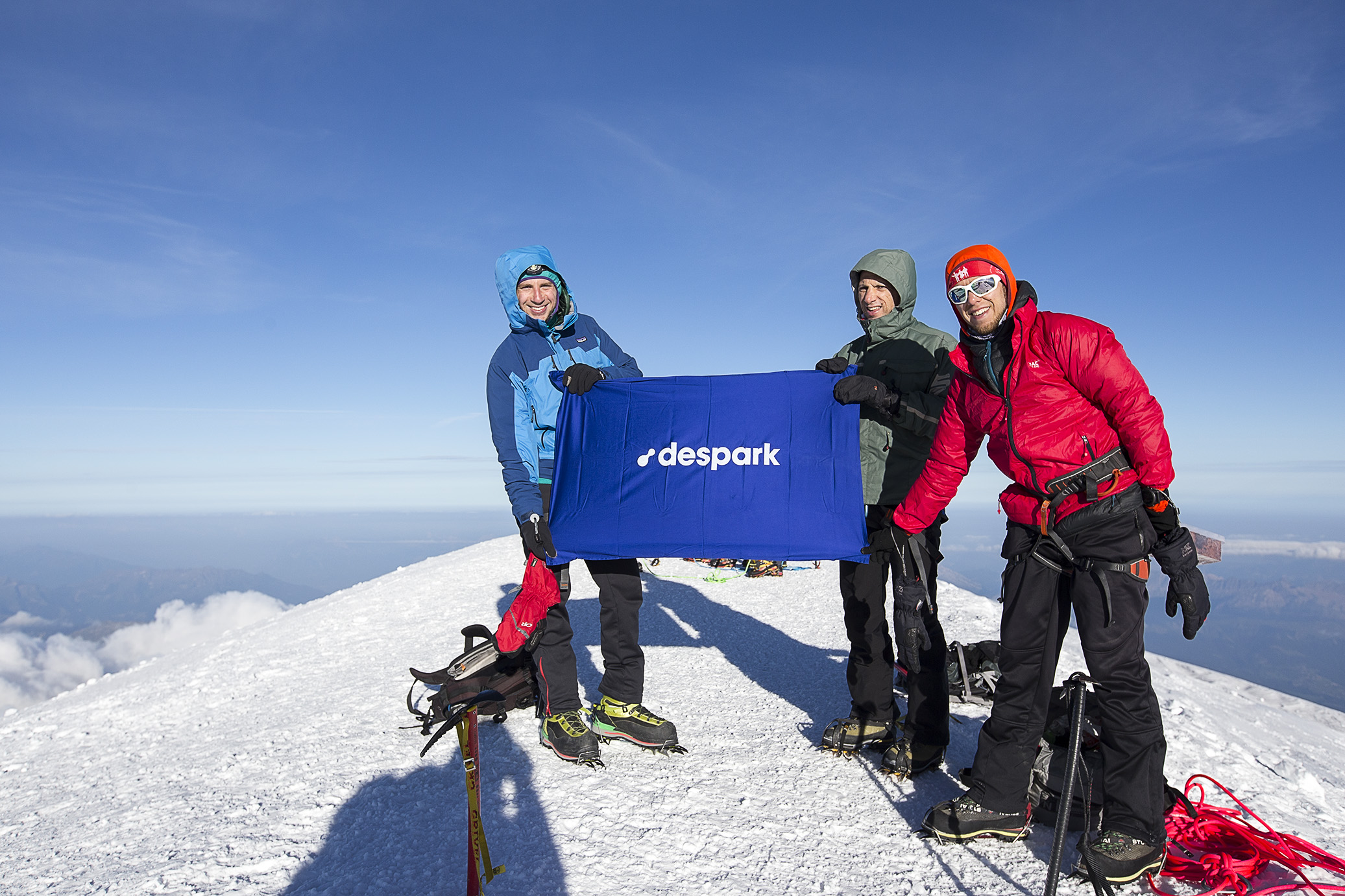
At exactly 7.36am we were at the top! Time for some promo shots 😉 We were so lucky with the weather, perfect views and happy faces all around.
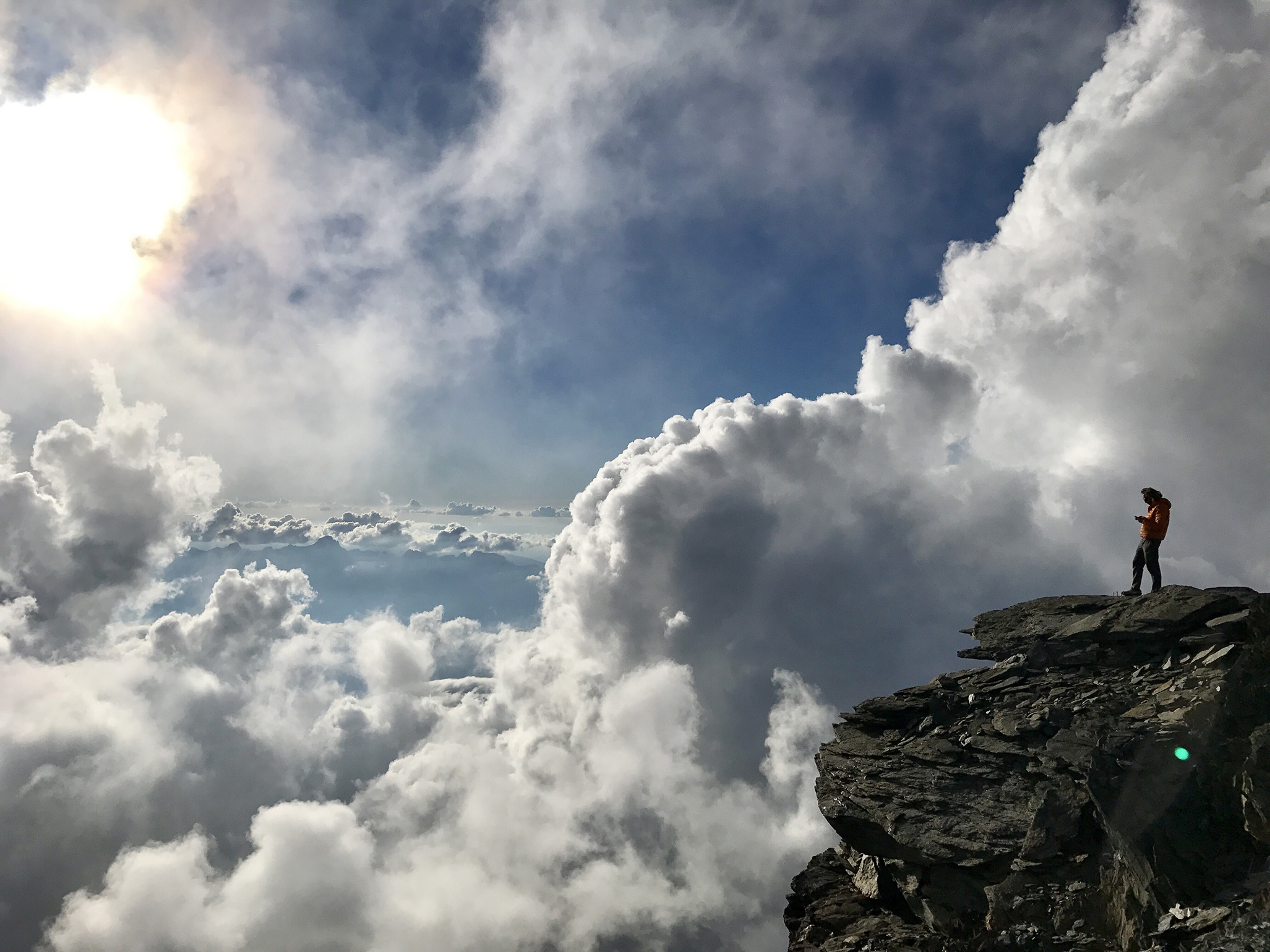
Above the sea of clouds, what a nice way to spend your 10-15 min at the top. But we’re only half way done so without wasting too much time, we headed down.

I didn’t really take any images on the way down. For one, I was able to document the ascent well enough, but also we wanted to keep a steady pace. We were back at Goûter around 10.30am and most proceeded to rest after the long day thus far. But I really wanted to go down in the valley so I packed my stuff and headed down to Chamonix. It took me another 3 hours of walking and an hour in various transportation means (tram, cablecar, car). I was back at the flat around 3pm, tired but quite happy 🙂
All in all, this wasn’t the most pleasant of climbs (that Goûter rock face on the way down with the afternoon heat was brutal), but I felt strong the whole way which is good. I’m also quite proud of the other Bulgarian guys and girls in my group who had never been above 4,000m but managed to summit nevertheless — way to go!
Now, onto the next one 😉

Beautiful!! What amazing views and photographs!
Wow! That one with the mountain peeking through the clouds in breathtaking!
Indeed! Blue skies are overrated 😉
What a great pictures 🙂
Wow, nature is beautiful
Awesome adventure!
It was pleasure reading the story.
Pics are top notch as usual.
Slowly but surely you are sowing hiking love in everyone of us.
You’re too kind, Ralev 🙂
That’s breathtaking!! Beautiful pictrures
What a stunning trip!! Congrats!!
Your photos are breathtaking and stunning! Thanks for sharing!
Much appreciated, guys! Thank you for the generous praise.
Brilliant. What a beautiful post ~ it is a great feeling of Mother Earth and the beauty we can explore…incredible adventure, and I sit here in awe 🙂
Always enjoy your comments, Randall, thank you! Coming from such a great photographer and blogger, it’s a great compliment.