After climbing Kilimanjaro in 2014, the supposedly easiest of the 7 summits, I started thinking about potentially tackling some of the remaining ones. This is a daunting (not to mention costly!) task and I’m not quite sure whether I’ve completely settled on it, but I figured it’s worth trying out Elbrus, which ranks as the second easiest 🙂
Located in Russia, close to the border with Georgia, Elbrus sits at 5,642m (18,510 ft) and is Europe’s highest point. Although lower than Kili and its 5,895m above sea level, Elbrus is actually a tougher climb because it’s located further north from the equator. The two are alike in that they are not technical climbs by any means, but Elbrus has snow year round and the weather is more precarious so you need better and warmer equipment. Not to mention that the summit day elevation gain (if you walk the way, more on that later) to the top of Europe is close to 1,900 vertical meters, way more than what you normally do in other peaks (1,000-1,200m summit days) so you have to pace yourself.
Unlike with Kili where I pretty much decided once in Tanzania that I’d be climbing it instead of tackling a different peak and hence hadn’t really prepared, I’d known about Elbrus for a few months. Although I’ve never had major issues with altitude such as headaches or an inability to breathe normally (which was once again tested in Nepal around Everest base camp in 2015), I did quite a bit of training and felt confident in my stamina.
The latter actually paid off as the summit day was harder than anticipated and the entire “walk all the way up from camp” group, myself included, agreed it was certainly a challenge. At the saddle around 5,400m, we all felt nauseous and for the first time I even briefly considered not going for the last and hardest push, a strange and unexpected feeling for me. It took a good 15 minutes to regain my focus and work through it. Luckily the sickening sensation went away and I found my rhythm again, as did the remainder of the group 🙂 More details below…
I’ve broken down the post into days to make it easier to follow.
Day 1: Airport to Cheget
My buddy Stu Avery and I decided to go for the hire a professional agency / tour company approach. One of the perks is you get to be picked up from the Mineralnye Vody airport and driven for 3-4 hours in these lovely vans to the Cheget area at the foot of Elbrus 🙂
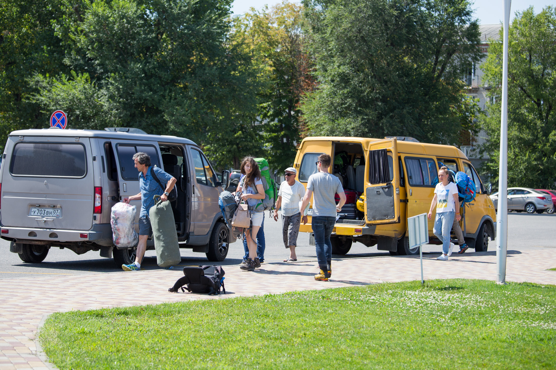
Arriving there in late afternoon, we had a bit of time to walk around “town” (meaning the semi desolate winter resort of Terskol / Cheget) and take in the scenery. We were surrounded by these beautiful 3-4,000 meter peaks and could see the glaciers, settled comfortably as if lava flows made of ice.
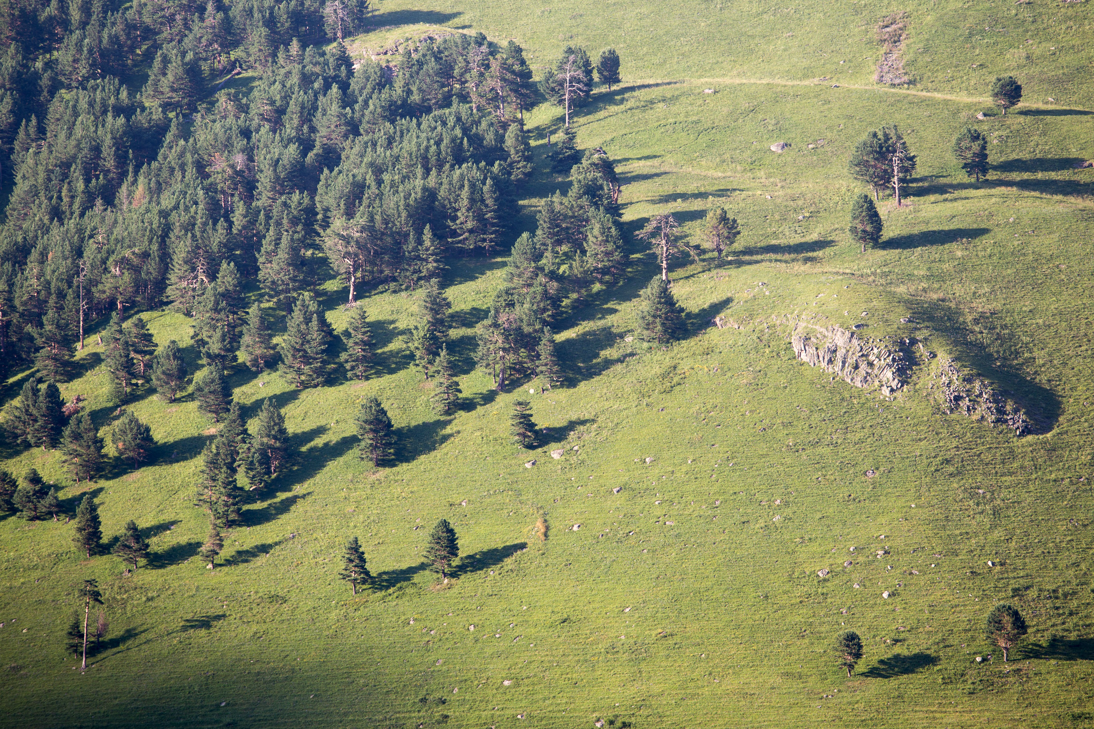
At this altitude, around 2,000m, the area was actually quite green. At dusk, the side shadows of the trees made for an interesting shot.
The area is very picturesque, as seen below. I wish we could go a bit higher for our walk, but it was time to call it a day.

Day 2: First acclimatization day to Mt. Cheget at 3,450m
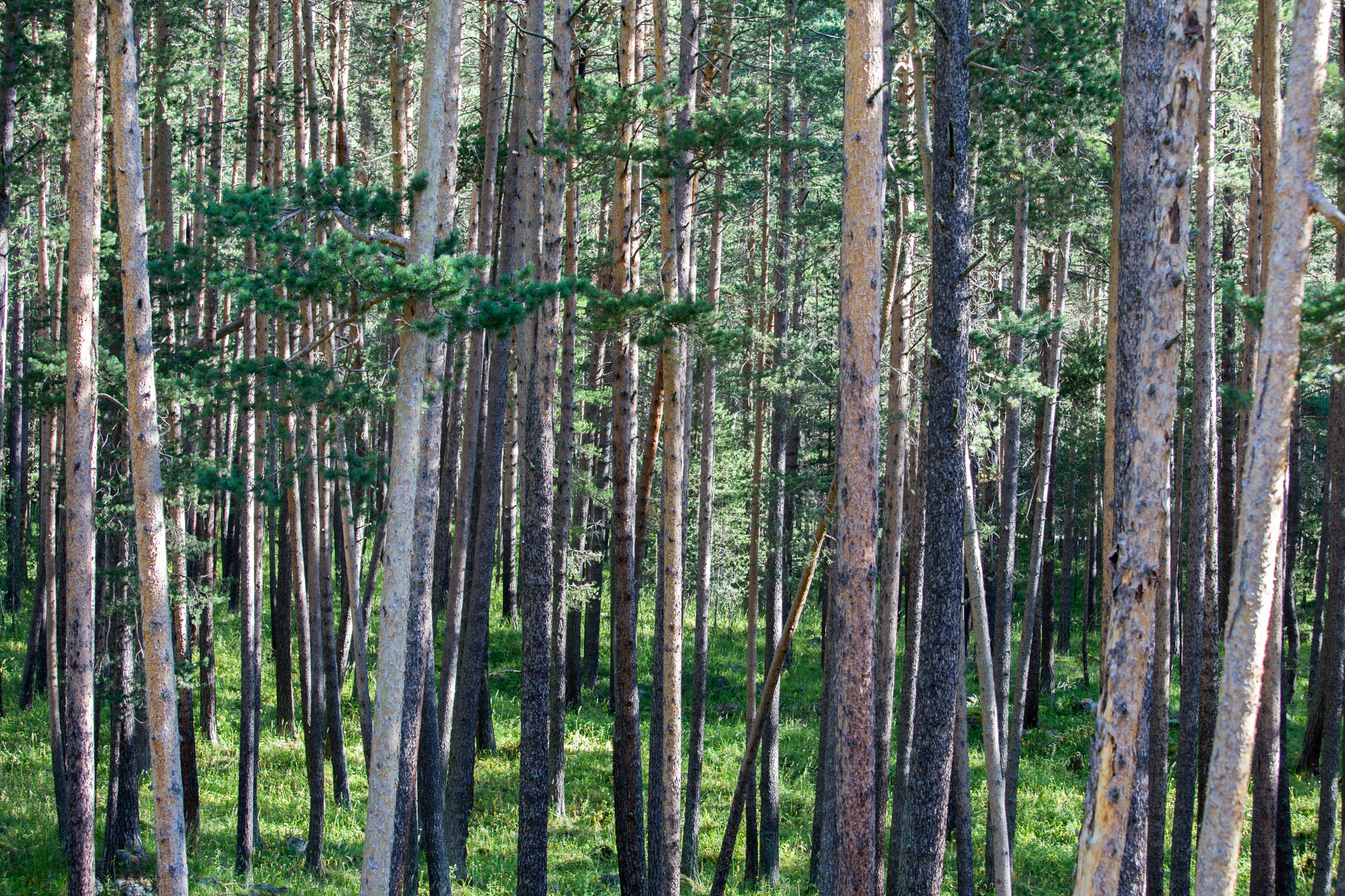
I got up early that day and enjoyed the view from my balcony, taking in the sounds and smells of the pine forest.
Soon after breakfast we took the chairlift up to around 3,000m where our day hike would start.
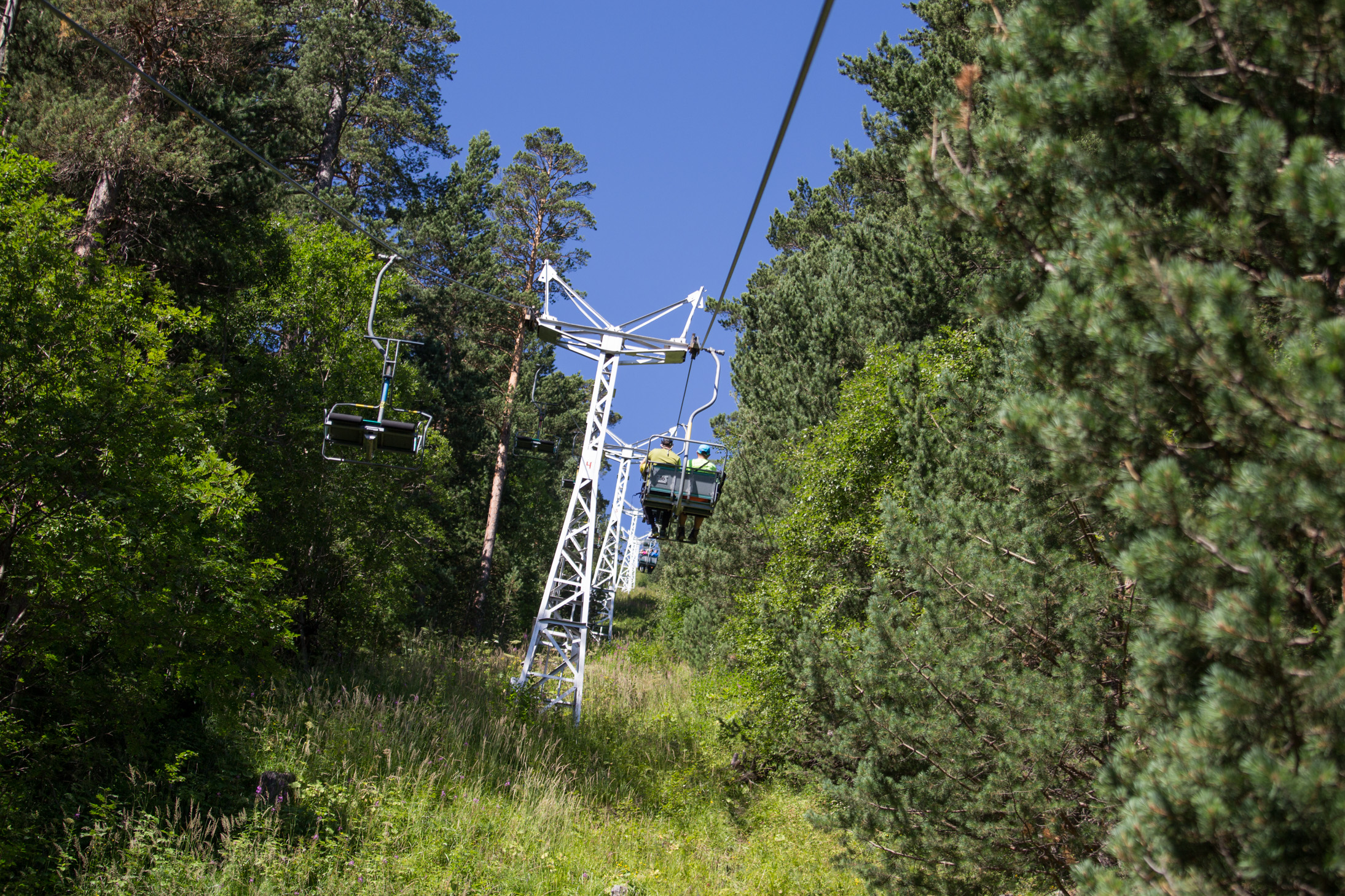
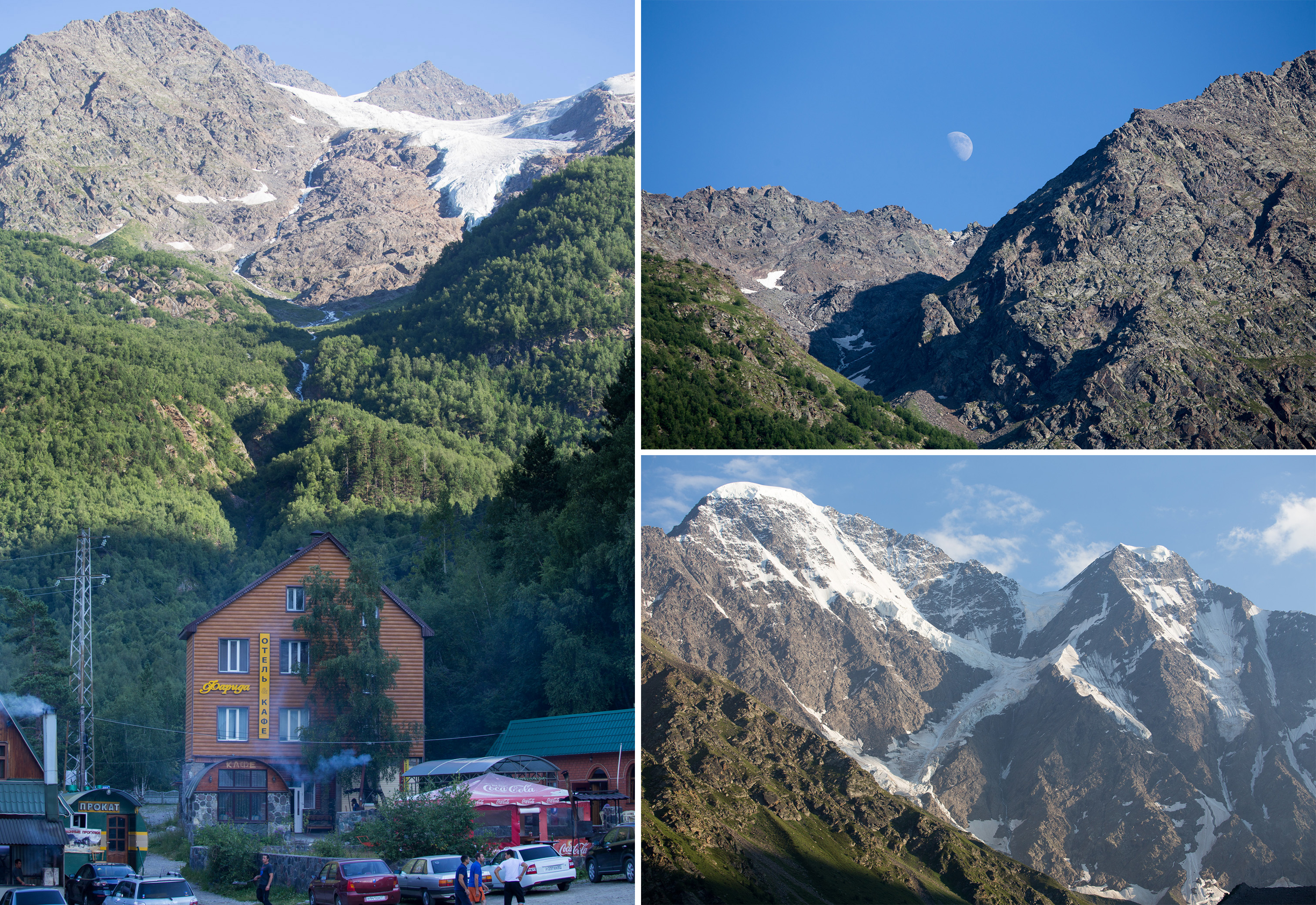
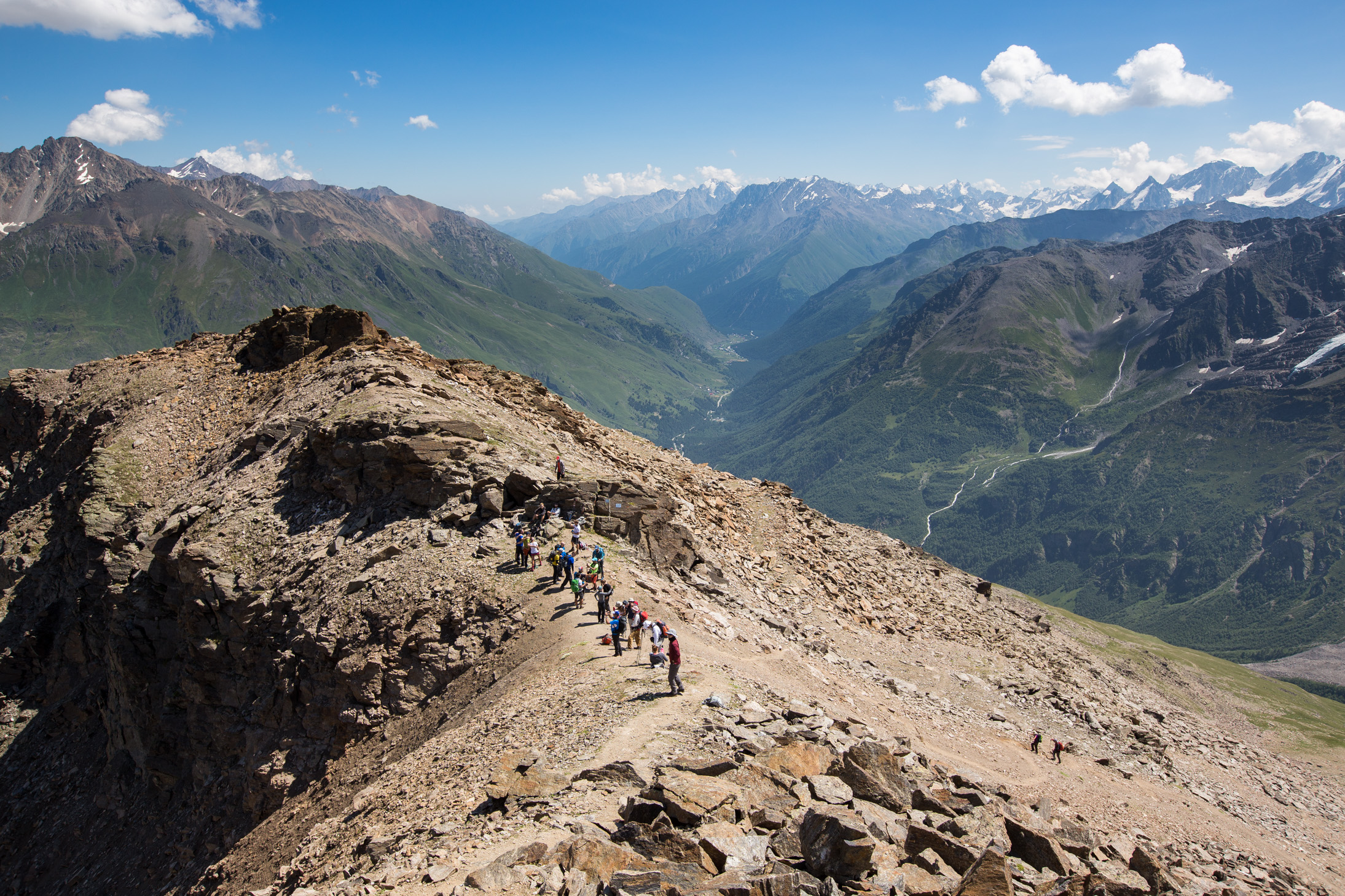
First view of Elbrus from the chairlift, what a beauty! Being the 10th most prominent peak in the world, it really stands apart from the surrounding area and you can’t miss it. Most often it’s climbed from its south side, seen here.
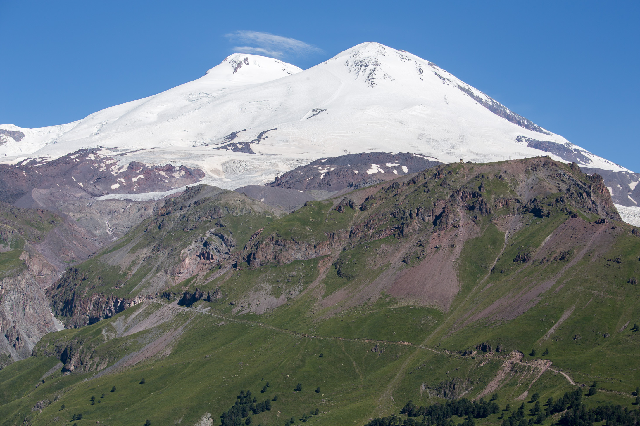
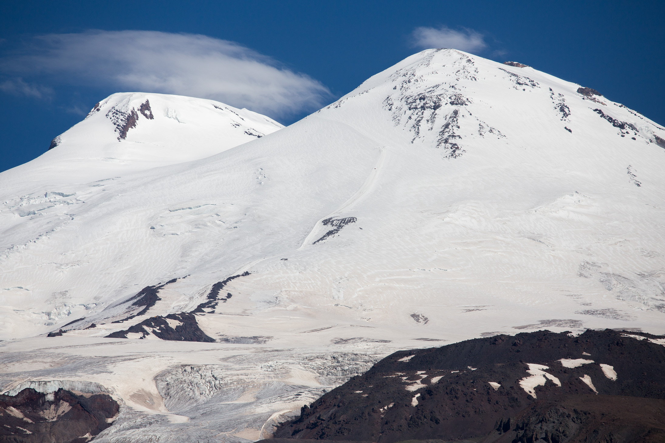
Interestingly, both of the domes are dormant volcanoes. The east summit (on your right) is 21m shorter than the west one, sitting at 5,621m. You can clearly make out the summit path — almost a straight line starting from the bottom left through that ski piste looking thing, past those rocks in the center of the frame and up to around 5,200m on the east summit before traversing it and heading for the saddle between the peaks. The dot you see above the rocks before the path takes a sharp left is actually a huge snowcat machine that was just left there… just think of the scale here, you can’t even see the people.
At the top of the lift, it was time for a briefing with the guides and off we went. With 25 people in it, this was the largest group they’ve had — not sure if in general, but certainly this year. Goal for the day is Mt. Cheget at 3,450m.
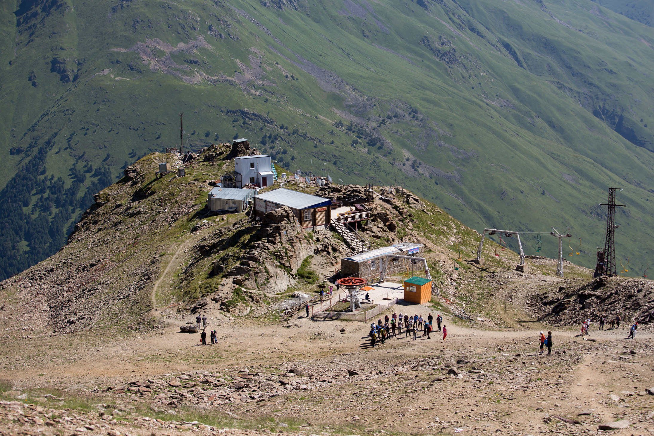
A bit further up the climb, we could start seeing things on the Elbrus side of the mountain. This is one the stations of the bigger lift that would take us to the base camp the following day. Once again we see the lava-like glaciers spewing down the slope.

The Terskol observatory as seen from a distance. It’s located at 3,090m so we’re about that altitude as well.

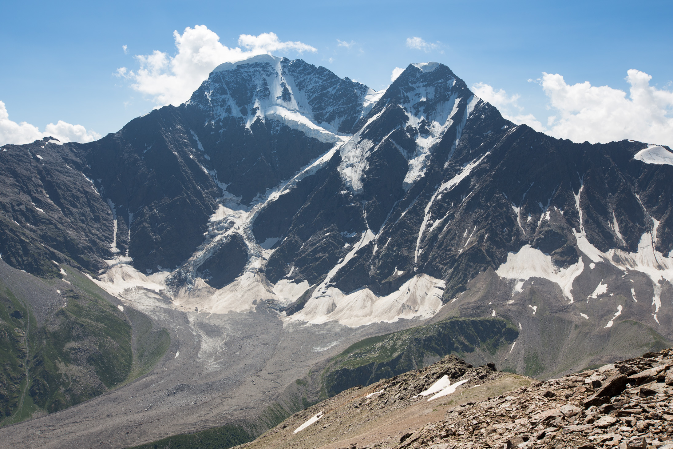
It was a really sunny day, a joy to walk around and take in the scenery of the Caucasus mountains around us 🙂
Dongusorun (4,454m / 14,612ft) on the left in all its glory!
The Finnish way 😉 There were 3 guys peeing in sync on the way up, but I couldn’t catch them unfortunately so I settled for 2 on the way down.

Day 3: Travel to base camp and second acclimatization to 4,800m
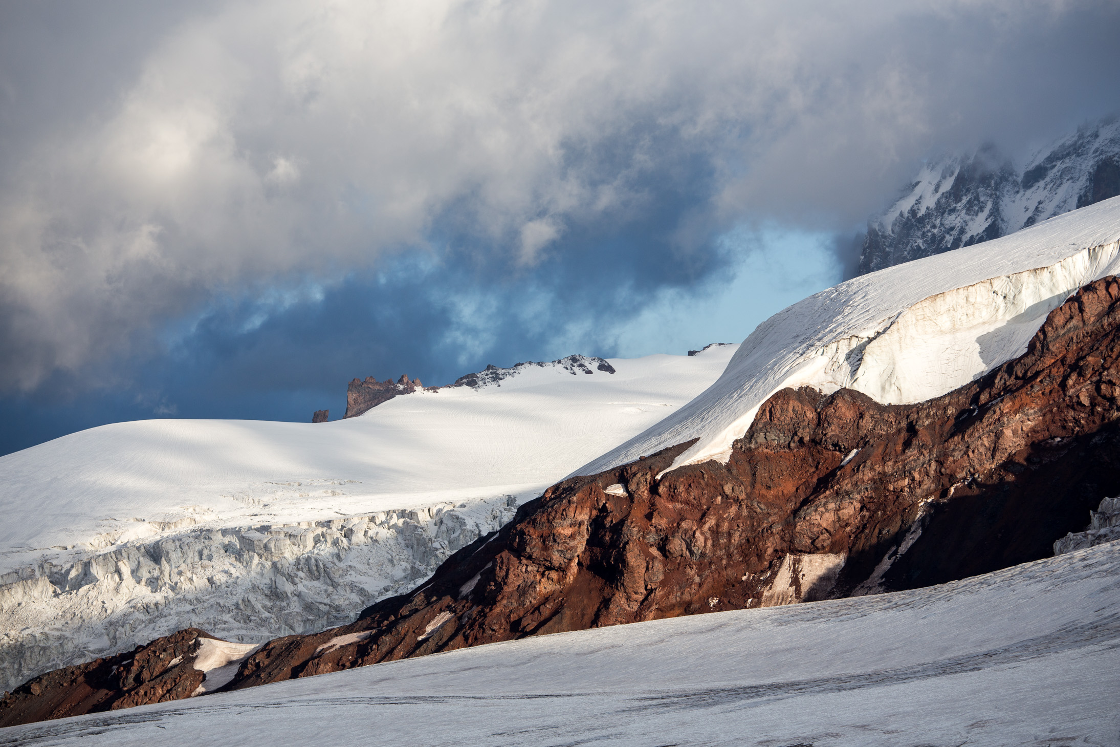
The following day we took the bigger lift up to 3,800m where the so called Barrels hut is, our base camp for the summit day. The weather unfortunately worsened, but that made for some more dramatic shots over the glacier.
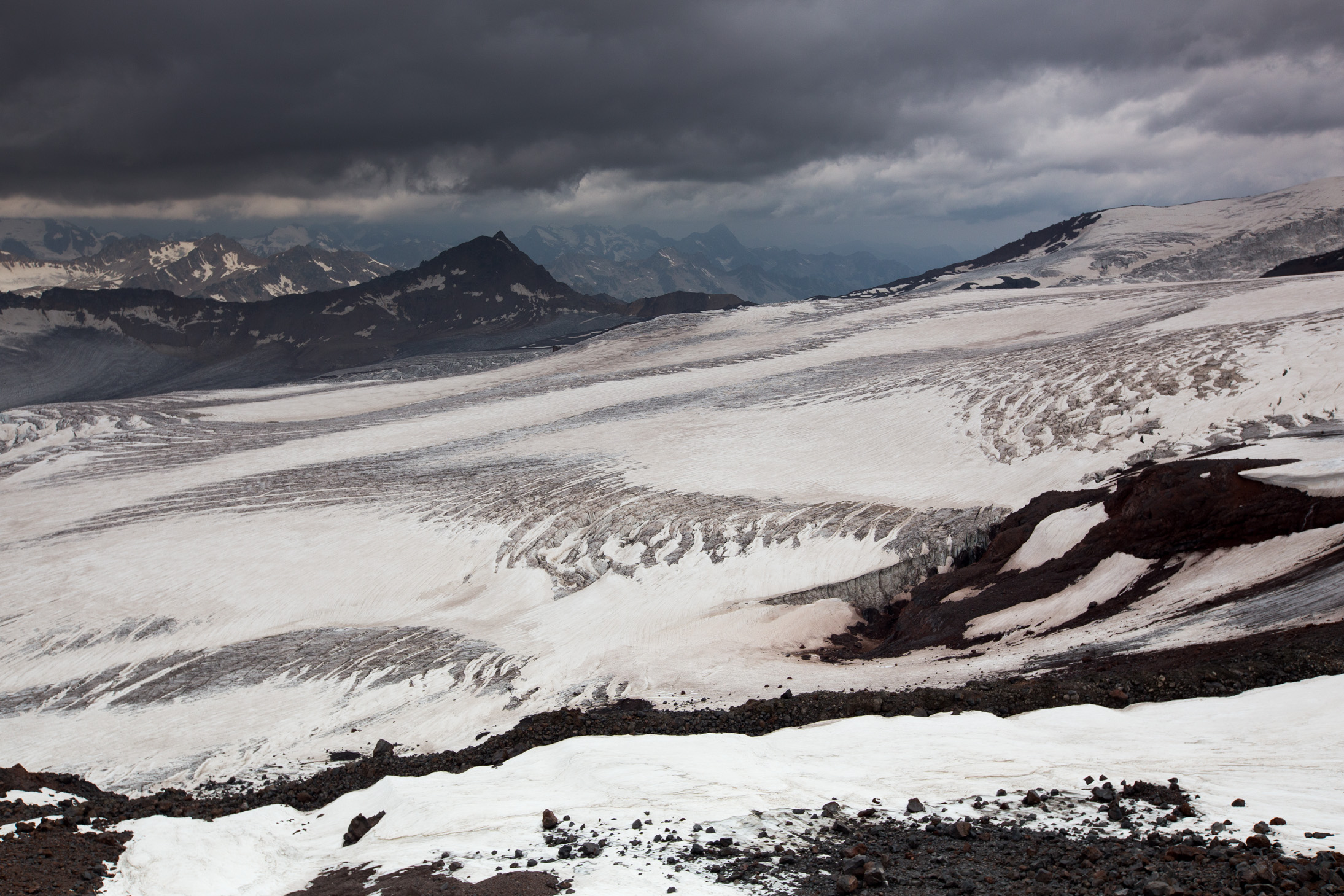
Dark clouds hanging above the glacier and summit.
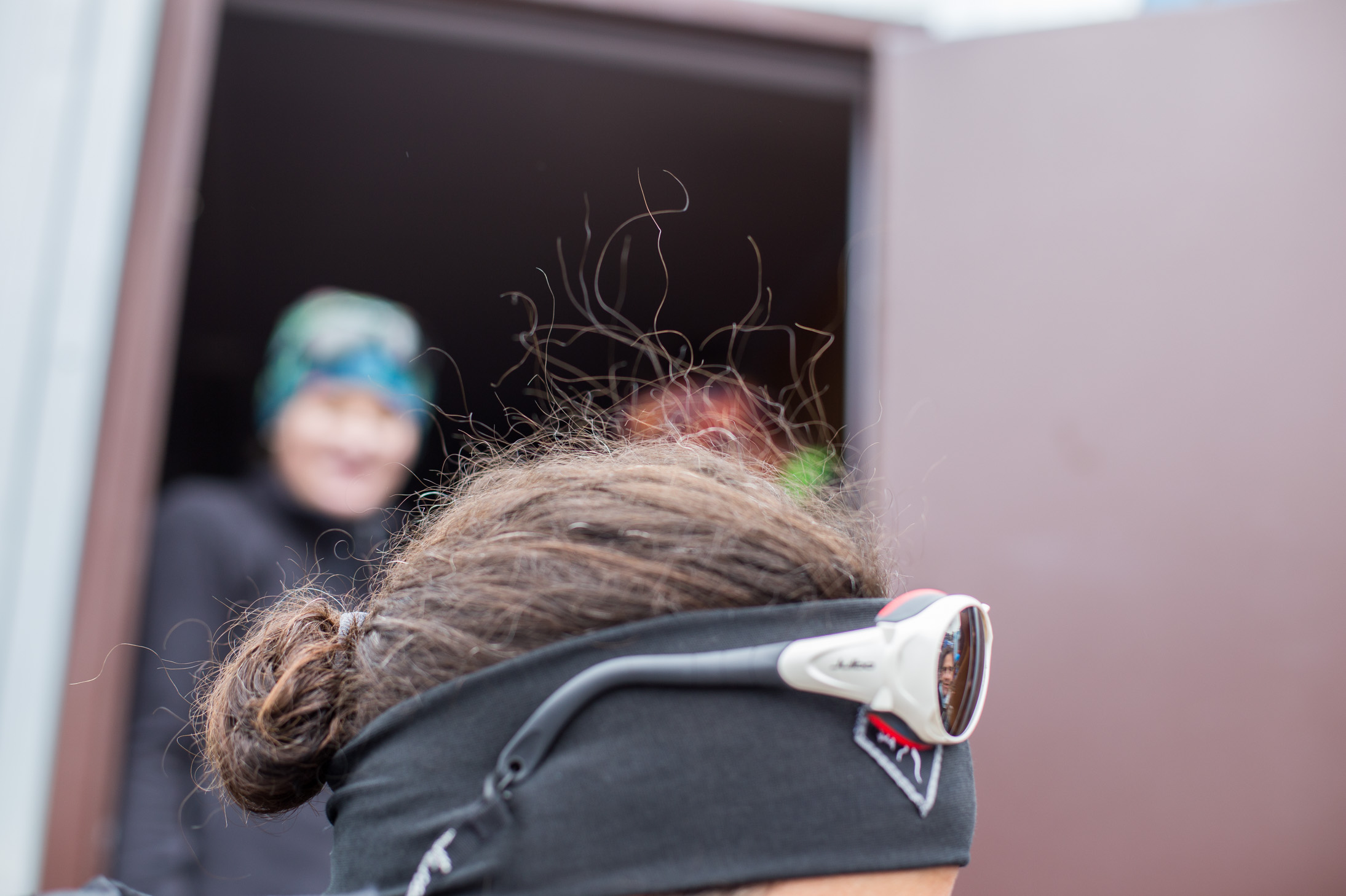
You could tell a thunderstorm was approaching by the fact that people’s hair was standing up. Trust me, as soon as we saw that we all went inside pretty quickly 🙂
Nevertheless, we had to go higher up to acclimatize better so after the thunderstorm passed in the early afternoon we took off with the goal of reaching 4,600m that day. Although at first it seemed things had calmed down, at around 4,300m the wind picked up the point where it was over 50km/h and snow was blowing pretty hard from the side. Not as bad as the whiteout in Antarctica, but getting there. We did reach 4,650m and turned back when I managed to get my camera out and snap this shot.
The hair of the lovely Kristin from Mallorca should tell you of the temperatures and conditions outside that afternoon 🙂 She was such a trooper though, summited 2 days later although she’d never been at that altitude before!
Day 4: Short acclimatization hike and ice equipment training
Having gone to bed early the night before after the long day, I got up around 6am and boy was I happy to see the sun outside! This was the ideal time for photos with the sun low on the horizon which made the colors very rich.
There were still plenty of clouds, but somehow that added to the scenery. This is one of my two favorite shots of the trip, what a spectacular view!

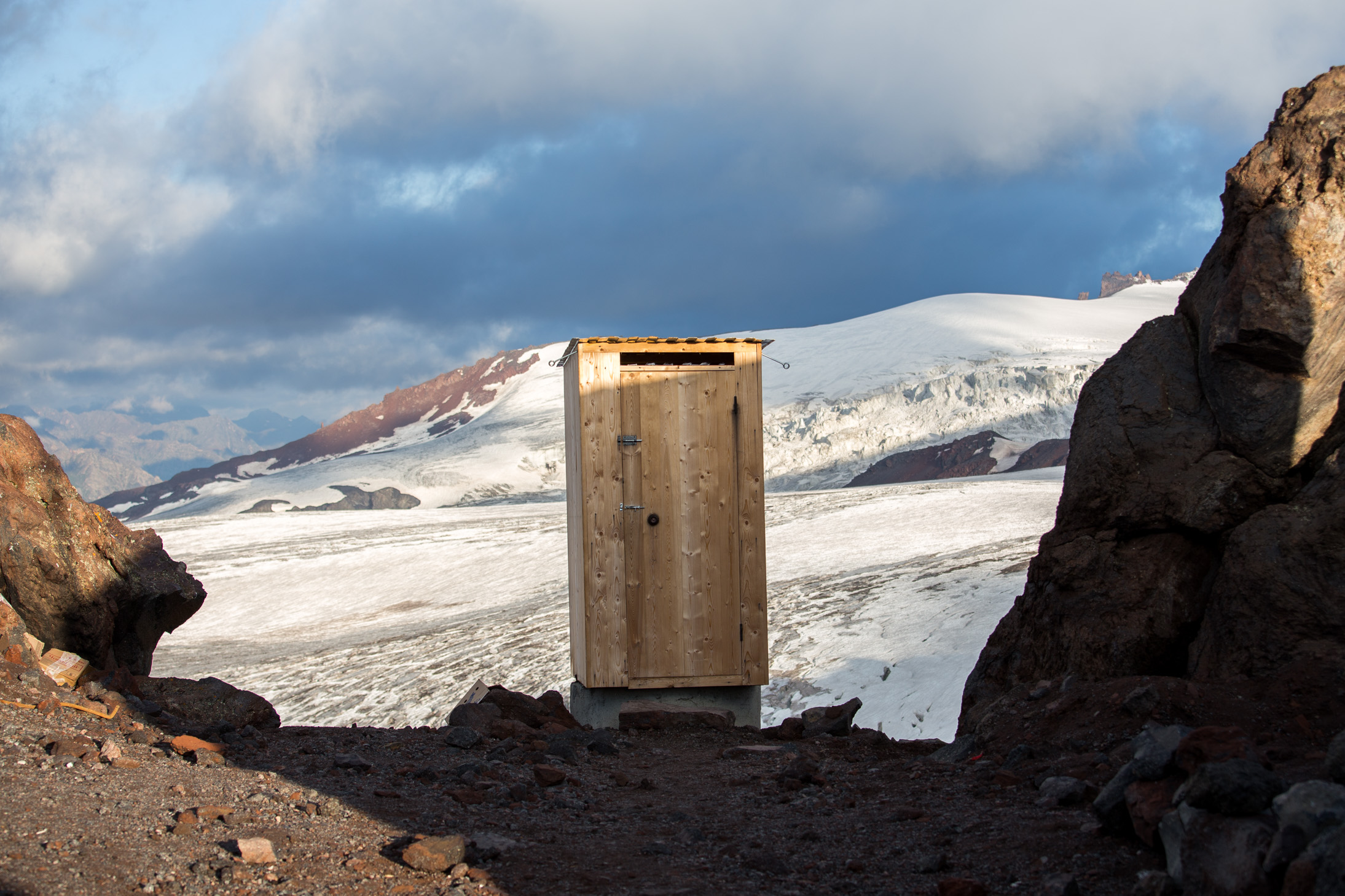
Even the long drop / pooper looked sort of ok with this light 😉
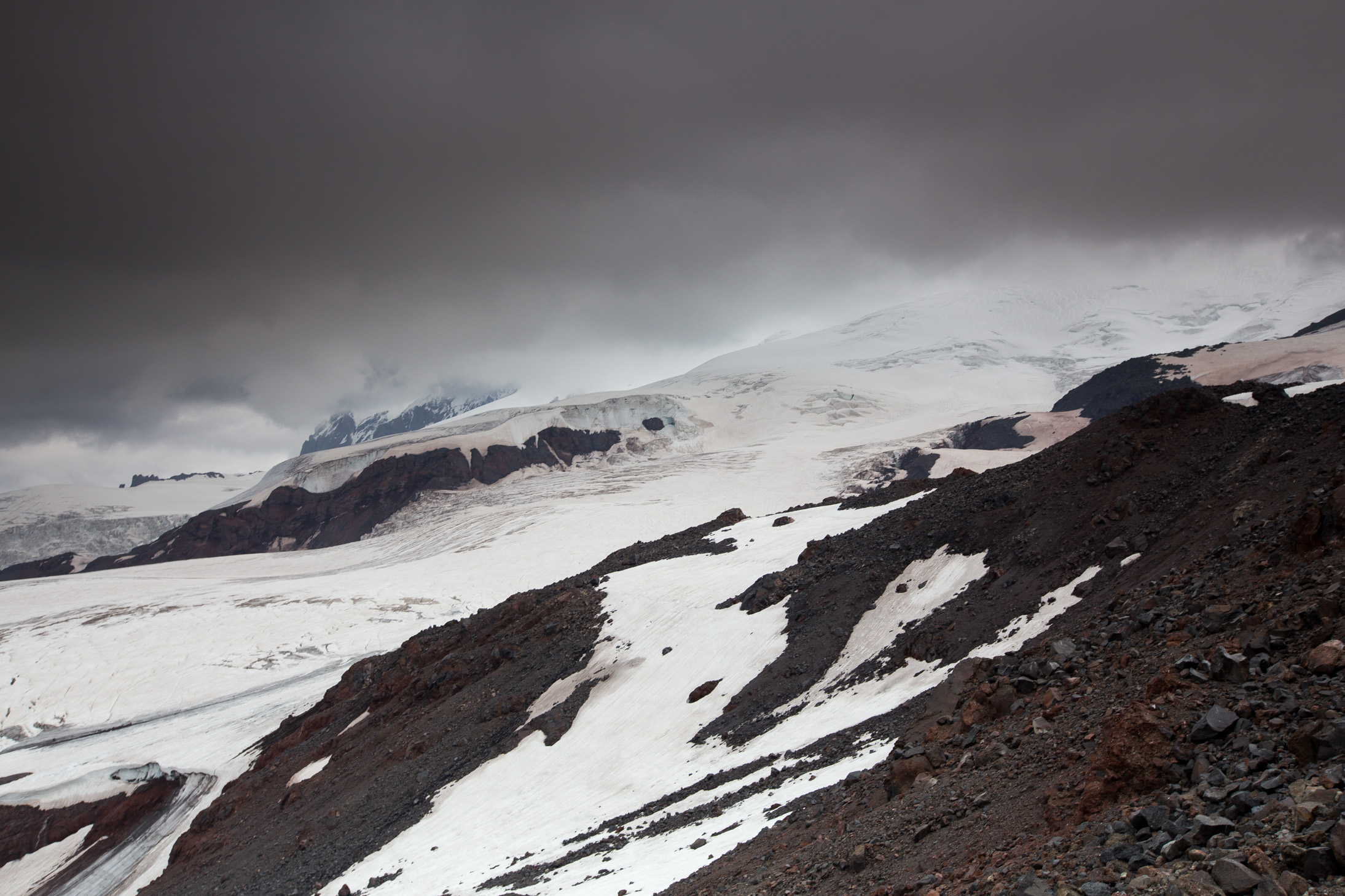
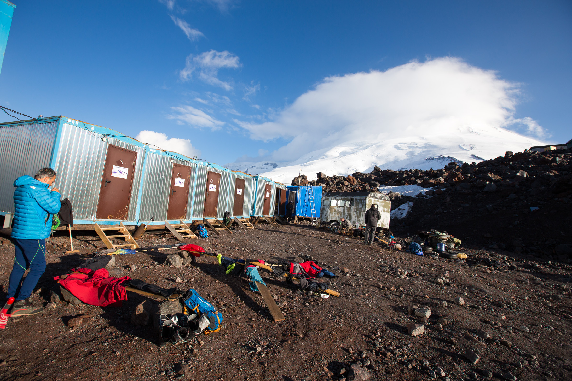
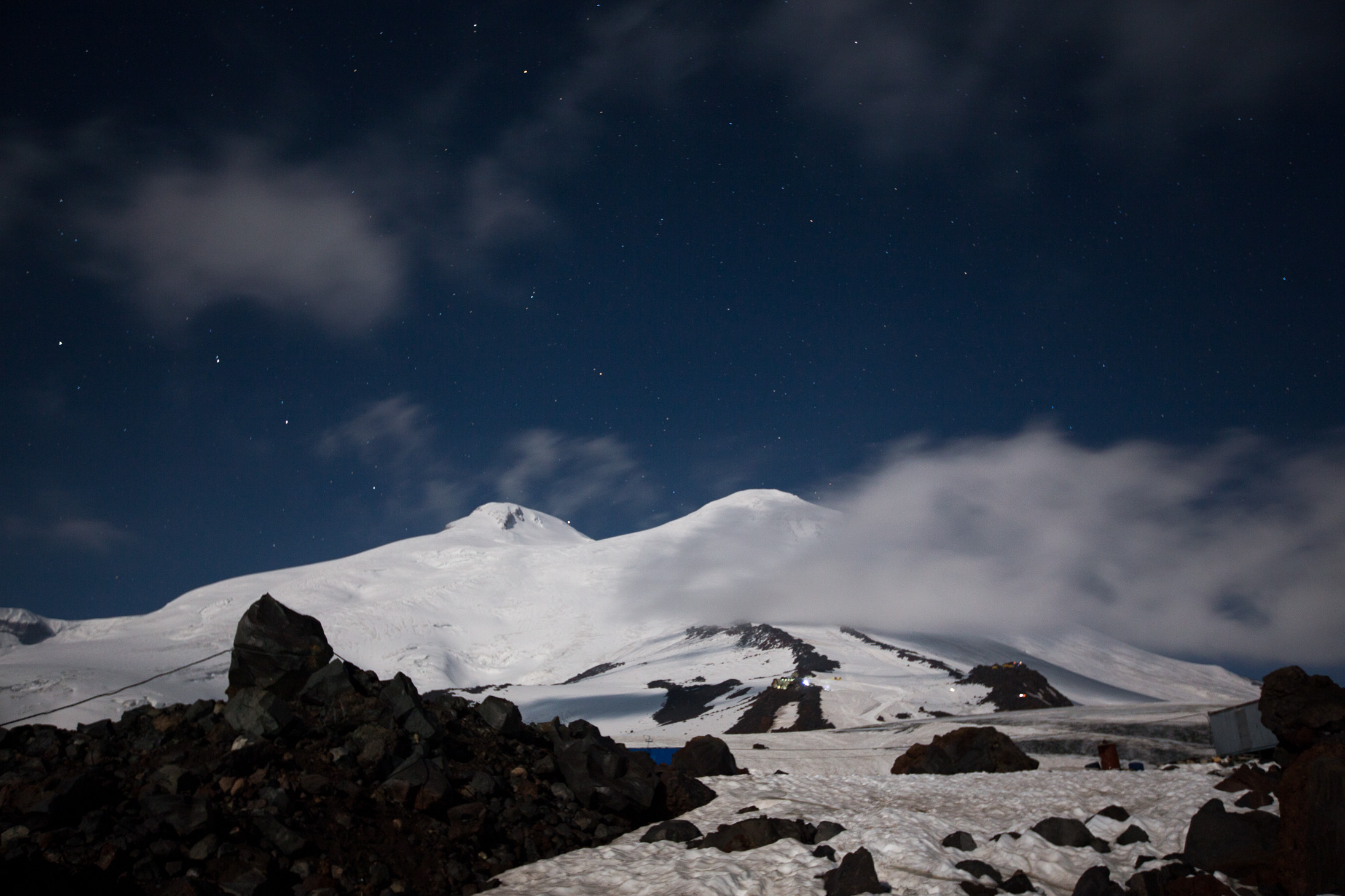
This is where we slept. Not the famous Barrels, but close to them. Same concept though — 8-12 people sleeping in very tight quarters, on bunk beds. Needless to say you can’t get much sleep with a bunch of other people making noise, especially when sleeping is already not as easy as it is at sea level. That in the clouds is Elbrus. Please note how we were attempting to dry our clothes from the trek the day before, desperately trying to get as much sun time as possible.
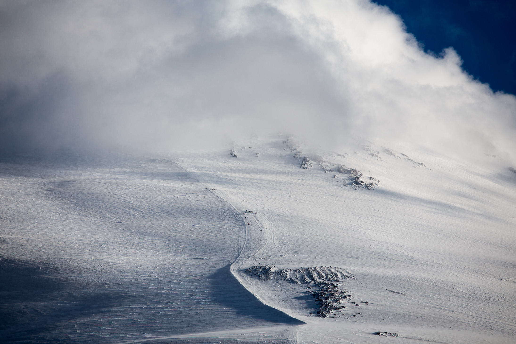
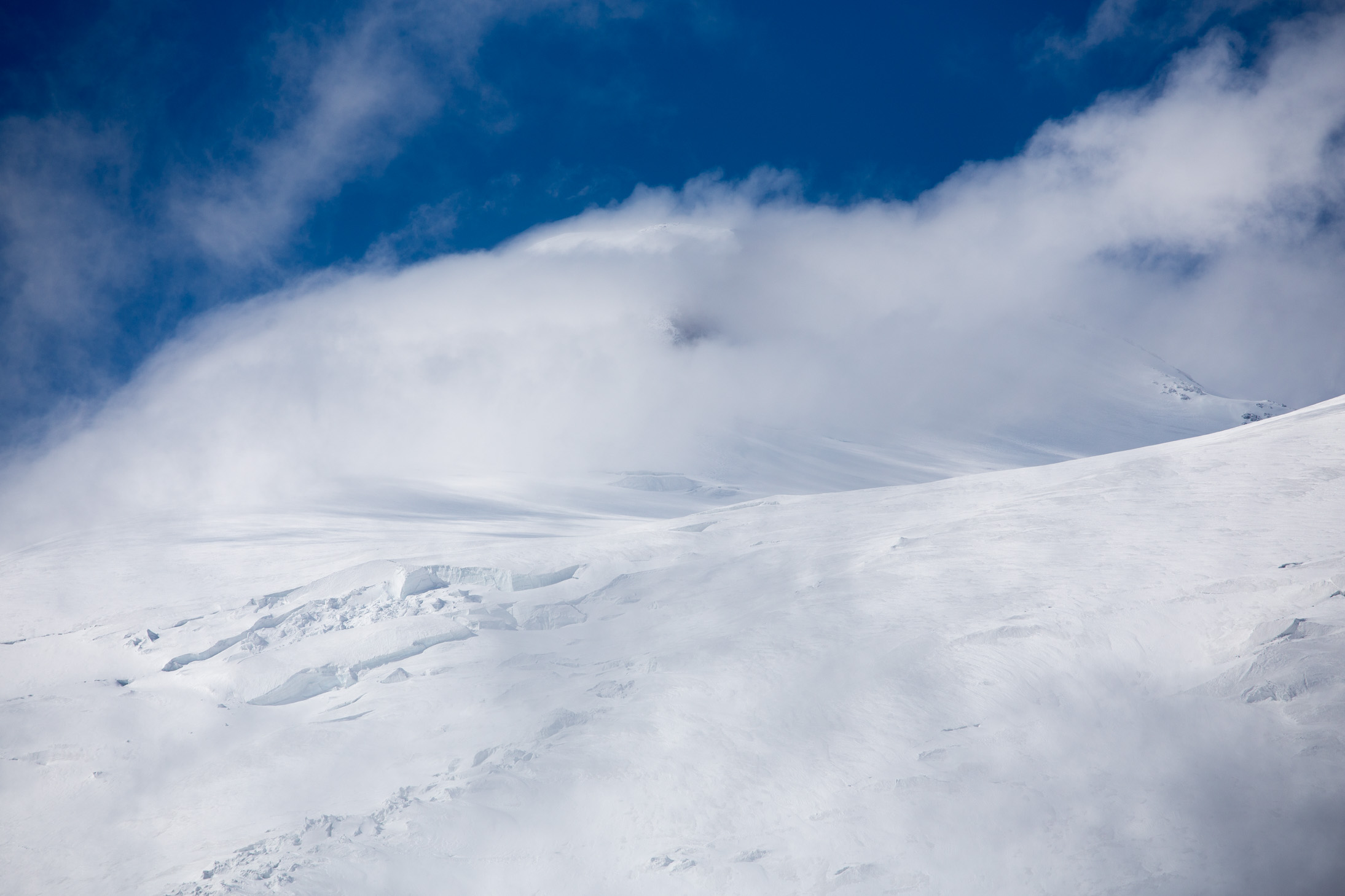
Suddenly out of nowhere, the clouds briefly cleared up and we could make out people climbing up the slope of the east summit. Less than 24 hours later, we would be the ones going this. The 7-shaped rocks that you see are the Pastukhov rocks, the top of which is at 4,800m. We had reached roughly the center point the previous day before turning back.
I just love how the clouds have engulfed the summit and how the people seem like these minuscule dots at the mercy of nature who can be swallowed any minute. Easily my favorite shot of the trip.
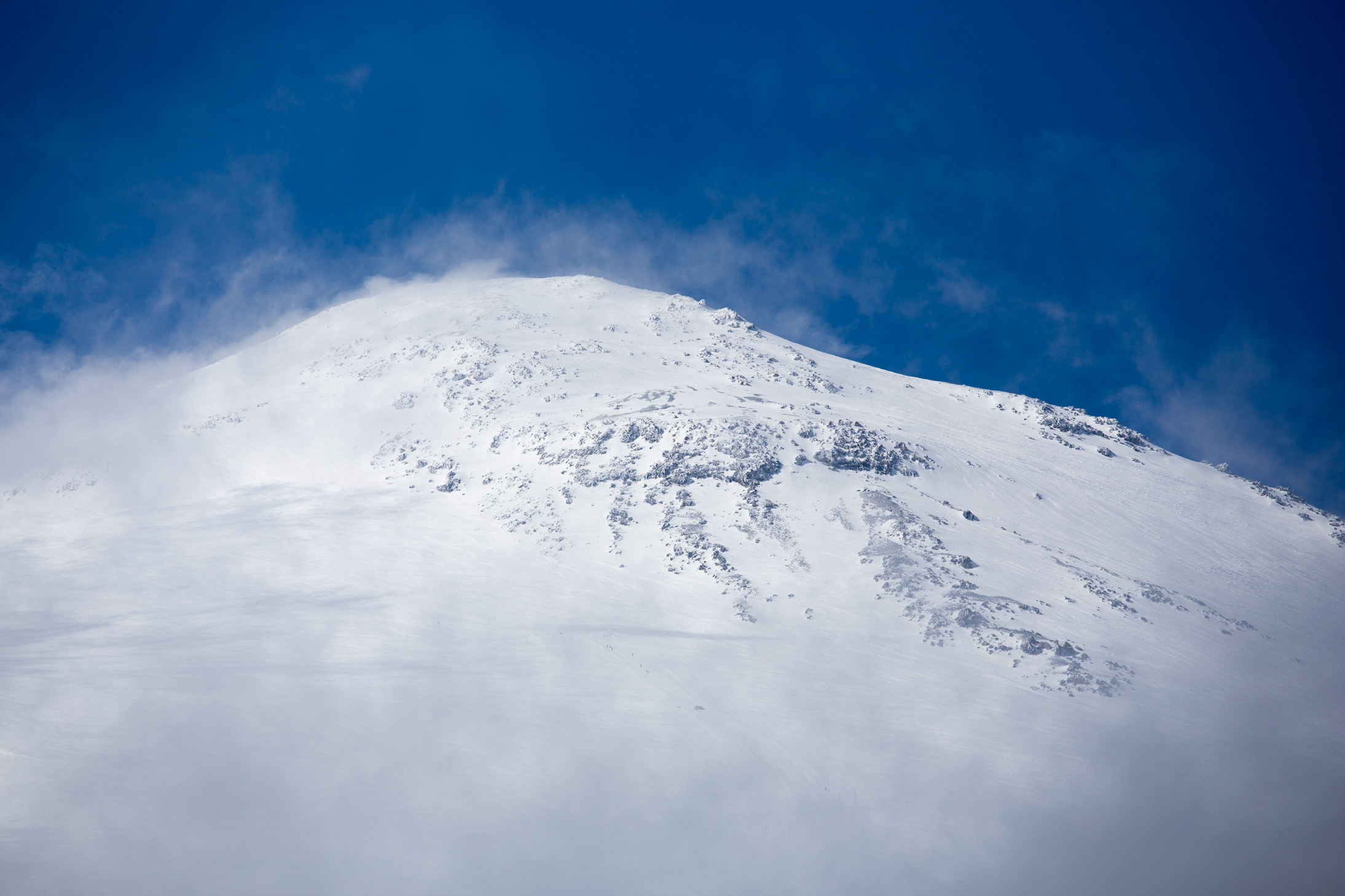
Minutes later things had changed and the top of the east summit was clear, with the clouds moving down and covering where we had just seen the people. Nature at its finest.
Meanwhile the west summit was covered almost the entire time so I couldn’t get an up close shot. What you see here is the end of the “saddle” between the peaks, a good spot for rest before the final push.
After this great morning session, all we did that day was a bit of crampon & ice axe training for those who hadn’t done it before and rest before the big day.
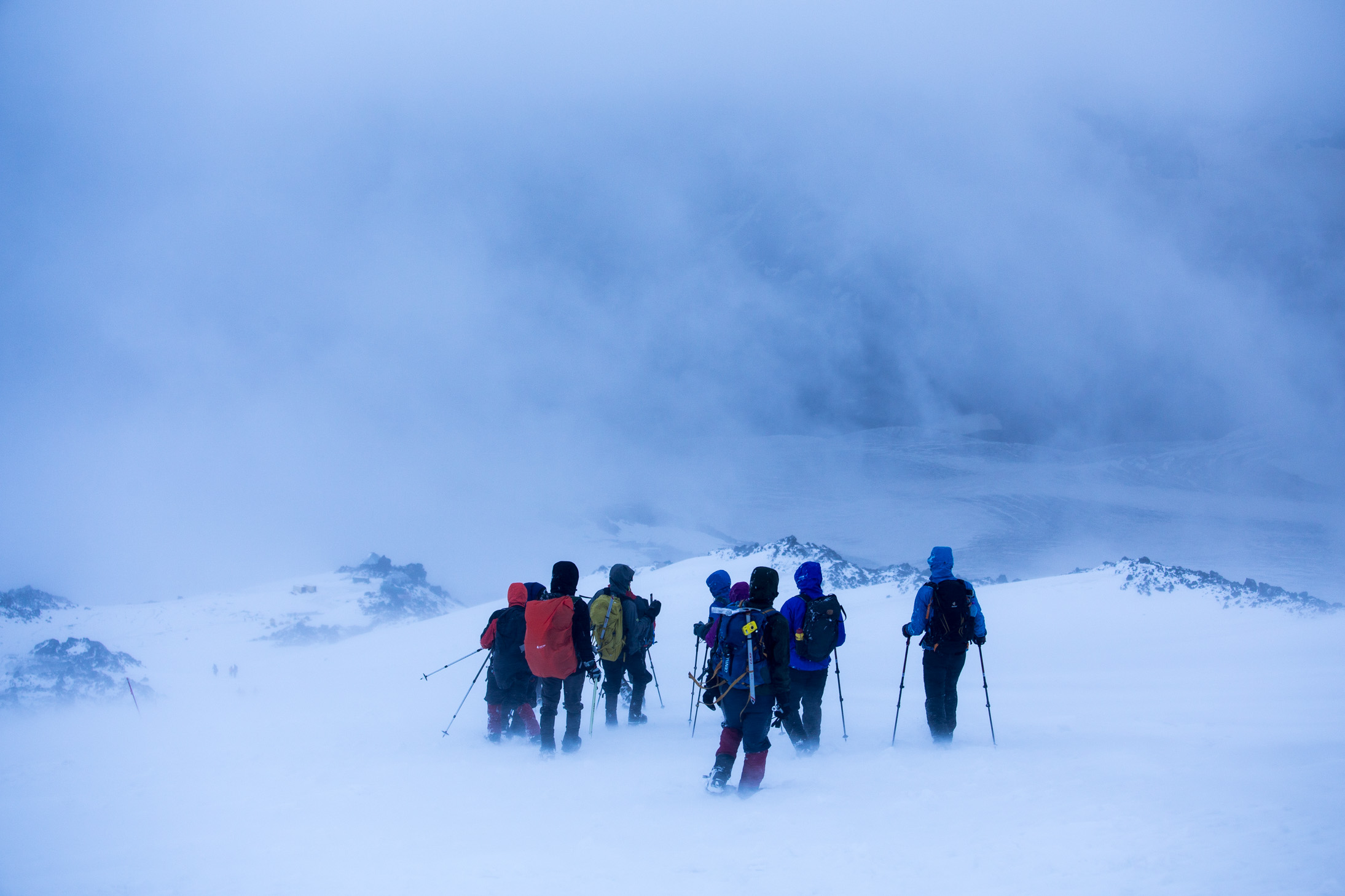
Day 5: Summit day
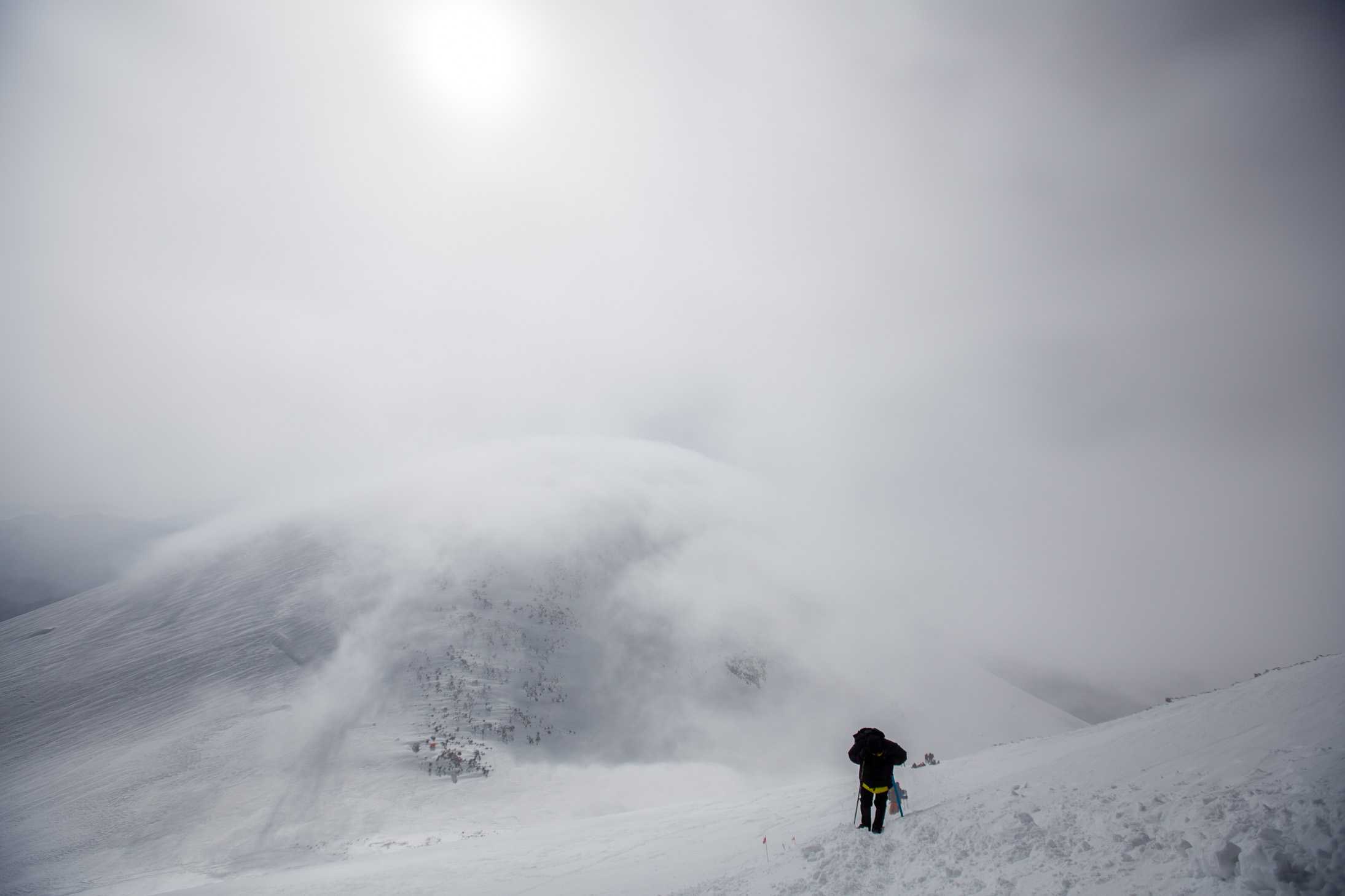
The previous day, 8 of the 25 people (myself included) decided that instead of taking the snowcat (which would take you as high as 5,000m), we would walk all the way from basecamp at 3,800m to the top. Due to our guides being concerned for the fickle weather, we had an even earlier start than what you’d normally do for Elbrus. We got up at 11pm and had a light “breakfast” (yep, I chuckled a bit when our guide Anna told us this considering we had dinner at 7pm 🙂 ) and set off on foot at 12am sharp. Needless to say, we didn’t even sleep that night.
Luckily, the weather was on our side! After forecasts of crazy strong winds and snow showers, at midnight it was almost completely still and the moon and stars were out. It was warm for close to four thousand meters and I didn’t even put my shell jacket on. It was the perfect start of our trek and it very much reminded me of Kili.
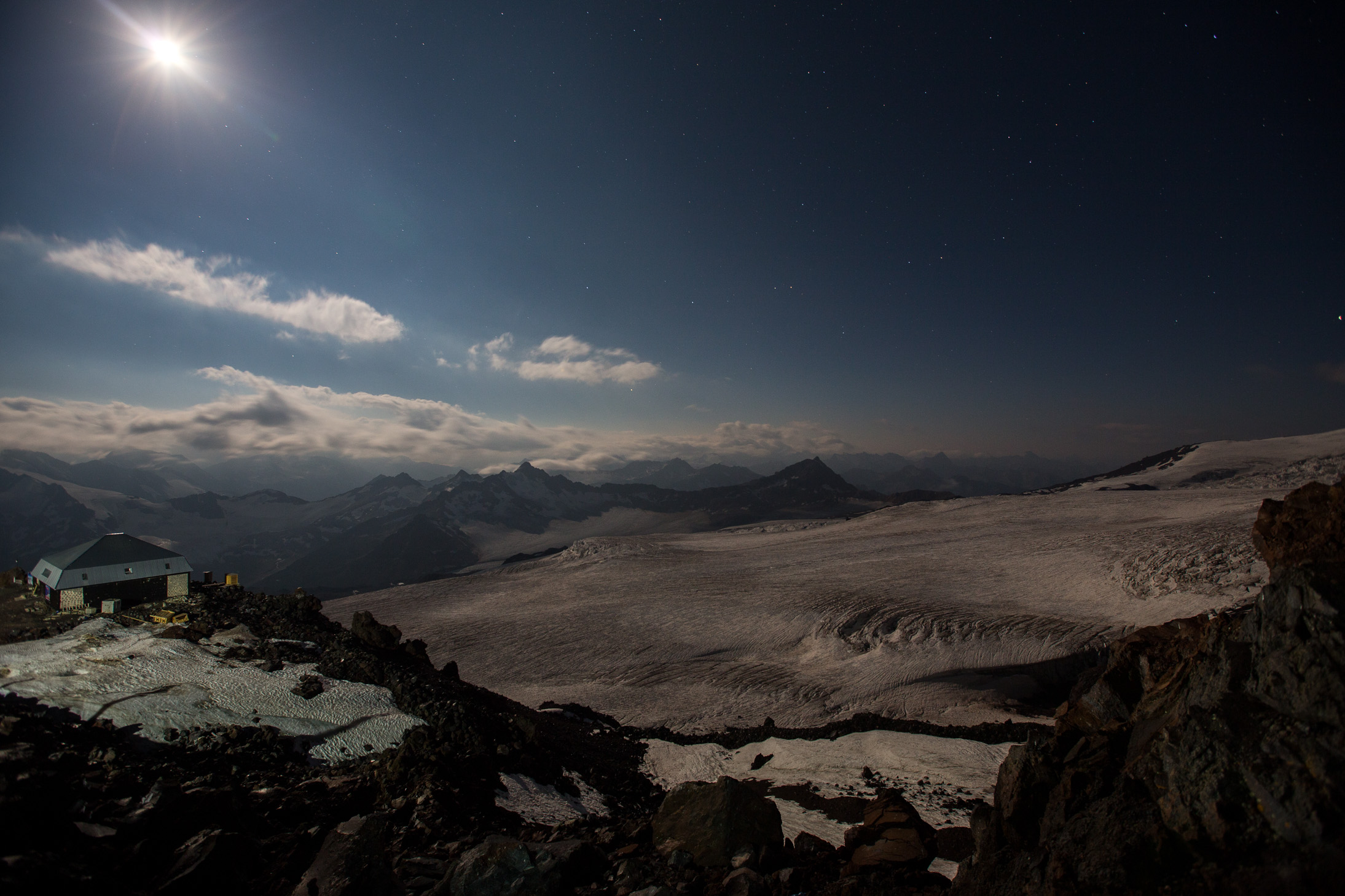
Our target for the day quite quite clear in the moonlight — straight ahead (and a bit to the left). I liked how the Big Dipper was right behind the west summit of Elbrus, cool alignment. You could tell we are high as you can normally see it from sea level.
Please note I didn’t really take many photos during the climb. For one, I was trying to keep a good pace and not stop often, but also it was really cold and uncomfortable at times to take off gloves and get the big camera out.
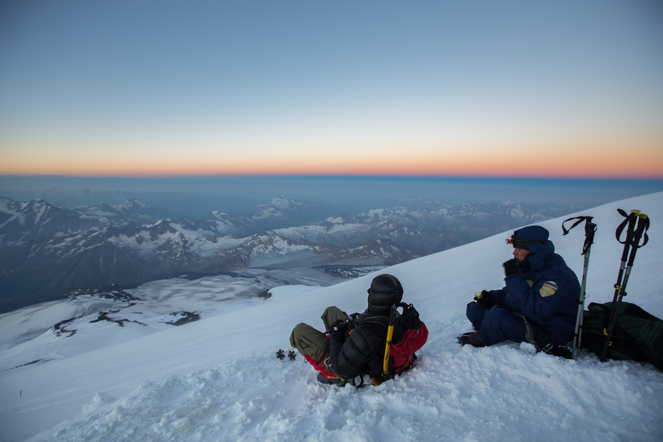
After roughly 5 1/2 hours of mostly silent and repetitive climbing, we were rewarded with this breathtaking view of the Caucasus mountains at dawn, minutes before the sun came out. We were already higher than most, if not all, peaks around us. I know it doesn’t look very steep on the shot here, but trust me, it’s no walk in the park 🙂 I felt fine though, no issues until this point.

A bit of a rest at 5,200m, just enough time to catch your breath, snack on a couple of power bars and drink some warm liquids before continuing up. The windchill was around -15/20C probably so you couldn’t really stick around for too long anyway.
Minutes later the sun hit the peaks with its pinkish glow… by far the most beautiful moment of the trip. Photo credit goes to Stu Avery who managed to get his iPhone out and snap this, my camera was already tucked in and we were walking up. Side note: I am continuously amazed by the quality of the photos these phones make!

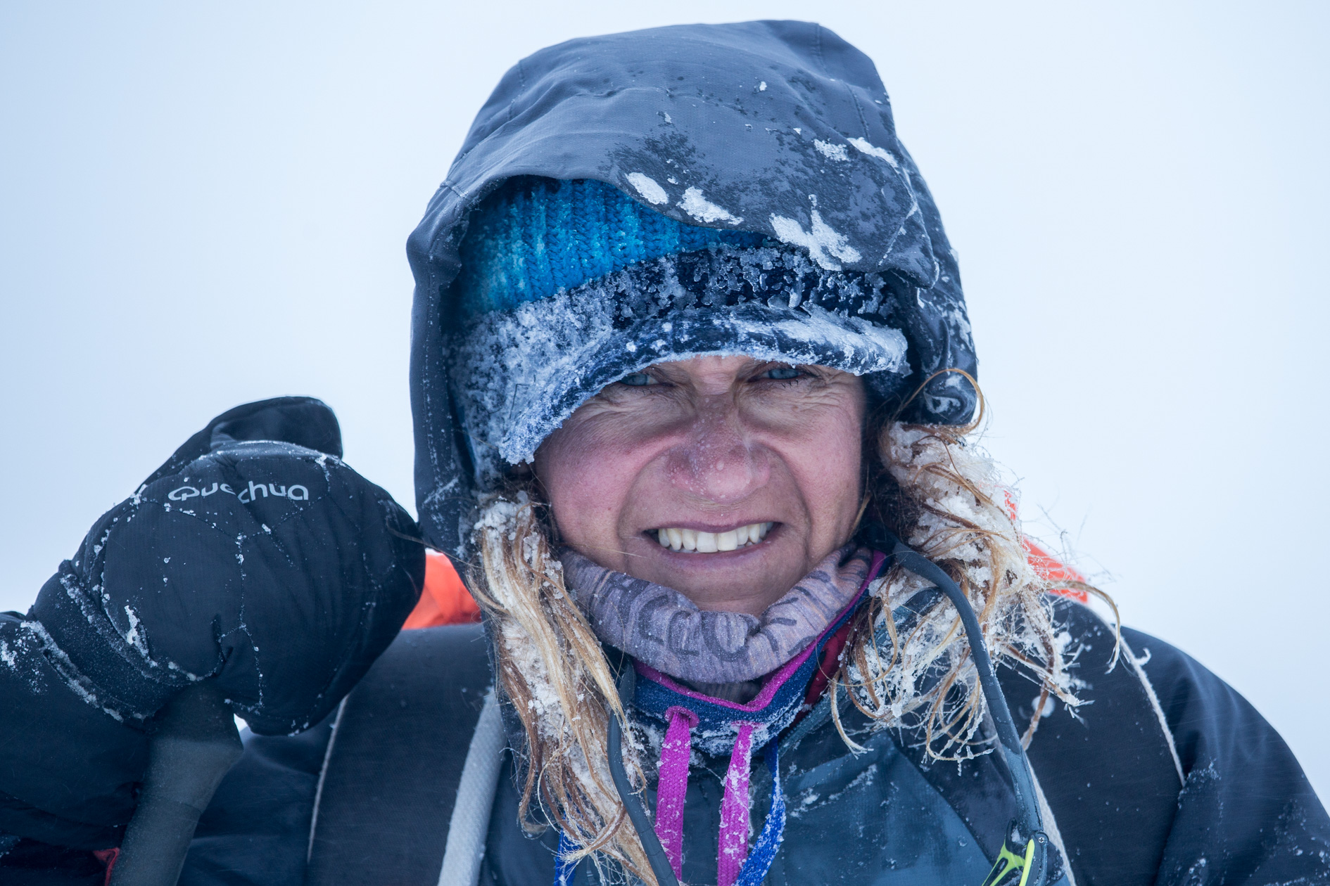
Whereas at the previous stop at 5,200m I thought we would traverse quickly to the saddle, by the time we actually got there I was very drained. Not sure if it was the altitude, the lack of sleep the previous night, the food I had eaten or not drinking enough water (or all of the above and more), but I felt quite nauseous — no headache or muscle aches, but overall lack of energy and the urge to puke. I spoke with the others around me and all more or less felt the same way, to various degrees. For the first time since the start of the climb I asked myself if I can actually get to the top — weird really, that’s never happened before, but certainly a good learning experience.
It was already getting close to 8am so the sun was going to come around the east summit soon and I decided to head for the sunny spot, which looking back was a good decision. I had something to eat and drank plenty of water so within 10-15 minutes I was already much, much better and regained my strength. Time to make the final 200m ascent which would also be the steepest / toughest. Luckily my breathing was fine so I actually found a pretty good rhythm and surely made my way up.
The shot below is midway through the final climb, as you can see. That behind me is the east summit and somewhere at the bottom is the saddle.
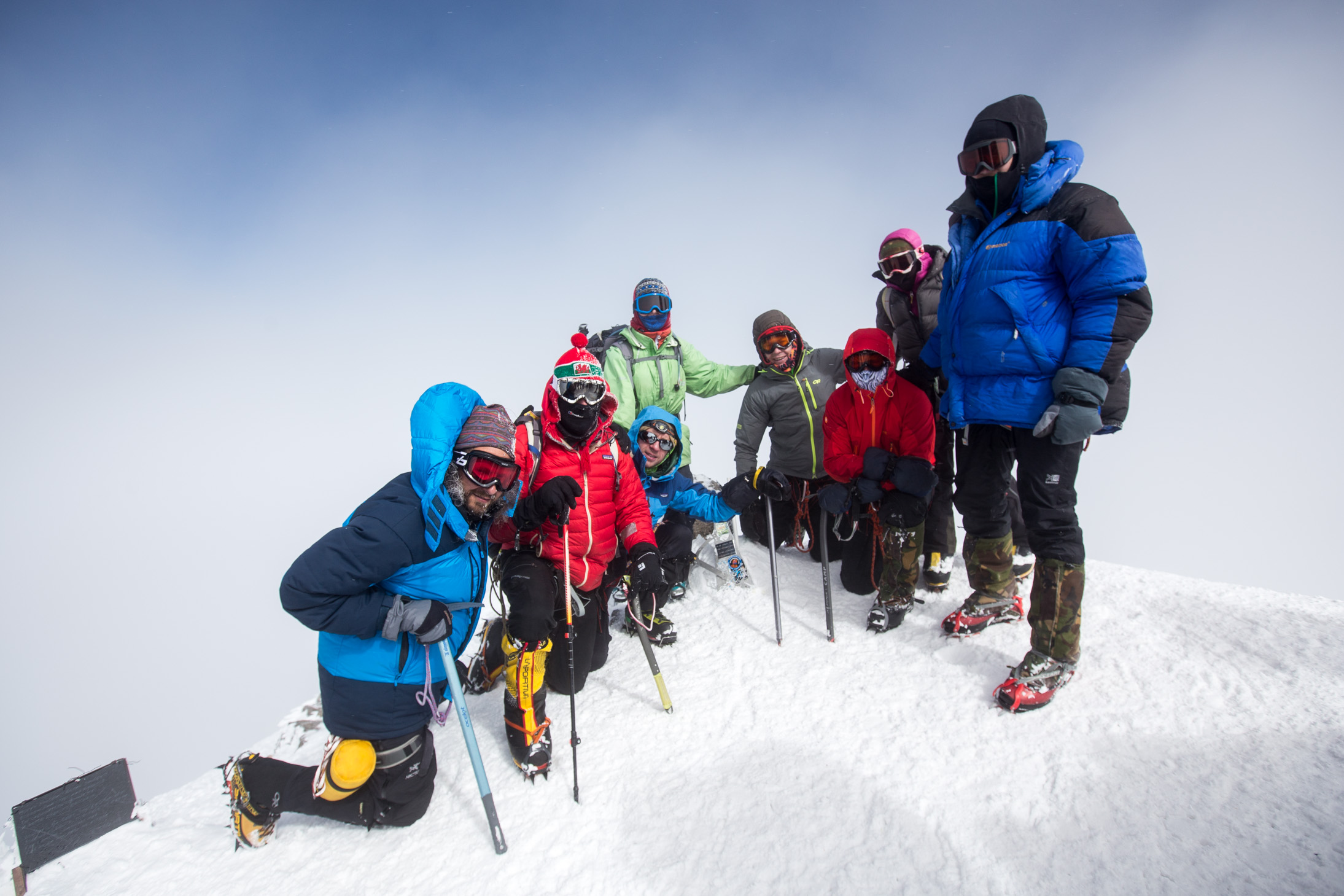
And we made it! Team DR at the top 🙂 By the time we got there (around 9/9.30am) the clouds had come in so there was hardly a view, but it was still sunny and overall quite nice given that the forecast was for snow showers and thunder later in the day. Don’t be fooled, by the way, there were tens of people who summited that day — 20 out of the 25 people in our group alone but many many others as well. A challenging peak, but definitely climbable if you’re in good shape.
It took us another 4 hours to come down and grab a victory 5642 beer at the base camp, followed shortly by a trip down to the village for a hot shower, a nice meal, and a 12-hour sleep 🙂
Elbrus, check.

Specacular event and amazing photos! You have such strength and courage–carry on!
Thanks, Cynthia! I hope the post doesn’t make it seem like I’m this courageous guy — many other people climb this peak, there are far far bigger challenges in the world of climbing 🙂 I was merely trying to be informative should anyone who visits here attempts to take it on and wants an accurate account.
Well done. It was very imformative, thank you. I am not a mountain climber and never will be, so am duly impressed.
Magnifico
Your favorite shot of the trip? Mine too. Stunning!
Thanks, Julie! Good thing I got up early to see this 🙂
Elbrus – I’ve never heard of this but I love seeing your amazing photos and learning more about the area. What an adventure!
It was a fun trip. We stopped by Moscow for a couple of days on the way in and, surprisingly I have to say, I loved the city 🙂 I’ll post that in the coming weeks.
What can I say but… WOW! I could never do this, I have a lot of respect for your courage 🙂
Don’t underestimate yourself, Suvi. Plenty of people climbed it, I’m sure with a bit of prep you can as well.
Magnificent!!
Awesome! Stunning pictures as well!
Wow! That’s some adventure! Having just done a hike at 4800m in Peru, the highest I’d gone in my life so far, I know how challenging this is. LOVE the part about the hair standing on end as the thunderstorm approached.
4,800m is quite high!! Did you to the Salkantay trek? I did that in 2008, loved it 🙂
Yep that was the one. We did it in September. If you’re interested. here is a link https://trailtopeaktheadventurouspath.com/2016/09/14/an-overview-of-the-salkantay-trek/
Very nice! I have a few shots scattered around the blog as well, perhaps through the Peru tag you can find them >> https://inasearchofbalance.com/tag/peru/. I imagine it’s gotten a lot more commercialized nowadays, back then it was still the far lesser known (and cheaper!) option to reaching Machu Picchu 🙂
That was what we were expecting, but I think it has really changed in the last year as more and more trekking companies have cast their lot in on that trail, and as it continues to be completely unregulated. It was spectacular scenery though.
Have you ever hiked/trekked in Patagonia?
AmazOn, amigo!