B
ack in August/September I got to take my yearly week off to hit the mountains, that’s about as much as I can do these days. After finishing the Kom-Emine challenge (part 1 and part 2), the E4 trek was the next logical step given I’m mostly Bulgaria bound as of late. It starts from Sofia and finishes at Gotsev Peak (the highest in Slavyanka mountain) where the border between Bulgaria and Greece lies. E4 is less than half the length of Kom-Emine (250km vs 600km), but has more ups and downs and is generally a bit more demanding. You normally do it in 10-11 days, but my goals was to make it in 7 which I managed to do — though with a bit of a break in the middle due to really bad weather conditions, more on that later.
Much like most of my recent adventures, this was a solo experience. For one, it’s much easier to be flexible and plan when it’s just your schedule. But more importantly, you set your own pace — want to push on and take 2 days in one go? Ok, go for it. Need to stop for an extra day or take a break due to injury? Sure. Does it get lonely? Not really — you do meet people along the way (not all the time, luckily 😆), especially at the huts in the evenings, but part of the allure is to be alone with your thoughts for a few days. At this point I’m used to and enjoy it.
The fact that you sleep in huts allows for a lighter backpack. I’m not going to share a gear list, but assume it’s more or less the same as Kom-Emine (part 1 has more detail on that), though I’ve trimmed it down a bit with a lighter backpack, less food and 1-2 fewer items of clothing — because who needs fresh underwear each day after all 😅 With 2-3L of water in the morning, I think it was around 9-10kg (20-22lbs) at the start of the day which is reasonable.
The single heaviest item remains the good old Canon 6D with a 70-200mm lens. The ever-present debate of whether to bring it or not inevitably finishes with me deciding it’s worth the effort because it just produces incredible photos. And I’m happy with the results, though the camera is getting old with its 10 years of faithful service and the newer models could certainly make the shots even better. I do have to say, the newer iPhone models also deliver some pretty great images, all of the wide angle ones are with my 13 mini.
So how was the challenge? I really really enjoyed it! Perhaps it’s the distance of time talking, but I’ve forgotten the bad bits and can say nothing but good things about E4. Sure, there are a few times when it’s not so fun (day 1, for instance, should you choose to make it as long as I did, just gets tiresome at the end and you don’t get any vistas to keep you going), but overall you cross some of the most beautiful places in Bulgaria. The mighty Rila mountain, the majestic & rocky Pirin, the indomitable Slavyanka, even good old Vitosha shows you a different side to it as you cross it to the south. I wouldn’t recommend doing it in 7 days unless you’re in pretty good shape, but in 11-12 days? Absolute must! ⛰
Route
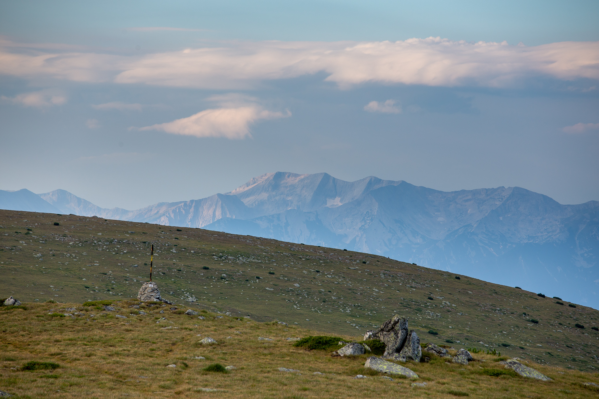
Here’s a map of the longer treks in Bulgaria. Kom-Emine is E3 and takes you across the country via the Stara Planina range (Old moutain), whereas with E4 you go through Vitosha, Verila, Rila, Pirin, and lastly Slavyanka mountains. Much more diverse in that regard.

Timeline
And here are some stats for the nerds. The fourth day was more of a half day — as you’ll see in the photos below, there were impending thunderstorms rolling in for the foreseeable days (plus I had a really painful foot injury which made every step oh-so-enjoyable) so I chose to put a pause on the trek. I resumed about a month later (busy period professionally + weather window opened up) with another 3 days to wrap up the challenge. I would have finished it in 7 either way probably, but the distances and huts would have been different in the latter portion of the trek.
| Day | Section | Distance | ELEV gain | elev loss | time | gps track |
|---|---|---|---|---|---|---|
| 1 | Sofia – Klisura | 52.06 km | 2,284 m | 2,026 m | 13hrs 29min | link |
| 2 | Klisura – Maliovitza hut | 35.82 km | 2,466 m | 1,495 m | 11hrs 16min | link |
| 3 | Maliovitza hut – Macedonia hut | 30.88 km | 2,292 m | 2,115 m | 11hrs 02min | link |
| 4 | Macedonia hut – Predela | 25.60 km | 773 m | 1,786 m | 6hrs 44min | link |
| 5 | Predela – Vihren hut | 24.29 km | 2,434 m | 1,502 m | 8hrs 49min | link |
| 6 | Vihren hut – Popovi Livadi hut | 47.46 km | 1,987 m | 2,505m | 13hrs 03min | link |
| 7 | Popovi Livadi hut – Gotsev Peak | 35.45 km | 1,840 m | 2,282m | 9hrs 58min | link |
| Totals | 251.56 km | 14,076 m | 13,711 m |
With that, here’s good stuff — the photos! Let’s dig in.
Day 1: Sofia – Klisura
52.06km | 2,284m up | 2,026m down | 13hrs 29min
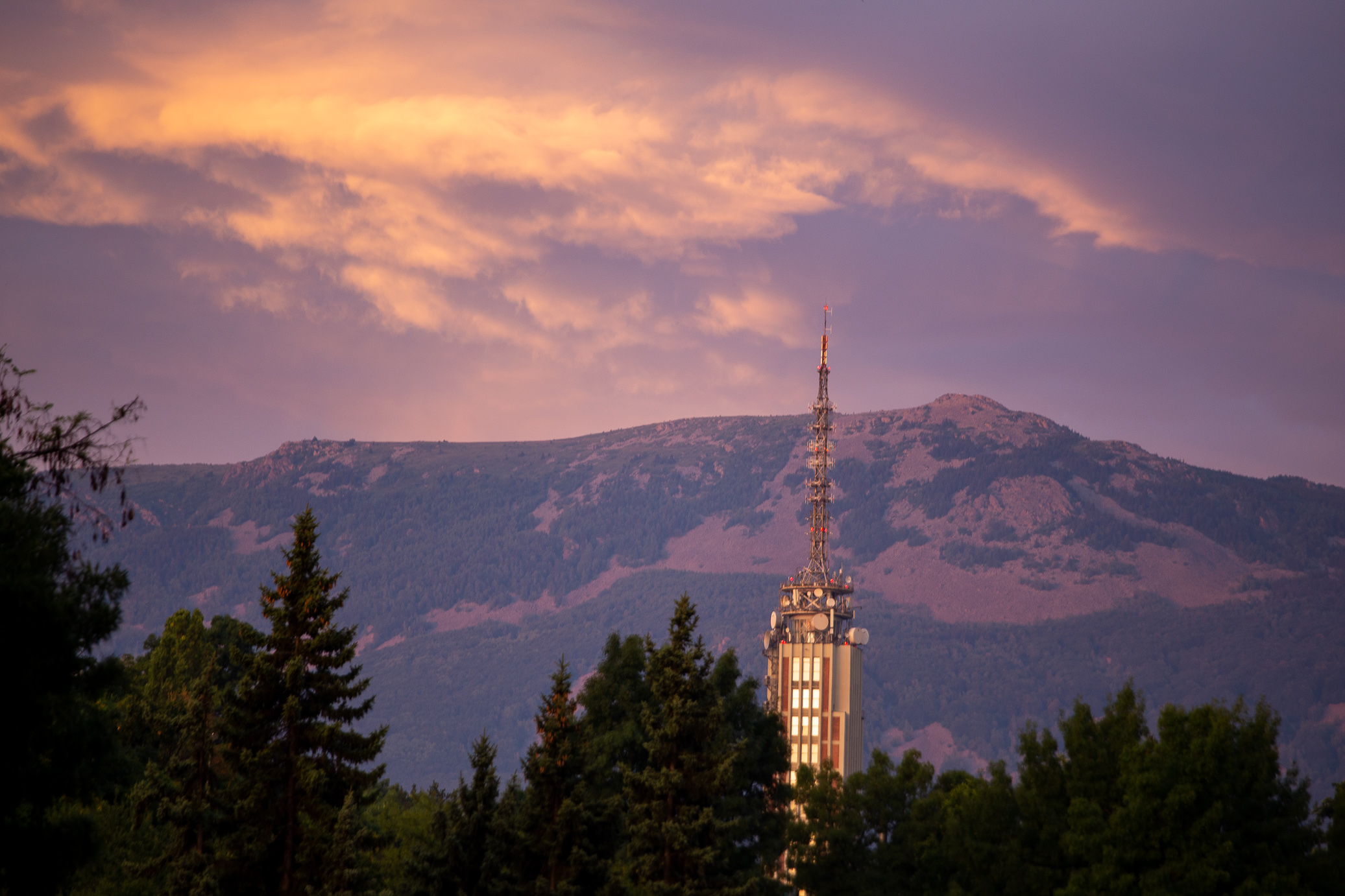
Just past 6am on a Sunday August morning, not a bad way to start E4. This is the famous TV tower in central Sofia with Vitosha in the background. Note that’s not actually Black Peak, the highest point and the one I had to climb that day — it’s Kamen Del which actually offers far better views of Sofia. You should really check this one out.
I had a really long day ahead of me and I’ve climbed Black Peak many tens of times (if not hundreds at this point) so I didn’t take any photos on the climb up. The weather also wasn’t great, lots of wind and low hanging clouds/fog. I reached the top in perhaps 2.5-3hours (my PR is around 2hrs) as I wasn’t trying to get exhausted at the very start. This photo was taken as I had started descending on the south side of Vitosha, but still close to Black Peak — you can clearly see the overhanging clouds.
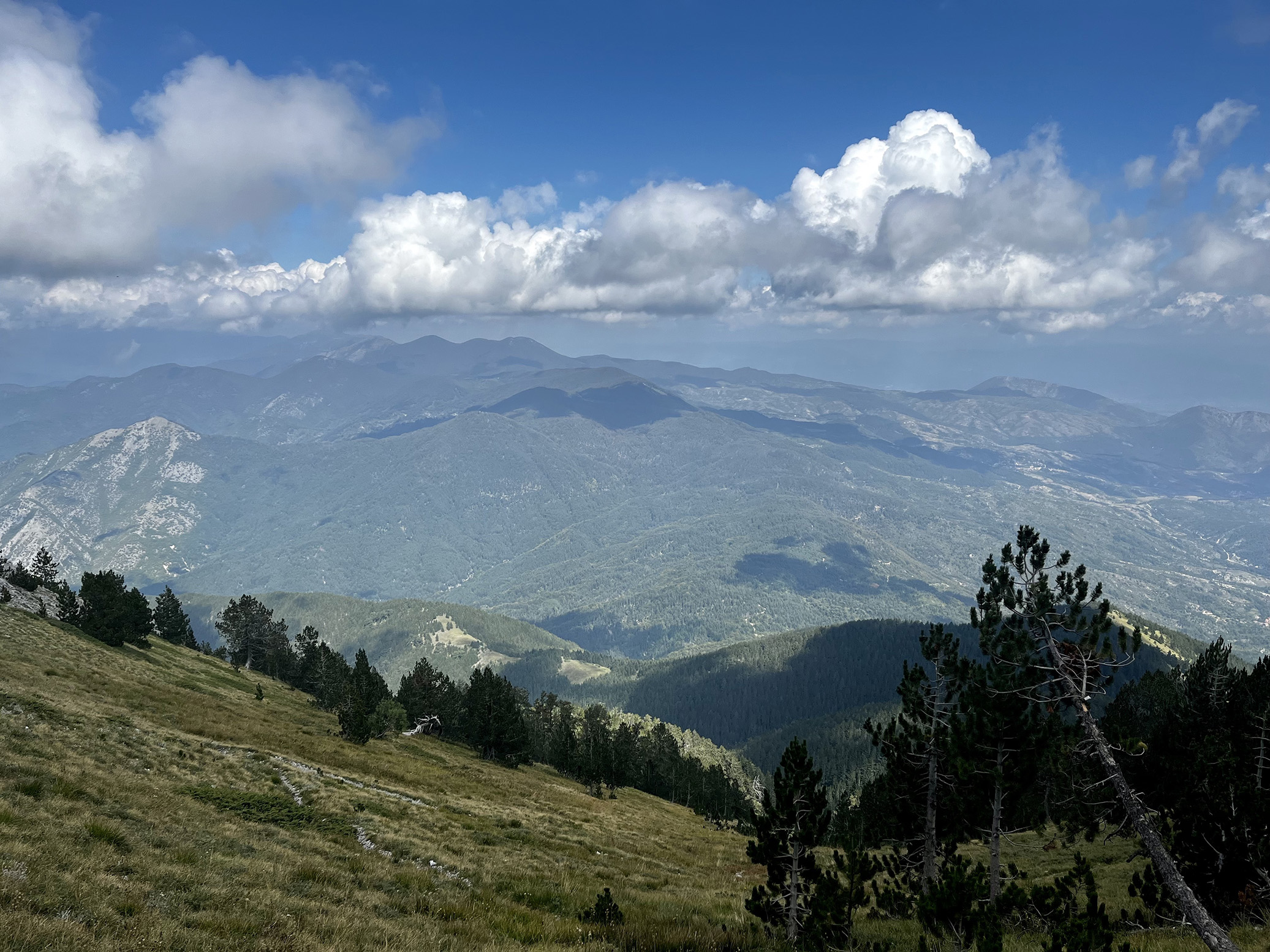
One of the few instances where I could actually see up ahead. The path essentially follows that ridge and continues onto the right of the photo in the distance, just below the mini summits you see.

First of many iPhone shots. What a great feeling to be level with the clouds. You can’t tell from the photo, but the wind was super strong, as it often it as at the Vitosha plateau.
I barely took photos for the next few hours. After you descend Vitosha you immediately enter Verila mountain and, I’m sorry to say, it doesn’t have a lot to offer in terms of vistas. Lots and lots of monotonous walking in fields and dirt roads. It’s probably the least fun day of the lot. But almost at the end of it, I got rewarded with this beautiful view — the last-ish rays of the sun poking through the clouds and the view of Rila mountain in the background. A good one to close out the day. Well, I still had another couple of hours to get to Klisura perhaps, but let’s not the facts get in the way of the good story 😅
Wanted to give a should out to Elza and her husband who’ve been taking in many a battered trekker for quite a few years now. There’s no official hut in Klisura so not many options really. They’ve converted their second storey into an AirBnB type thing and it’s just what you need — hot water, a warm dinner (home cooked! mm mmm) and a welcoming host 😃 Should you be planning E4, let me know and I’d be happy to share their contact details. The photo was taken the following morning as I got in late, but it belongs in day 1 overall.
Day 2: Klisura – Maliovitza hut
35.82km | 2,466m up | 1,495m down | 11hrs 16min
After the long first day, I left a little later than normal, around 8am perhaps. The first part of the day you walk in these dirt roads that I imagine are used by the wood cutters. Not the nicest, but hey, you cover lots of ground quickly.

Within perhaps no more than an hour you hit an open plateau and get to look back — this is Vitosha in the distance, with Sofia on the other side of it. Really helps you put into perspective how far you’ve come in just a day.
I’m never sure if these are wild horses or not, but they do make for a nice photo of what lies ahead 🙂

As I reached the 4 hour mark (around 16km), I realized that my goal for the day was no more than another 2-3 hours ahead (8-10km) — which was quite confusing as all the descriptions had it pinned at ~36km. I then realized I had made a mistake in the trail, or rather you had to actually not take the fastest trek to Maliovitza hut, but use the scenic route 🙄 To get back on track, I took an old path few people walk these days as evidenced by how overgrown it was. At the end, I pretty much covered the same distance as the “traditional” E4 route for the day, but got to enjoy a few hours of complete solitude among some old forests. Not too bad.
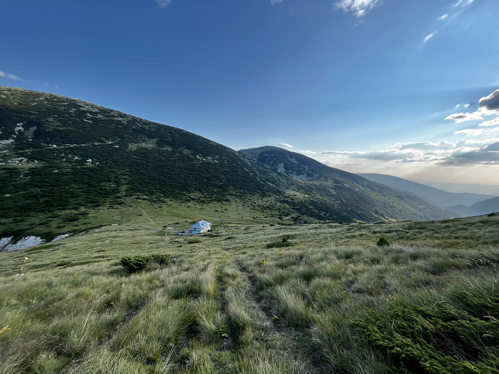
After a massive climb up to hit the ridge (the scenic route was no joke), I poked out of the tree line to find myself opposite the Rila Lakes hut, seen below, where the normal path lies. From this point you’re out in the open as you’re above 2,000m altitude.

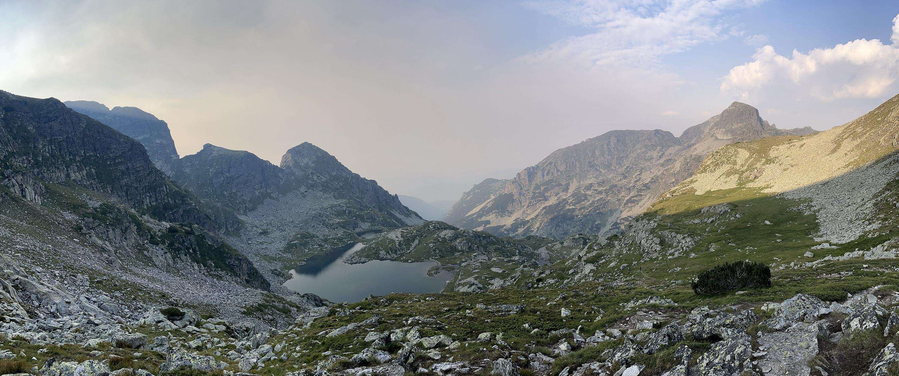
Speaking of the hut, here’s its name sake — the Seven Rila Lakes, a group of glacial lakes that is perhaps the most visited mountain tourist destination in Bulgaria. A place I normally avoid, especially on the weekends, as it’s just too overcrowded. But in what was already a late-ish afternoon, I got to enjoy them. What a view from the top!

Looking to the east, I could clearly see the path ahead — alongside that ridge on the right, all the way to those 3 spiky looking peaks on the left-ish side of the photo (the first one is Maliovitza and the hut is right at its foot on the other side). It seems close, but there are quite a few ups and downs along the way, including a steep final ascent and even steeper descent. The lakes you see here are called Urdini lakes.

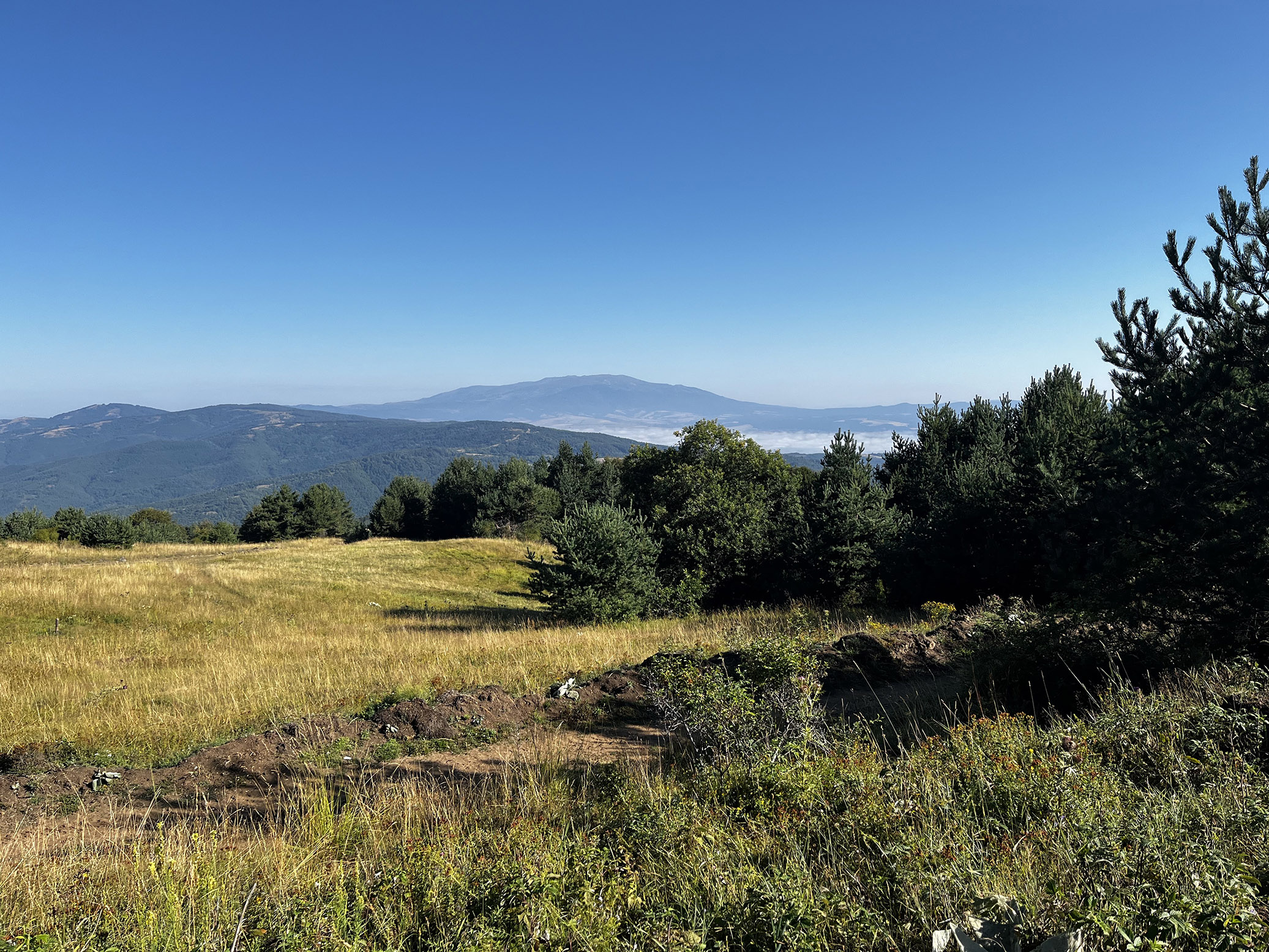
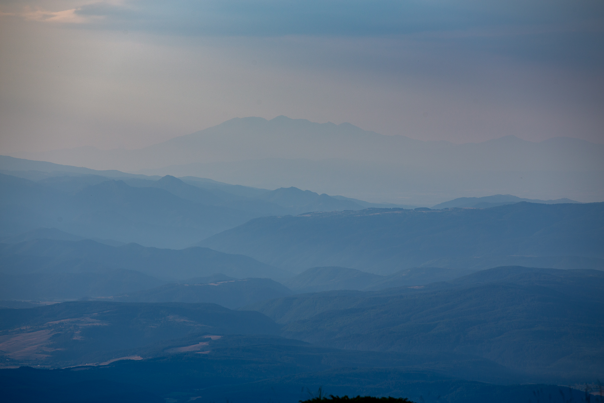
Walking along the ridge, you get to see Pirin in the distance. Looks close, but it’s a 2-day trek to get there. That’s where the 70-200m lens comes in handy.
Midway through you get a preview of the final climb of the day, Maliovitza Peak as seen from the east (it’s the rocky bit all the way to the left). As you’ll see in day 3 below, it looks *very* different from the other side. It’s just a 200m vertical ascent from this side, but after 9-10 hours of walking, it’s still not the most fun 20-30mins 😃

Almost at the Maliovitza ridge, I got to enjoy this beautiful sunset as I looked back on the the path in the last 2-3 hours. I know it doesn’t look steep here — and it’s not really that bad, but the wide angle lens certainly softens it up even more.

The last sun rays in the valley on the other side. Another hour or so I was at Maliovitza hut. Wow that ended up being quite a bit longer than I imagined at hour 4… Still not sure why the “official” route had to take such a detour. Sure, it’s much prettier and hopefully the images do it justice, but isn’t the point of the E4 to just cross the damn mountain, not swivel up and down 😅
Day 3: Maliovitza hut – Macedonia hut
30.88km | 2,292m up | 2,115m down | 11hrs 02min
Another long-ish day ahead of me so by 7am I was up and running. That in the distance is Maliovitza Peak (the one on the right) at around 6.30am perhaps, basking in the morning rays. Told you it looks very different from this side!
Perhaps one of my most favorite moments of the entire E4 — an hour or so after leaving the hut, I had gained some altitude and was on a path that does not draw a large crowd normally, and especially on a Tuesday early morning. Normally in the mountains there’s always some sort of a noise, but this time it was completely silent. No birds, no water, no wind, no people — complete tranquility and bliss.

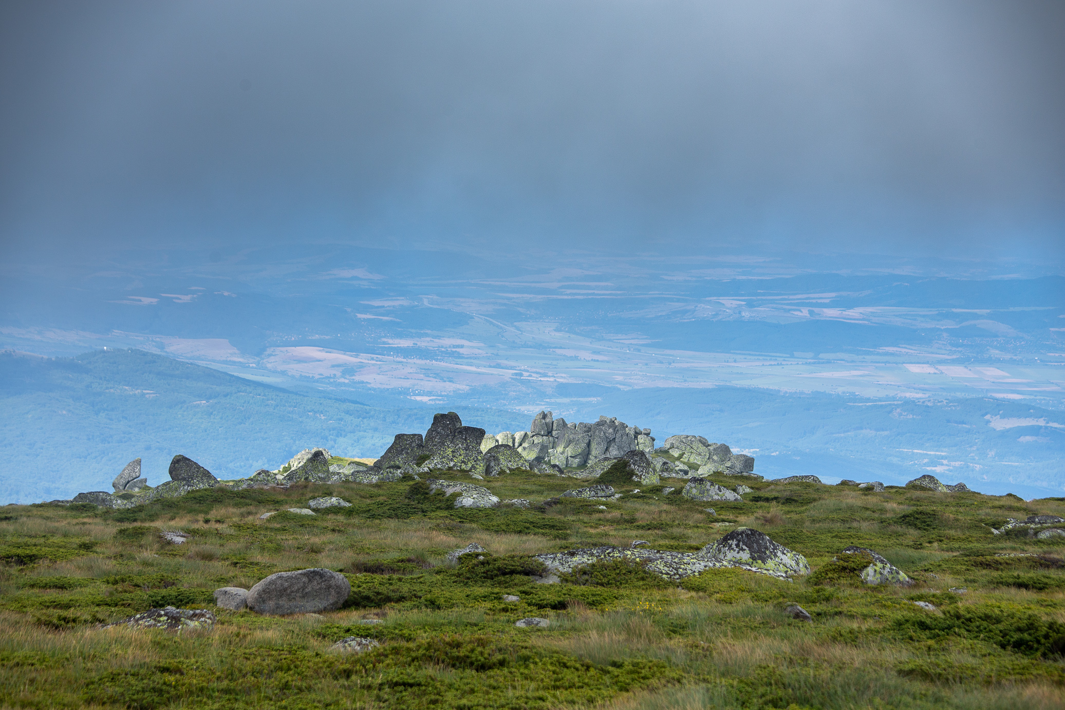
Before long, I had gained a bit of altitude and started reaching some impressive looking peaks. Photo take right near the Scary Lake.

For the next few hours I didn’t do any photos. The previous one above was actually taken on the other side of those jagged peaks in the distance, almost at the center of the shot below. From that point I had to walk all the way off to the right of the frame, lose several hundred meters of altitude to cross that valley you see, only to then have to climb them back up… it’s not called a challenge for nothing. At least I had this buddy keep me company, he was a constant companion since leaving Maliovitza in the morning.

Nice views of what was ahead of me. This is Smradlivo Lake (Stinky Lake… yep, no joke) and at the very very end was my target for the day (yep, no joke), mind you I had already walked for 5-6 hours at this point.
Ribni Lakes (Fish Lakes), right next to Smradlivo Lake above. Quite a beautiful area, thought it’s a shame that the hut at the lakes isn’t well maintained at all.
Final push towards the end goal for the day. The super wide angle lense distorts the image and you can’t really tell, but it’s a near vertical, several hundred meter drop on each side here. But man oh man, look at that view!

11 hours and 30km later, I was finally at Macedonia hut, nestled in this valley. My happiness of getting there before dark was only matched by my unpleasant surprise it was unmanned (but left open) so there was no hot water and I had to take a completely cold water “shower”… not fun. The hut keepers did show up an hour later, they were out looking for berries, so I got a warm meal and some good tea. Really helps recovery and moral boost, let me tell you 🙂
Day 4: Macedonia hut – Predela
25.60km | 773m up | 1,786m down | 6hrs 44min
When doing those multi-day treks, you check the forecast constantly. Ideally you leave when there’s a good several day window, but that’s not always possible so in this case I knew it wasn’t going to be 7 perfect days. All of the apps I was following were unanimous on the fact it was going to rain on day 4 for me, the question was when exactly and where it would find me. I decided to make a really early dash and see how far I could get. This was taken around 6.30am, just as I was leaving the hut.

It wasn’t long before the clouds started rolling in though. At least I had some photo opportunities after gaining some altitude. You can see the hut down on the left of the photo below.
Early morning layers.
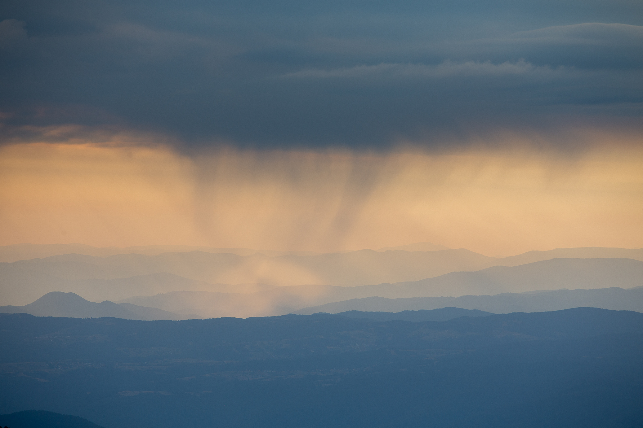
Was this rain? I wasn’t sure, but it sure looked pretty with the close up shot.
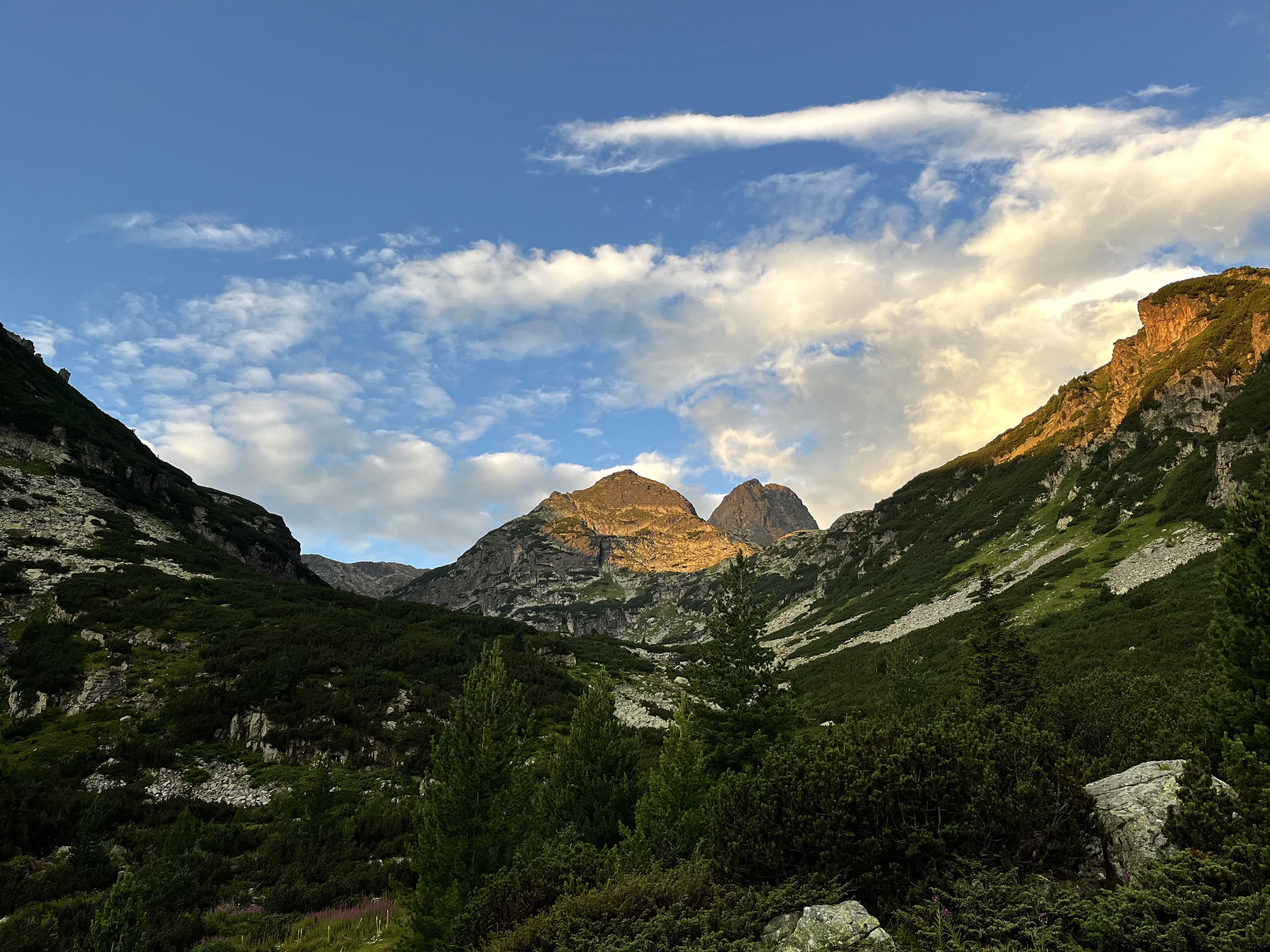
And there was Pirin and Vihren Peak (the highest I’d be climbing on the E4 and the cover photo of the post), so tantalizingly close now! Had this been a full day for me, I would have gotten quite close to it.
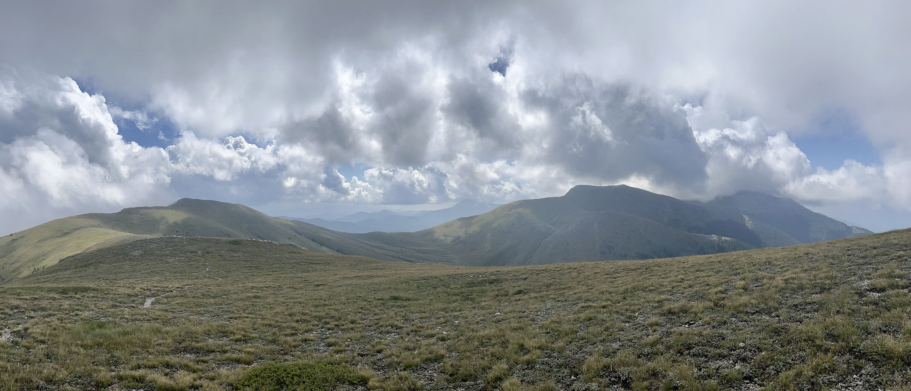
The next 3 hours were pretty much a race against time, with the clouds chasing me on my heels. This is Kapatnik, the southmost 2,000m+ peak in Rila. From here it was a steep 1,000m+ climb down to Predela, the divide between Rila and Pirin. Last quite pitstop and photo looking back on the mighty mountain before picking up the pace again.
Almost at the bottom of the valley, I sensed a few raindrops and when I looked back I noticed the sky was completely covered. So much for hypothetically outrunning this thing.
I got to Predela at a decent 6hrs 44min (normally you do it in 8-ish) and got lucky that I didn’t get poured on. But I decided to stop there. For one, all forecasts showed not just rain, but a decently high likelihood for thunderstorms and I tend to draw the line that possibly getting electrocuted… I’m getting soft 😆 On top of that, I had developed a really unpleasant ankle/foot injury over the past couple of days, the point where every step was quite painful. Not as much when you’re rushing as the adrenaline keeps you going I imagine, but as soon as you stop it would hurt and then the entire evening and morning after it would just be swollen and painful.
So the prospect another 3-4 hours of climbing back the 1,000m that I had just descended with an unknown severity of the ankle problem and possible thunder storms didn’t seem too appealing, oddly enough. It was a tough decision as I don’t quit easily, but it became clear after about 30min that it was better I went back home. The news that I had just become an uncle also helped tip the scales 😉 So I cleaned up as much I could and hitchhiked back to Sofia. I got picked up by a lovely mountaineer couple so we had some good conversations on the way back. Though my mind was still very much on getting back up and finishing this thing.
(I strongly recommend playing the song above, it adds to the experience. If you didn’t play the first one you should also go back and do it. You’re welcome 😉)
Day 5: Predela – Vihren hut
24.29km | 2,434m up | 1,502m down | 8hrs 49min
Remember how I had descended 1,000+ meters from Rila’s Kapatnik Peak to hit Predela where Rila meets Pirin? Well, I had to know climb it back up 😃 It was a beautiful September day and for 3/4s of the climb I was in the forest.
As I was climbing and keeping a good pace up, I kept being rewarded with views like the one on the left. At one point though, I had an odd feeling like someone was watching me. Turns out there was! This wild goat was protecting its baby goat which was running around. The mom had heard me rustle the leaves and just stood there, observing me. A little unnerving, I had to say. I got out of their way quickly though..

Gotta appreciate the little moments as well.
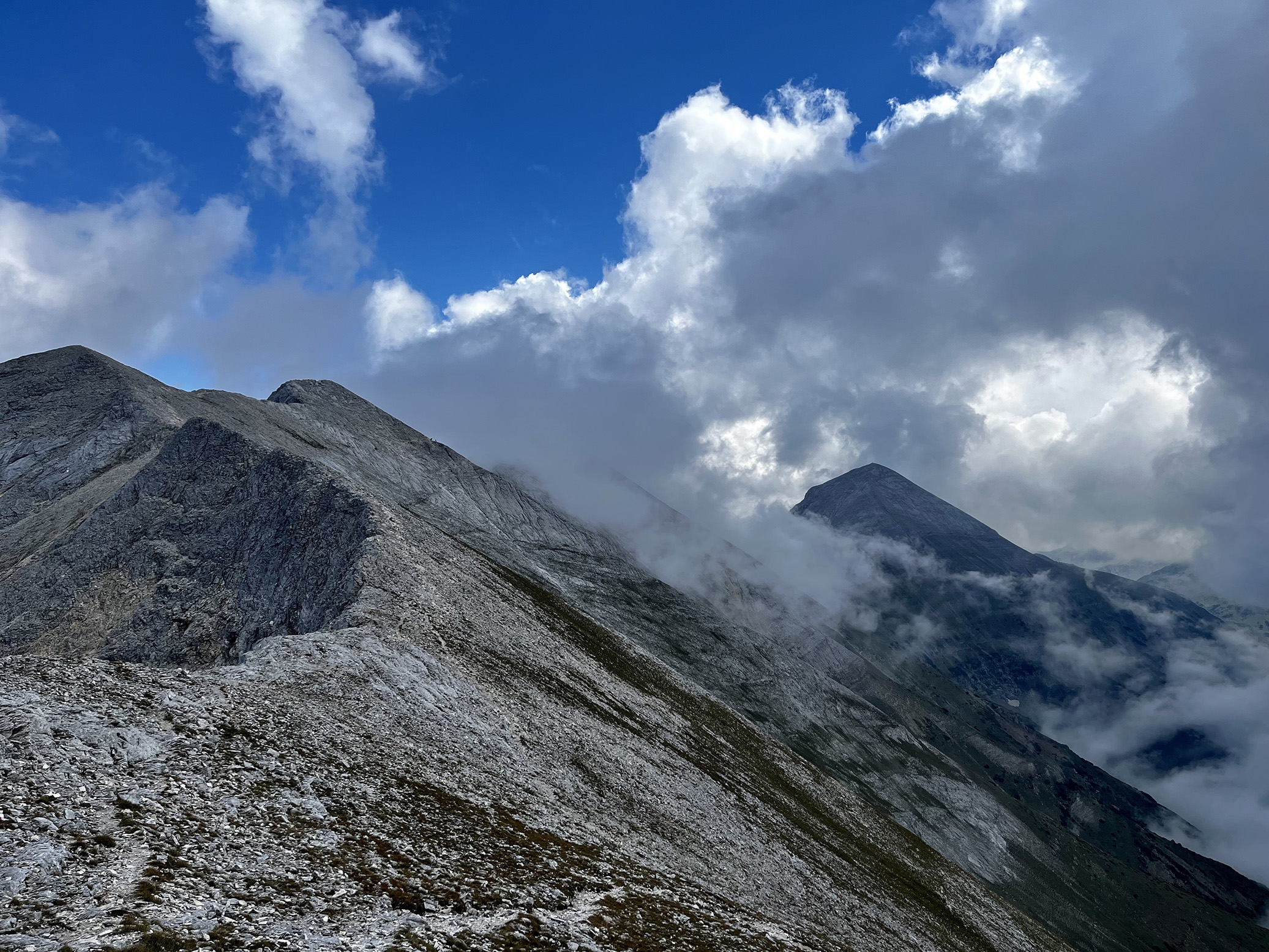
The weather wasn’t perfect, but that often makes for some incredible shots. At the end of the climb up I had the main target for the day in sight — Vihren Peak, highest of Pirin and second highest in Bulgaria. Seems far away, but it’s only 3-3.5 hours away perhaps. That dot is a man, btw.

Getting near now! This rocky traverse is one of the most famous (and beautiful) treks in Bulgaria. There’s a path that follows the ridge line and is quite picturesque (I’ve done it a couple of times), but it takes quite a bit more time so I chose to just traverse it, there’s a path that undercuts the peaks at what’s a fairly stable angle — you cover a lot of ground that way.
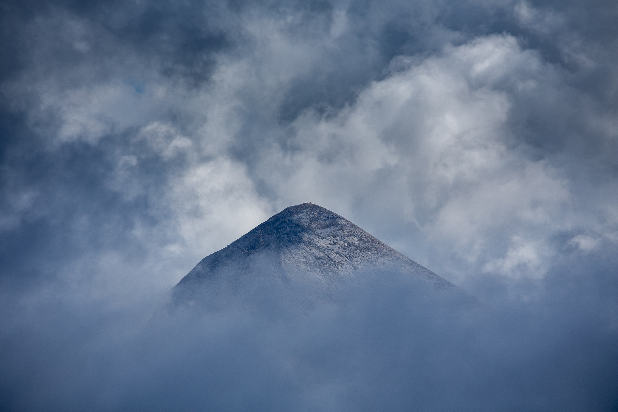
All of a sudden the weather opened up a bit, literally for a couple of minutes, and Vihren revealed itself in all its 2,914m (9,560ft) glory. What a view! I’ve climbed it perhaps close to 20 times and it never gets old. The tiny tiny dots at the top are people — just crazy. Favorite shot of the trip.
The most interesting part of the day’s trek was going through Koncheto (on the left below), a super super narrow portion of the path. There’s a several hundred meter fall on each side — not vertical, but nevertheless near certain fatal outcome should you slip, hence the metal wire.
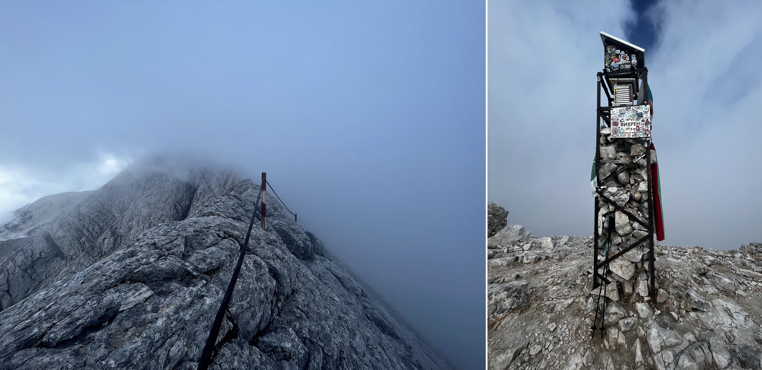
Once you cross it, you’re very near the final vertical 300m push towards Vihren. On the right below is the photo from the summit. It took me 7.5hrs to get to it — had I been in better shape and not made a couple of poor navigational choices (“shortcuts” 😒), I could have probably gotten it down by at least an hour. And that would have opened up the opportunity to push further beyond Vihren hut, hypothetically allowing me to finish the whole thing in 6 days. But alas, it’s a couple of hour drive to Predela from Sofia and I left rather late so there was only so much daylight I could use — it was September, as a reminder, the day was at least an hour shorter.
Last couple of hundreds meters of descent to go. You can clearly see Vihren hut at the foot of Todorka Peak (the leftmost one). Btw, Todorka sits at 2,746m so no more than 30-40min before the photo was taken, I was ~160m higher than that, I’d quickly lost quite a bit of altitude… guess I was in a rush to get down after the splendid 4,000m up and down that day 😰

And that wraps up the first day of my return to E4. The best news was that my ankle felt fine — time for more adventures!
Day 6: Vihren hut – Popovi Livadi hut
47.46km | 1,987m up | 2,505m down | 13hrs 03min
Another monster day ahead of me, not that I knew it when I left. I wanted to push to do the remainder in 2 days as I had ground to make up, but wasn’t sure whether I’d be able to reach Popovi Livadi. I focused on keeping a good pace — and enjoying the magnificent weather and views. below is Vihren from the other side. This is not the face you descend, it’s the one of the left side. Really nicely lit up by the morning rays.

Two hours after leaving Vihren hut, I had gained some altitude and could see Vihren and Kutelo Peak (on the right). What a view! I stood there for 5 mins just admiring it.

Mirror mirror on the wall..

A final view of the Banderitza valley and Vihren, now in the distance. Not too shabby.

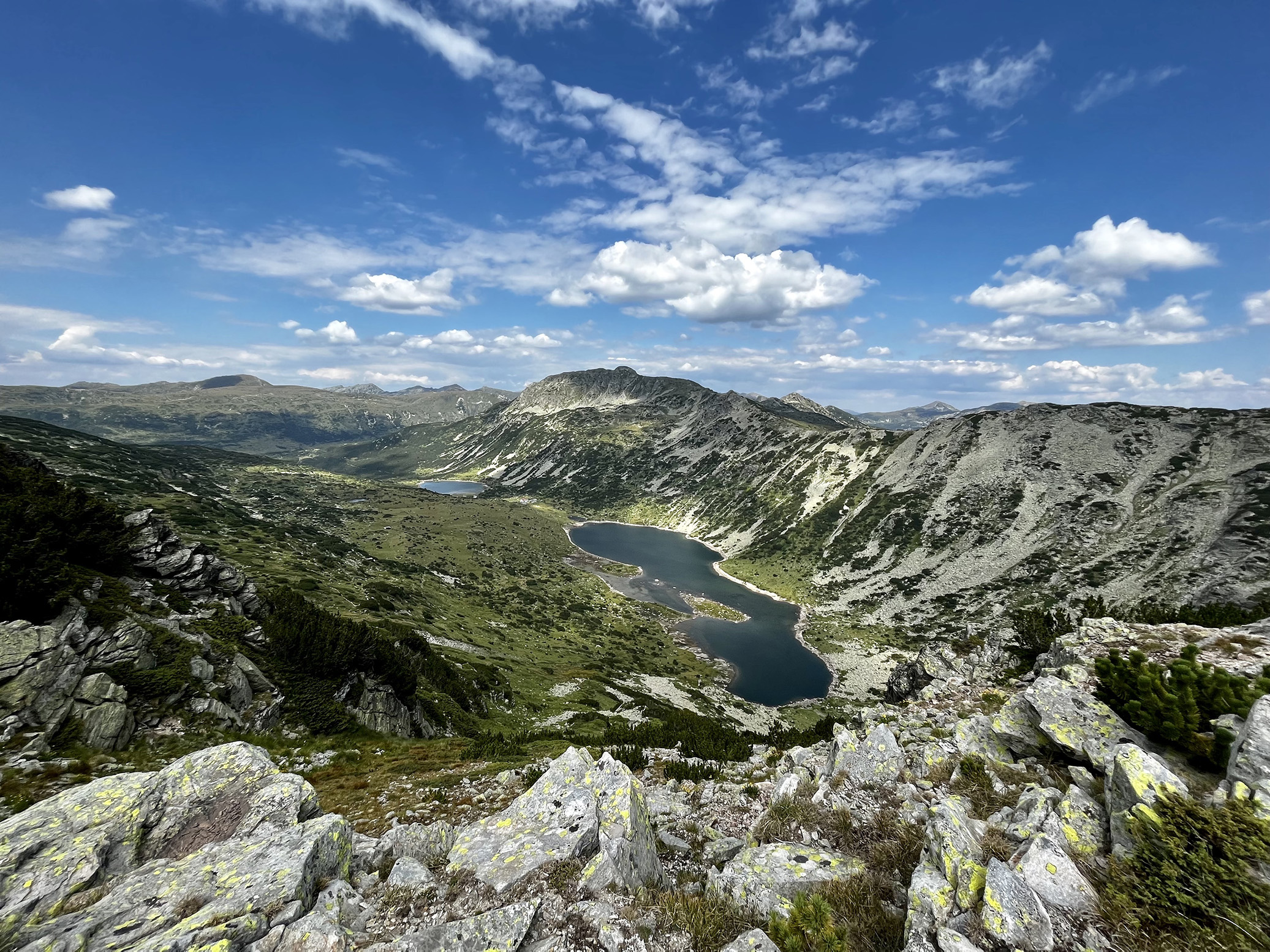
The next couple of hours I kept my head down and big camera tucked in so I can cover ground. Got to enjoy some cool views and traverses (on the right below) on my way to the Tevno Lake shelter/lodge (left). Got there in just under 4 hours which was a good indicator, normally it takes like 6. The weather was also on my side, as you can see, so I decided to go for it.

The view of Kamenitza Peak from Tevno Lake — not a bad place to grab your lunch. In this case it was just a sandwich, not enough time to order something.

Moo, b*tch!

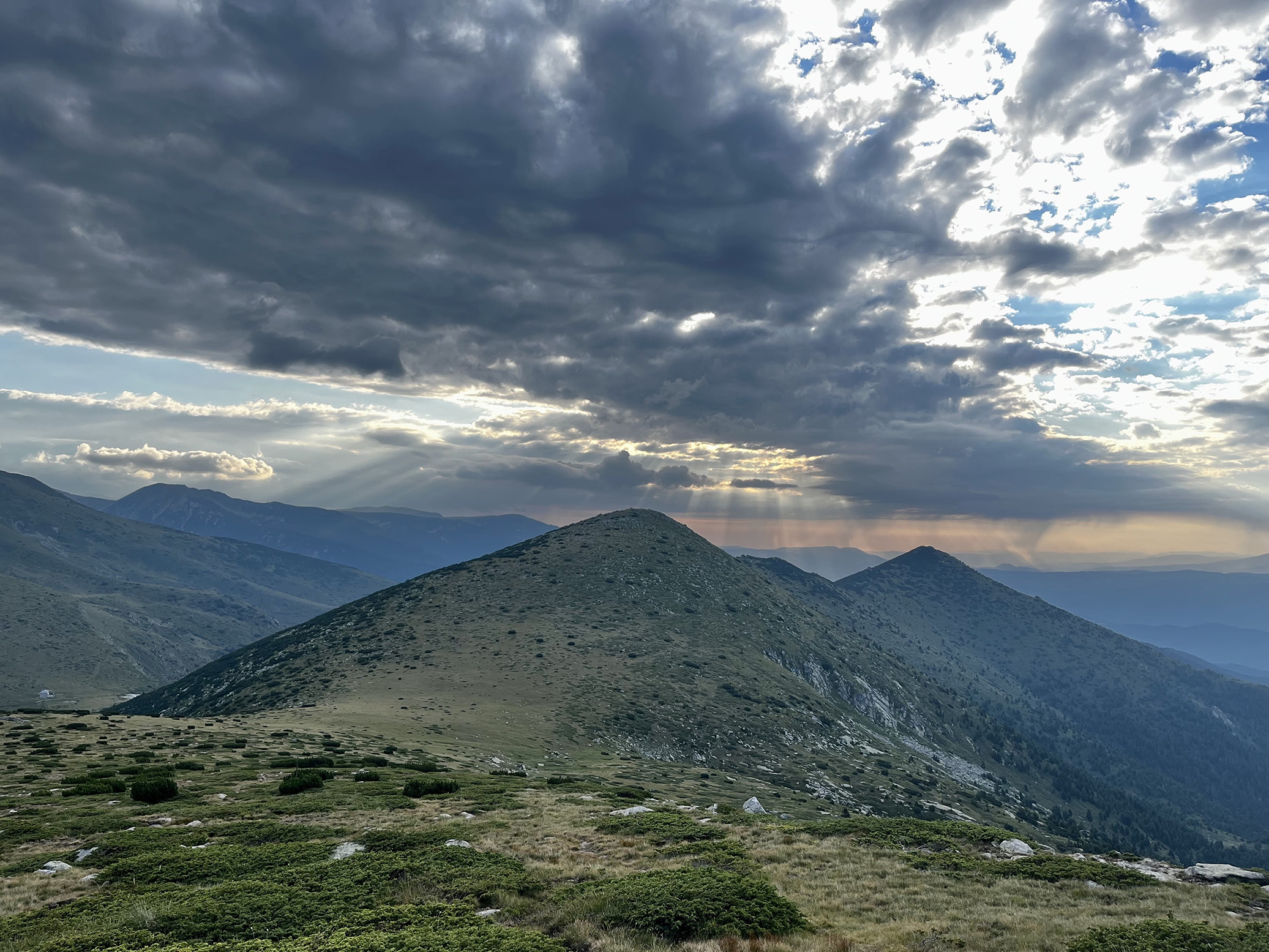
I didn’t take photos the next ~4-5 hours. After Tevno Lake, you lose altitude as you reach Pirin hut (short stop here to get some water and eat a soup) but then the path turns into a dirt road that wasn’t the most exciting of places to shoot. Plus, I had another 25-27km to walk easily, so the focus was on putting one foot in front of the other. Below is Orelyak Peak (2,099m / 6,886ft), the highest in central Pirin and the last big target for the day. Just another couple of hours and I’d be at its foot.
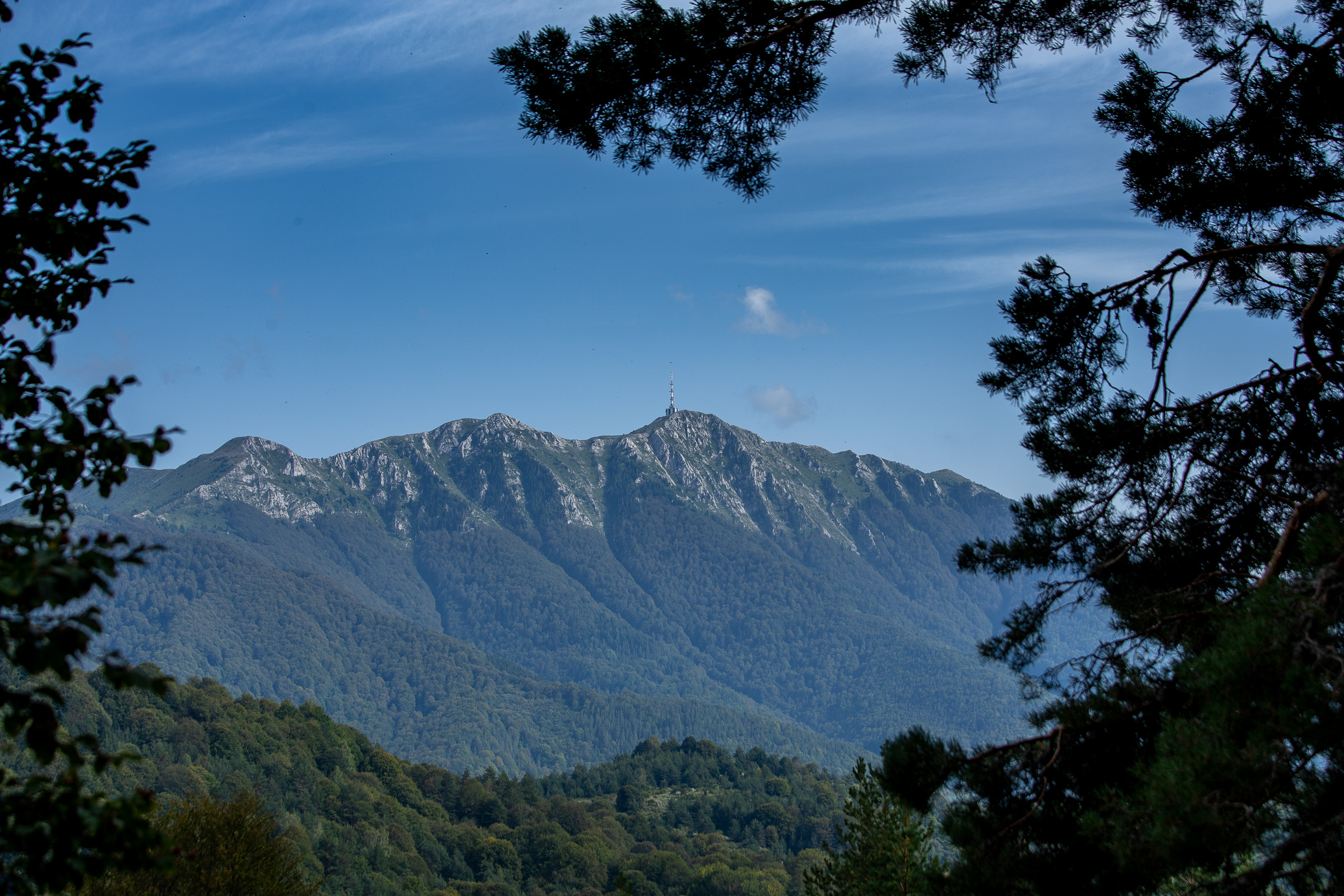
All of a sudden, an unexpected view — the goal for the whole E4 trek, Gotsev Peak! It’s the one on the rightmost of the photo below. Though you actually climb up that central peak (Tzari Peak) and traverse on the ridge line to get to Gotsev. So tantalizingly close.
Cool looking tree.

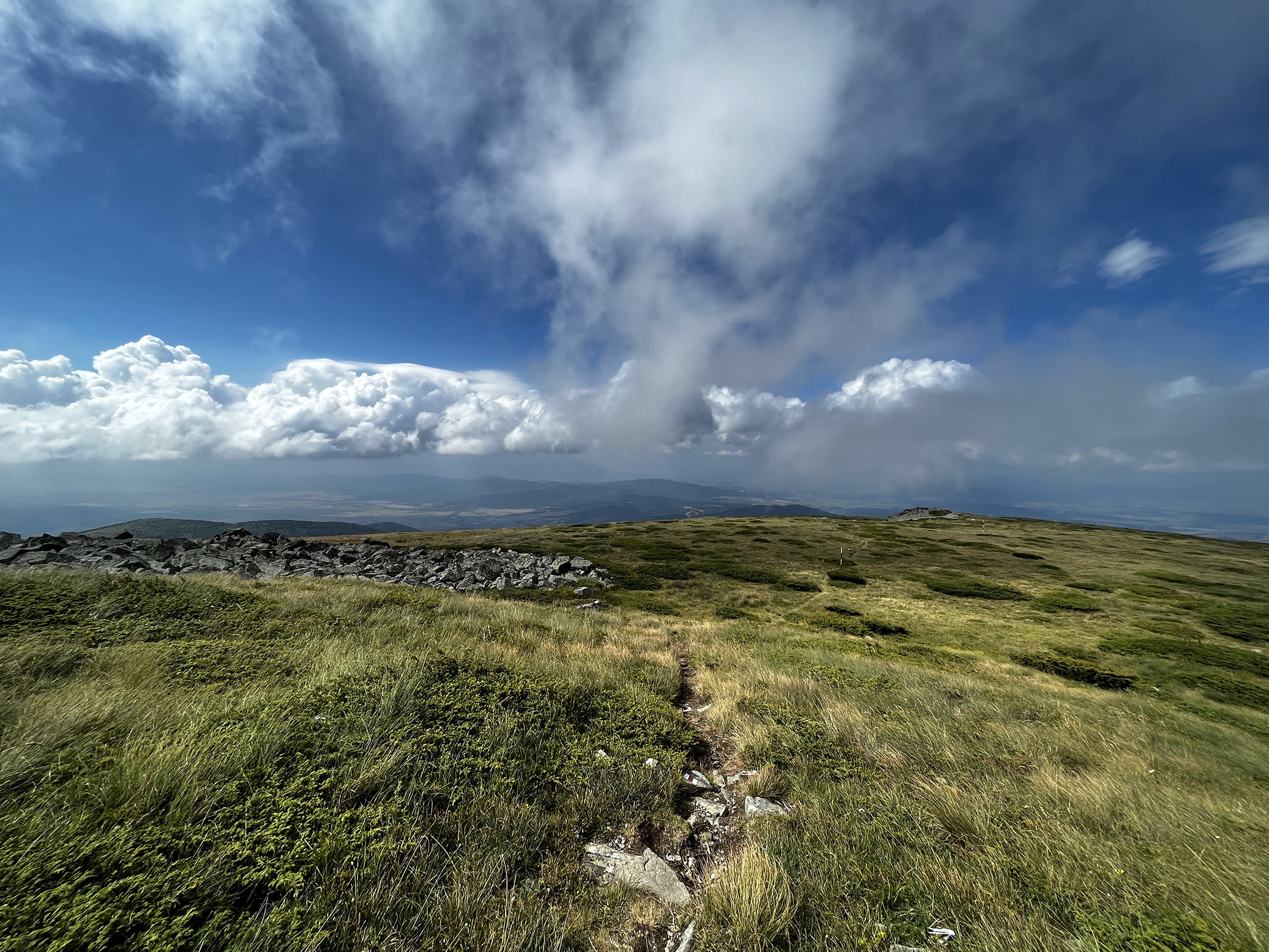
Enjoying the afternoon colors near the final climb, 300m of pure goodness after over 11 hours of walking 😃 After reaching the ridge, you walk on the plateau for a bit (just at the foot of Orelyak Peak, which remains on your right) before going for a steep descent to get to Popovi Livadi. Look at how green it is, btw, very atypical for September — you’d think it would be yellow at this stage.
And that concludes day 6. What a long trek! But almost there 🙂
Day 7: Popovi Livadi hut – Gotsev Peak (more precisely Izvora hut, after the descent from Gotsev Peak)
35.45km | 1,840m up | 2,282m down | 9hrs 58min
Motivated to finish this bad boy, I got up early and headed off. Most of the first part of the day was yet again dirt roads so nothing too exciting. But then all of a sudden BANG, a 3-4m (10-12ft) cross in the middle of nowhere appears. Quite literally, there was nothing around. No time to investigate so I snapped the photo and moved on.

Not long after I found myself at the foot of Tzari Peak (one of the 4 highest in Slavyanka)… damn, I thought this would be an easy last day, but that’s a 1,000+ meter ascent right there. Fun.

Beautiful September day though. Midway through climbing Tzari Peak here — from this point you go through the forest and around that hill on the right, then zig zag your way to the top essentially.
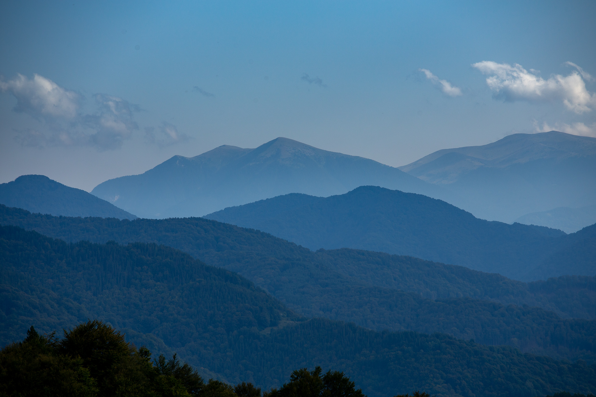
Just a look back at southern Pirin, almost from the ridge line of Slavyanka.
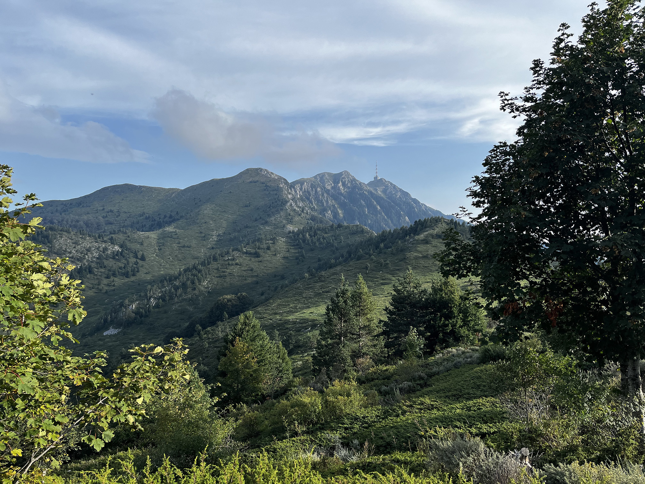
Aaaand I’m at the top! Almost 😒 Gotsev Peak is the one in the clouds on the other side, just need to do follow the ridge line and get to it. Simple, right? Technically, yes — but after days an days of tons of walking, having just done a 1,000m climb up and really feeling like you deserve a break, this last hurdle is just a little annoying 😄
Final climb ahead. Just 300m up — I know it doesn’t look steep (probably due to the wide angle phone lens), but it’s no joke. You have to deserve it I guess 🤷♂️

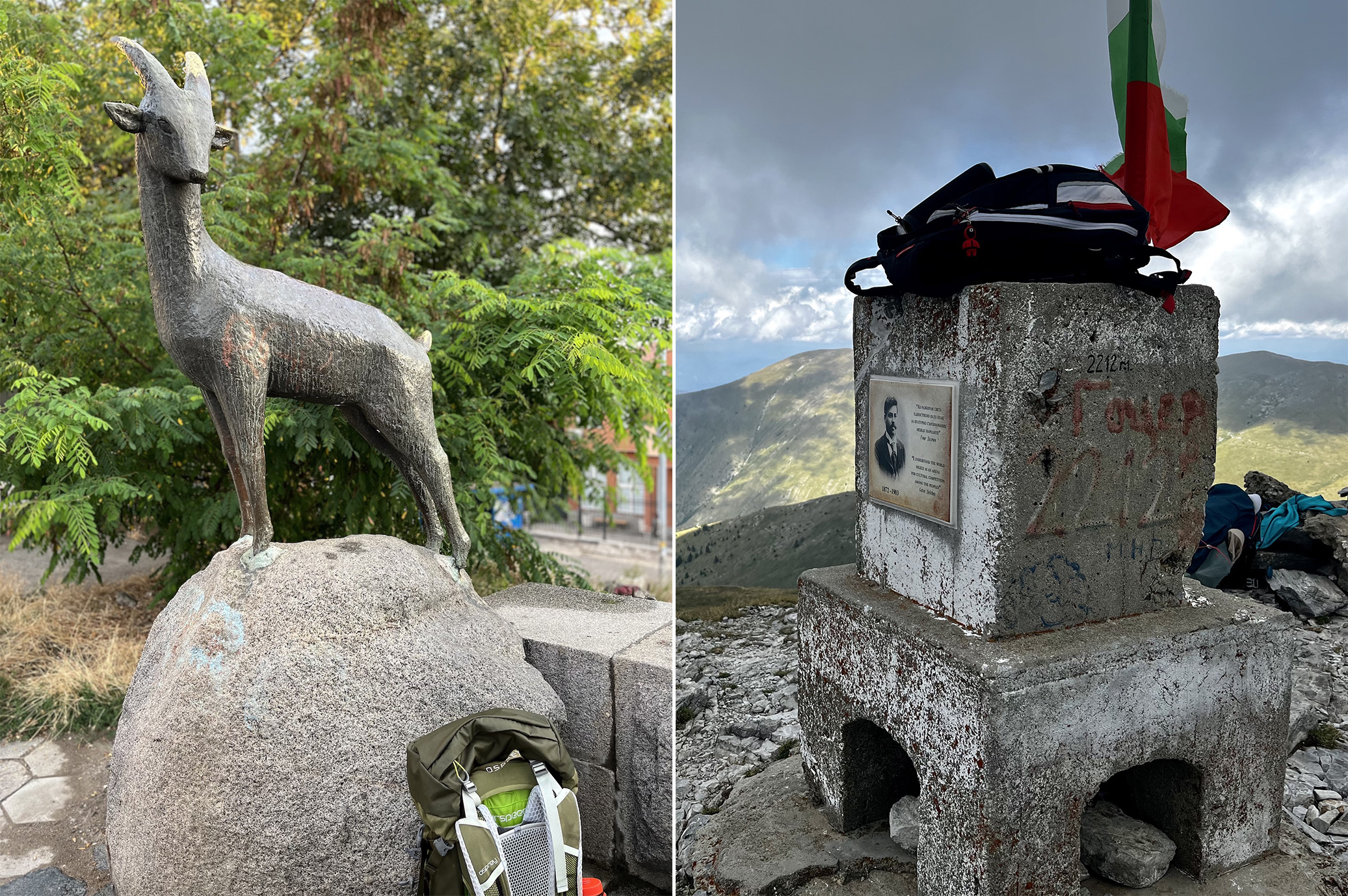
This time this is really it — the goat statue at the start of E4 in Dragalevtzi (Sofia) and the pyramid atop Gotsev Peak (2,212m / 7,527ft). What a journey!
What followed was another steep descent on the other side to get to Izvora hut. Legs were pretty sore at this point, but the motivation to get back to your family helps you push through. Interestingly, I stepped onto the paved road and no more than 1-2min later a car drove by and picked me up (not the first time I’ve hitchhiked after a long trek, though Aconcagua still holds the record for craziest story), which saved me 4-5km of walking easily. The driver, a young shepherd who had gone to check on his cows, told me that he’s pretty much the only one who drives up here — imagine that, 10 hours and 35km of walking and had I been a couple of minutes off, I would have missed the guy, how lucky! Hence why I never stop pushing for a good pace in the mountain, you never know when you’ll catch a lucky break 🙂
So how would I reflect on the E4? It was fantastic — I can only hope the photos do it justice, it’s absolutely worth taking on. Fingers crossed the post inspires at least 1 person to jump at the opportunity — you, my friend, will love it 😃

Hi, can you forward me the details of accommodation in Klisura you mention in this article? Doing the E4 in a few days after my wife decided that im not going to Ukraine. Many thanks, Simon
Haha we all follow what ours Mrs says 😀 Just sent you an email, let me know if you’ve received it. Prefer not to share the number publicly, they wouldn’t want it.
Btw, the E4 in this season should be challenging. Let me know if there’s anything I can do to help.
Hello,
Really enjoyed the post! Would it be possible to share some of the details of accommodation? And is it possible to cut the route short as I might have only around 7-9 days for this trip? Thank you and warm wishes from Switzerland.
Hi Lorenz, could you drop me a line through the Get in touch page so I get an email and I’ll get back to you soon? 🙂 Happy to help!
Hi there , I’m really happy to have discovered your blog. I’m considering doing this route in late June this year, and you’ve helped inspire me. Many thanks!
You should totally do it 🙂 And then come back and share some photos! Thanks for stopping by and safe trekking 🥾⛰️
Hi how are things, I’m looking at doing the E4 in 2 weeks. Just wondering what town you headed to after completion? Id be looking to get back to Sofia afterwards.
You need to head west, through Petrovo and Katuntsi, ultimately aiming at Petrich or better yet Sandanski. The latter two have buses and trains that run to Sofia. The tough part is that there isn’t much (any?) transport to them really. Best option is to hitch a ride. Just have a Google translator nearby ready to communicate with whoever picks you up, explaining your options for destination. That’s what I did, sans the translator app 😃
Good luck on your trek! You’re the fourth international group that’s messaged me about the E4 this year alone — it’s either getting popular or there are very few resources in English out there 🙂 Should you need more help, let me know.