So I finally got around to finishing Kom-Emine back in August. I went back and forth whether that was the best way to spend the little time I take off nowadays, but ultimately what prevailed was my disdain for leaving things unfinished. Interestingly enough, I continued the trek only a couple of days after my end date the previous year so in a way it felt like a natural continuation. Since I won’t spend time talking about what Kom-Emine is, I suggest you look over part 1 when you get a chance. In many respects, it’s the more visually exciting bit of the 600km.
Unlike last year, this was a solo experience. I did look for buddies to do it with but, shockingly enough, not that many enthusiasts were eager enough to do an average of ~50km of walking up and down a day in the hot summer days 🤔 And while in the west you often end up synching with others and making friends, the east is different and I actually was alone like 98% of the time. Which, combined with the often monotonous surroundings, had its upsides — you tend to zone in and walk with your own pace. It almost felt like meditation (or rather what I’ve been told meditation is supposed to be when you do it right) in that there were times where literally 40-50min had passed between me checking my watch and realizing I hadn’t had a single thought in the otherwise constantly buzzing head of mine. It was glorious. But doing it alone is not everyone’s cup of tea.
I wasn’t in my best shape, certainly not in the “Let’s climb Denali” — that was probably the most prepared I’ve been for an expedition. Running a small but ambitious nonprofit startup and being a parent can be taxing on one’s time 😉 Luckily, Sofia sits right at the doorstep of Vitosha mountain so I did do some longer treks and felt I can handle whatever the east had in store for me.
It’s probably a good thing I found the time to write this post a few weeks after actually walking the thing. Thanks to many a mountaineer’s good old habit of quickly forgetting the bad, I feel much more positive about the whole experience. But I certainly felt differently on a number of occasions while in it 😄 I can vividly recall asking myself quite a few times (like I do on any respectable challenge) why on Earth am I doing this and whether I should have just picked the seaside option like “normal” people do. I have yet to figure this one out.
East vs West
So how do the two parts of Kom-Emine compare, in the strictly mountaineering sense of the question? Well, they are different. The Balkan range itself is higher in the west which makes it more demanding, but also more rewarding. It is the more scenic part of the challenge — especially once you get to Ambaritza / Kupena / Botev peak. You get to be on the plateau more often and enjoy the views all around, which does help with the motivation to keep going. Since the altitude is overall lower in the east, you walk in forests or without much scenery for what felt like 70-80% of the time (complete guesstimate here) so the allure is a bit lost. Then again, considering it is the much hotter side, the trees do provide some much needed cover.
Overall I do prefer the west and especially the central part of the Balkan range. Yet you can’t complete the challenge without the east 😉 The latter is much more a mind game than anything else. With half of the days in the 60-65km range, you do have to find the internal drive to put one foot in front of the next despite the discomforts. And there’s a wide selection of those, don’t you worry 😀 But the idea that each day brings you closer to that sought after glimpse of the Black Sea is a powerful motivator. And I can tell you that the moment that big blue fills the horizon is really something special.
Timeline
Here is the breakdown of the days with the numbering continuing from last year. I was planning on doing it in 7 days, but when I got to what was supposed to be the end of day 1 (or 10 overall), I felt the impulse to push on. It was still relatively early, despite me leaving late-ish at around 6.30am and taking too much time with the photos, and the hut looked quite unpleasant — and mind you I’ve slept in some really interesting places 😉
So it ended up taking me 6 days, in no small part because the weather was on my side and the heat I was expecting was acceptable. Overall I’m confident I could finish it it around 12-13 days, especially if I leave my big camera and do it solo the whole way. Or even 10-12 if I actually get in shape, have friends bring me supplies at certain checkpoints, and do some running 😀
| Day | Section | Distance | ELEV gain | elev loss | time | gps track |
|---|---|---|---|---|---|---|
| 10 | Buzludzha – Chumerna | 66.24 km | 2,460 m | 2,424 m | 14hrs 19min | link |
| 11 | Chumerna – Kotel | 57.30 km | 1,635 m | 2,481 m | 13hrs 30min | link |
| 12 | Kotel – Varbishki pass | 26.24 km | 697 m | 891 m | 6hrs 26min | link |
| 13 | Varbishki pass – Daskotna | 64.05 km | 2,020 m | 2,187 m | 15hrs 12min | link |
| 14 | Daskotna – Kozichino | 43.71 km | 889 m | 602 m | 10hrs 32min | link |
| 15 | Kozichino – Emine | 39.04 km | 842 m | 1,128m | 8hrs 28min | link |
| Totals part 2 Kom-Emine TOTALS | 296.58 km 600.97 km | 8,543 m 20,637 m | 9,713 m 21,933 m |
The heavy camera debate
Speaking of the camera, here’s what I wrote 12 months ago when talking about doing the east next year — “And I certainly plan on not taking the big camera and reducing the extra weight quite a bit.” I’m honestly starting to think I enjoy making it difficult for myself 😳 The conversation in my head is more or less always the same: it would be so much nicer if I didn’t carry that thing, but I have this nagging feeling that I won’t be doing this again so might as well suck it up and take some proper pictures. Hope it was worth it.
Ok, enough of an intro, here’s the good stuff — the photos! Mind you quite a few are taken with what’s now an ageing iPhone camera so the quality isn’t great… it’s the story that matters?
Day 0: Sofia – Kazanlak & Trek up to Buzludzha
6.70km | 740m up | 4m down | 1hrs 42min
Decided to be eco friendly this time and take the train to Kazanlak. Despite having to wear a mask almost the whole time, it was a pleasant experience as you’re basically at the foot of the Balkan range on the south side and can enjoy the views.

A quick trek up to the Buzludzha hut & monument got me there just in time to see the sunset. Not a bad way to start!
Day 10: Buzludzha – Chumerna
66.24km | 2,460m up | 2,424m down | 14hrs 19min
This was supposed to be an easy first day with a 33km trek to Gramadliva hut to get the body warmed up without overdoing it… well that went according to plan 🤨 I got up relatively late and left at 6.30am, thinking I was in no rush. I took my time with the photos as soon as the sun started peaking through the trees.

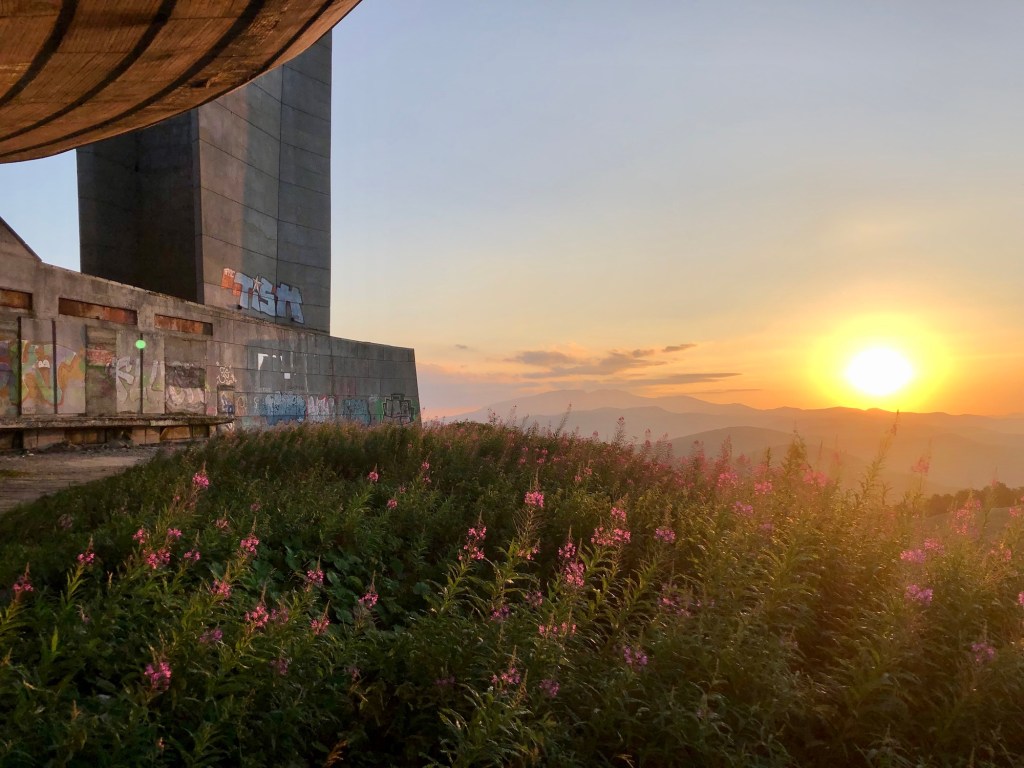
Maybe 30min into it, the path took me above the tree line and looking back I saw the Buzludzha monument lit up from the morning rays. What a great start! Should you want to peek inside it, check this post out.

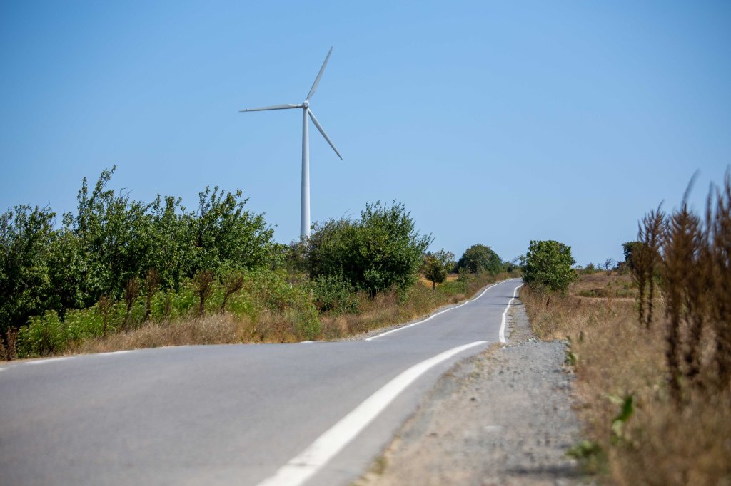
Soon after that you start encountering the wind turbines in the area. Not sure if the photo gives you an accurate idea, but they are massive, something like 85m high with a wing span of around 80m or so. It’s especially impressive when you’re just underneath one of those things — and a little scary, I would add, as you hear these crackling, metal-screeching noises like something is about to break and come tumbling down. The sounds can overpower your rational brain that knows nothing will happen 🙂
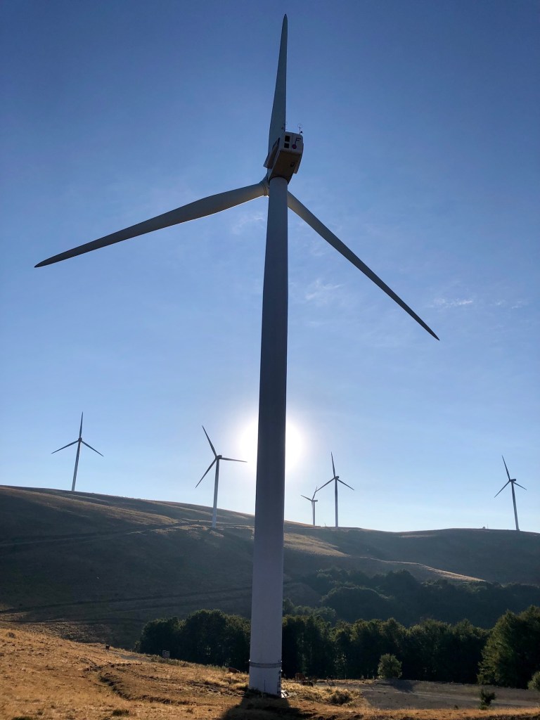
Though not the largest wind farm in Bulgaria, this one hosts at least 20 of those giant wind turbines. Quite a sight. But the sad part here is the abandoned huts you see down at the bottom, the smaller one called Bedek and the larger — Mladost. So many of those were built back in the day and left to ruin, what a shame. I do hope we see them restored one day, but it’s doubtful.

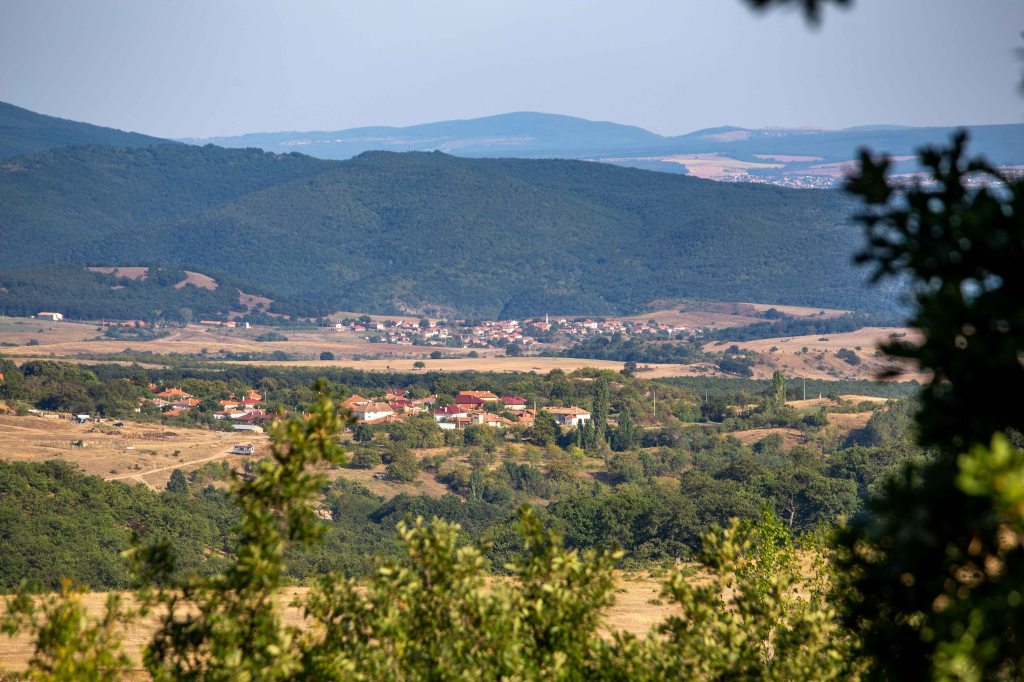
Just before you dip into the forest again, you get a glimpse of what’s ahead. I didn’t know it at the time, but my end point for the day was going to be the hut right below that highest peak you see in the distance with what appears to be a small structure on top (it’s not). That’s Chumerna peak. Seems close perhaps, but that’s as zoomed in as possible on my telephoto lens, in reality around 60km away with the ups and downs 😉

Munching on some old signage.

All of a sudden in the middle of nowhere, a TV! With the owner’s name, Simo, written on it. Just think about that for a minute, someone actually carried an TV up here…

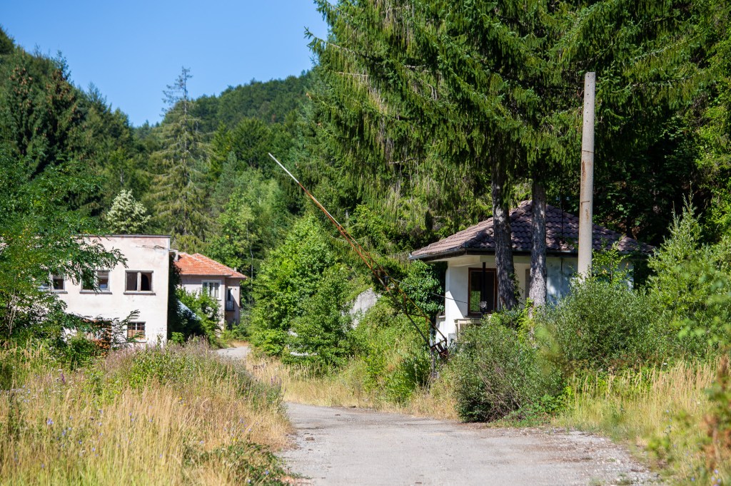
Since the east side of the Balkan range is lower, there are quite a few more mountain passes and human presence overall. You go through a number of these (semi) abandoned… neighborhoods is probably not the best term, but there’s no good translation for the lovely Bulgarian word “махала”. A collection of houses? Anyways, it’s interesting how we’ve stepped away from the mountains and gone into the cities.
This is the last photo I took with the big camera on day 1, one of the few times you’re out in the open. It’s still relatively early, maybe around noon. I felt great and was keeping a good pace so it had dawned on me that maybe I can push on and combine days 1 & 2, but thought my late start wouldn’t give me enough sunlight (days are already shorter at the end of August). Though I “officially” decided to make the call when I got to Gramadliva, perhaps I subconsciously had made it already as I took almost no breaks after this and picked up the pace further.

When I got to Gramadliva hut, I was 1.5-2hrs under the 9.5hrs I thought it would take me based on the times of two friends of mine. It was around 1-1.30pm and although I had another 34km and the same 9-9.5hrs of expected walking, I felt I can get there below that time. The tricky bit is that there are practically no other places to stay after this before Chumerna hut if you’re not carrying a tent. Perhaps a couple of huts, but you normally need to call ahead and there’s no guarantee — and they are so close to Chumera that you might as well make the whole thing, considering you have another 60km to walk the next day again 🙂 So once you decide to continue, you have to commit to it.
The second 34km felt like a sprint! Literally no photos, just zoned in to make it on time. And I actually did some light running at the end where possible, though it’s not easy with a 10kg pack after 10-12 hours of walking. I made it to Chumerna with my headlamp turned on for maybe only the last 20mins. My average pace was 4.6km/hr which, considering the 2,500m ascent that day, means I did not lose much time in breaks.
I’ll be very honest, my feet were hurting at the end, I had gained a couple of gorgeous blisters (which I knew would stick around until the very end), limped around quite a bit in the evening once the adrenaline was gone, and wasn’t sure if that decision was going to cost me to take a rest day or even cause further complications.
The big reward of the day came in the form of an unexpected meet up with a friend of mine at Chumerna. Kalin was there on a high altitude trail running training camp for 30 days — what a nice surprise! Absorbed in catching up, we forgot to take a photo even 😀 But a great ending to a long first day.
Day 11: Chumerna – Kotel
57.30km | 1,635m up | 2,481m down | 13hrs 30min
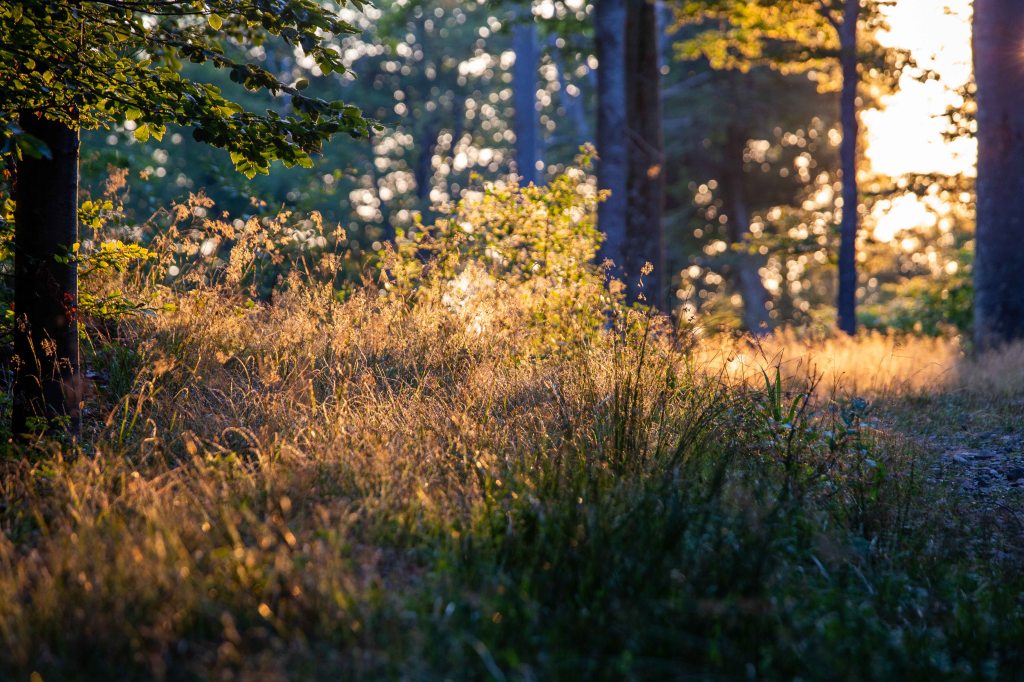
It’s always surprising to me how quickly the body can recover with some quality food and a good night’s rest. I was definitely still a bit sore, but quickly gained a decent rhythm. Another long day ahead of me and although I wanted to leave earlier than the fay before, I also needed proper sleep so I ended up starting at around 7am. The sun was just out, lighting up the path ahead. One of my favorite moments from the trip.
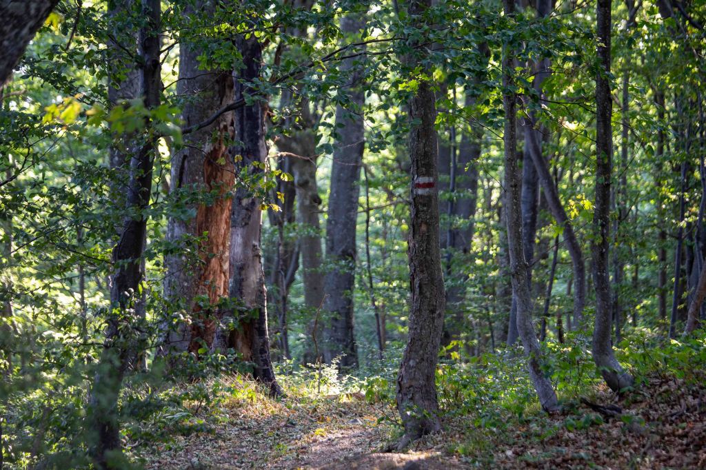
And back to the usual — trees upon trees and the emblematic white-red-white marking for Kom-Emine. Mind you that photo is actually a bit misleading, you walk on dirt roads with small uneven rocks as the foundation a lot of the time, not great little paths that are soft on your feet.
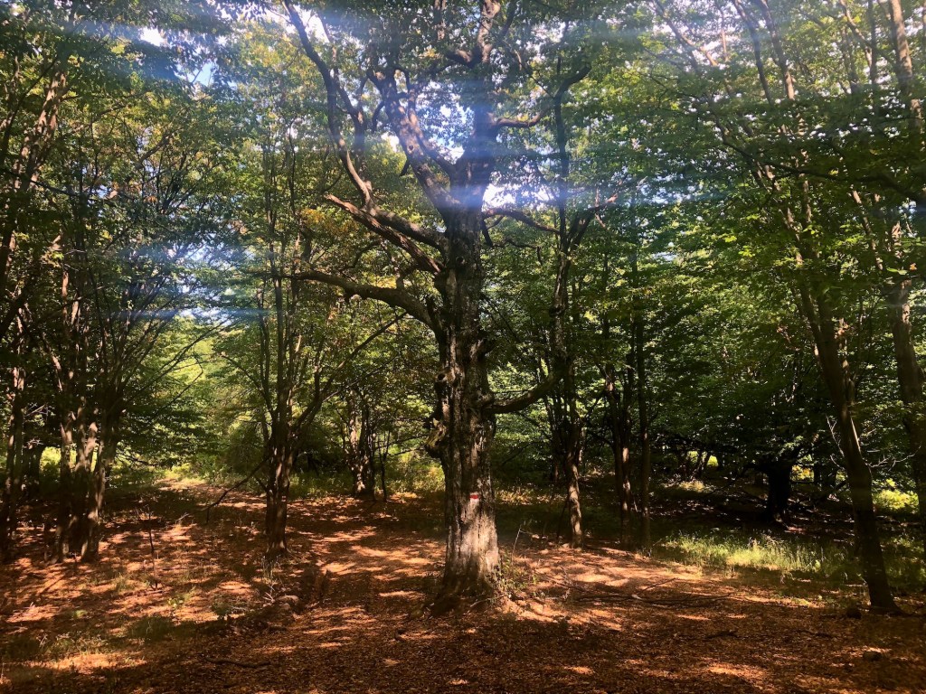
The first part of the day was just a lot of ups and downs. I mean it quite literally — up a hill for 40-50m, down on the other side. Up again 70-80m, down 120m. Again and again. It’s what the Nepalese lovingly refer to as “Nepali flat” 😀 On the 20th repetition of this, it does tend to annoy you. Though you do come across some nice tucked away areas like the one below. One of the good things of the east is that fewer people go so it’s a bit wilder and more preserved.
I think those are bear shelters. Or just hunting observation decks.

10.5 hours and 43km into the trek you reach this field and think man, where did the mountain go?! You also make the wrong assumption that you’re nearly in Kotel and it’s a matter of an hour or slightly more than that. You imagine you just need to get over that hill there You’re ready for that day to be over. But Kom-Emine has something else in store for you — getting over (or around, actually) that hill gets you to another one, even higher and even further away. It ended up being 3 more hours of non-stop walking to get to Kotel. That second day seemed neverending.

I started descending towards Kotel just as the sun was getting low on the horizon. Made for some nice dusk photos.

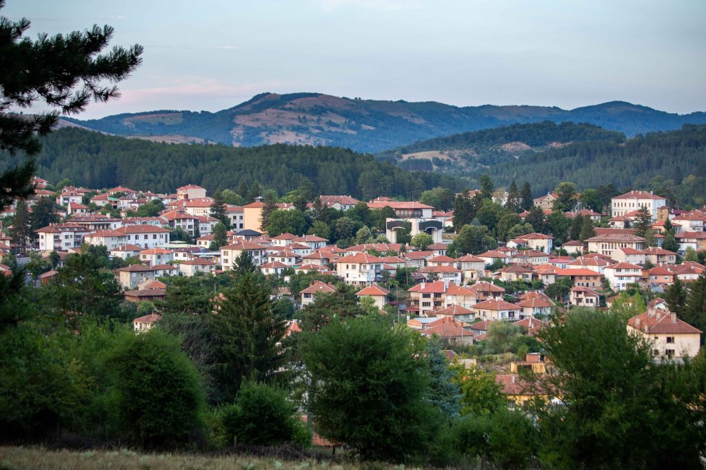
And there it was, Kotel at last! Boy was I cursing it in the end — who the hell built this city so far away from Chumerna?! 😀
As this was a Saturday evening and on top of it, a really famous traditional folklore festival was taking place that same weekend nearby, almost all places to stay were booked up. I was lucky to find a great little hotel that let me stay if I paid for a triple room — I had no problem with that, I just needed a shower and a hot meal.
Day 12: Kotel – Varbishki pass
26.24km | 697m up | 891m down | 6hrs 26min
Finally, a “rest” day with just 26km to walk, the shortest of the bunch. Not ideal as the day after you have to do 64km, but yet again there’s no place to stay in between that lets you have two normal days of 45km-ish. Then again, after the first two monster days, I needed the break. I washed all my clothes the night before and waited for them to dry in the sun; ate a hearty breakfast and chatted with the hotel owner, such a sweet lady; got some supplies from the pharmacy (band aids mostly); treated the blisters as well as I could (I’ll save you the gorgeous photos of those, you are welcome 😉); and generally took my time, leaving around maybe 10am.
Kotel is located on an important road crossing the Balkan range so lots of traffic. You have to walk on it for a bit, which is a surreal experience, given that you’ve been almost entirely on your own in the last 120km+. I was glad to get off it, though, the car fumes were a bit too much.

Kotel as seen when you look back after gaining some altitude.

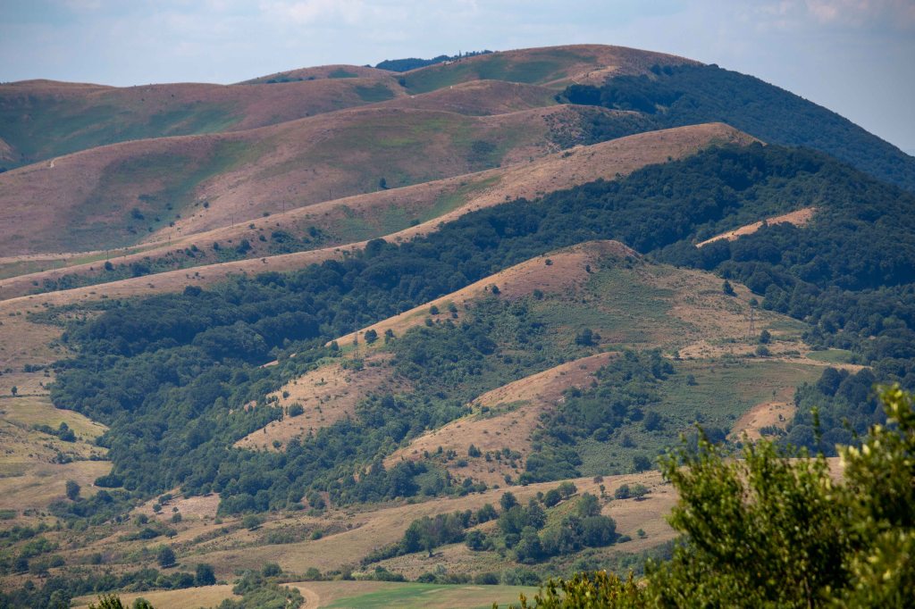
Love those hill, typical Stara Planina (the Balkan range).
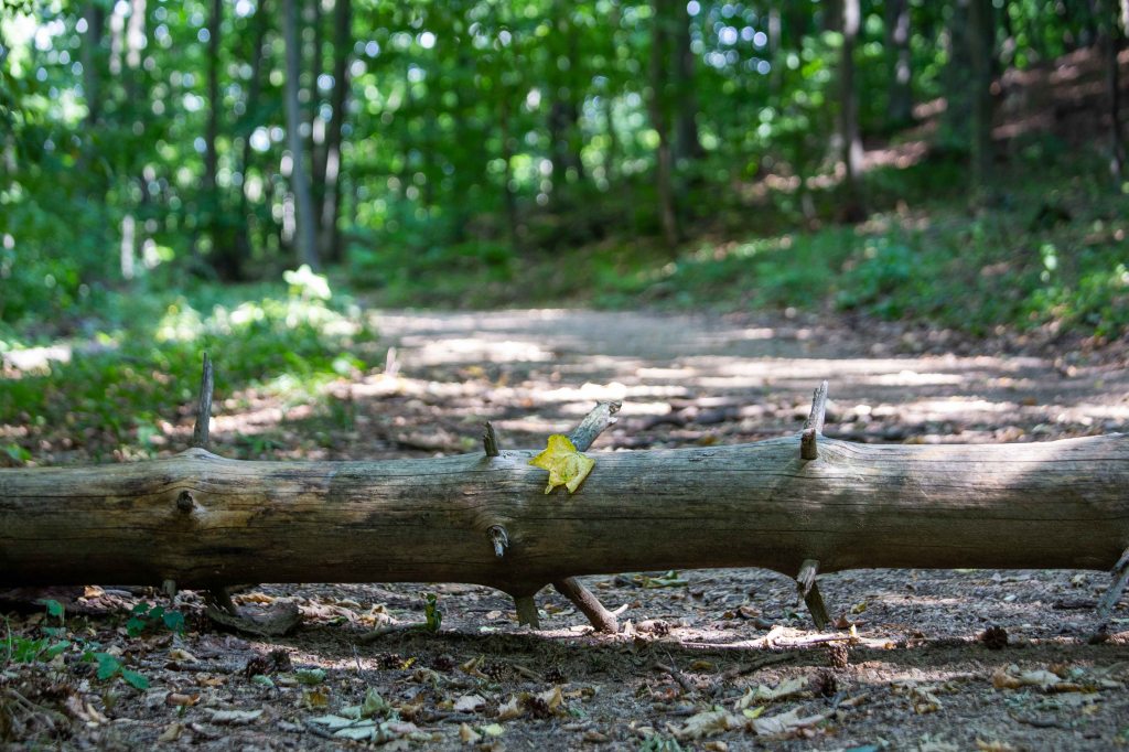
A gentle reminder that fall is almost upon us. I swear, I did not plant that leaf — it was there when I saw it and just as I snapped the photos, the wind picked it up.
A not so gentle reminder that rainfalls are few and far between and temperatures in August can add to the fun of the experience. Managing your water supply becomes vital.

Hence why it’s a good idea when you come across water to stop, drink, and fill up. And by come across I mean get the GPS coordinates of the water options as they are not always on the main path so make sure you plan accordingly. On a separate note, I do respect the tradition in some areas to build a fountain (чешма just sounds so much better…) in the name of someone, seems like a good way to honor their memory.

And before I knew it, day 3 was done as well. I reached Varbishki pass early enough to take a shower, rearrange a few things in the backpack, and eat a big dinner.
Day 13: Varbishki – Daskotna
64.05km | 2,020m up | 2,187m down | 15hrs 12min
The last big big day! I got up early this time and left at around 5.30am probably. After descending a bit to get to Varbishki the day before, now I needed to gain some altitude. An hour into the trek, I saw the gorgeous moon behind me and couldn’t resist breaking my rhythm to take a photo.
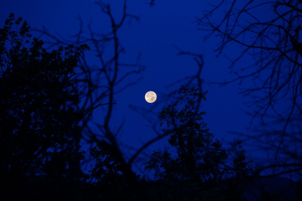
Moments like these cheer you up 🙂

Breakfast for champions.
After 8 hours of mainly walking under the cover of trees, out of nowhere you hit this vista near the Rishki pass. Neat.

Both of us thought it was time for lunch 😉
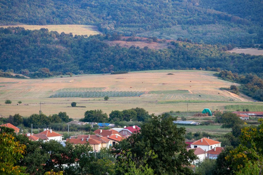
12 hours and 50km into the day, you emerge from the trees to see villages. For a good few minutes I thought Daskotna, my target for the day, was the second one in the middle of the photo. Imagine my disappointment when I realized it was in fact the one all the way at the back, slightly to the right of the center of the frame and beyond that hill. Great.
When I got to Planinitza, the village before Daskotna or just 4-5km to the finish line that day, the sun was just about to set which made for some good shots. I found a comfortable spot and sat down, resting and taking in the pastoral village life. There was a person feeding his horses near me while down in the valley I could see people tending to their fields; the local mosque was calling for evening prayer; dogs were barking in the distance. It was thoroughly enjoyable not to be in a constant rush.
Having rested for a tad longer than I had the time for, I was close to getting to Daskotna in the dark. Since that didn’t sound too appealing, I pretty much ran the last 2-3km. I’ll leave it up to you to decide which was the better option 😀
Day 14: Daskotna – Kozichino
43.71km | 889m up | 602m down | 10hrs 32min
Once I got over the last big day, I knew I’d finish Kom-Emine. Despite the achy start to most mornings, I felt leaner and in better shape to take on long treks. I got the blisters under control and the pack had gotten lighter after I’d eaten a bunch of my food. Things were looking up 🙂
The misty morning over Daskotna village.

At this stage, the mighty Balkan range is mostly hills with more and more villages sprawling around. By the way, this is as good a time as any to mention that you definitely need some sort of GPS tracking in the east — in my places the markings are hard to find or even entirely gone for long stretches. There were quite a few instances where my phone saved me. If you take this challenge on one day, do yourself a favor and download an offline-capable map with the coordinates you need, including water stops.

On a number of times that day, I had to walk for several kilometers straight up on the road. It’s not the main main one, of course, but still not the nicest experience when a noisy car comes speeding by and gives you a noseful of stinky gases. Gone were the incredible landscapes of the central Balkan range…
First glimpse of the Black Sea!
And here’s my best angle — covered up in anti-bug netting 😀 Jokes aside, these things are super annoying and there’s very little you can do. I could go on and on about the bugs and the discomforts of Kom-Emine, but it doesn’t add a lot of value to the post 🙂

Kozichino at last! That’s as high as the mountain is this far east…

At the place I stayed (literally the only one in town) I bumped into a nice couple I kept seeing on the trek every once in a while. They had a tent so their schedule was a bit different to mine, but it was nice to share stories with fellow peregrinators. We were all pumped for this to be over 😀
Day 15: Kozichino – Emine
39.04km | 842m up | 1,128m down | 8hrs 28min
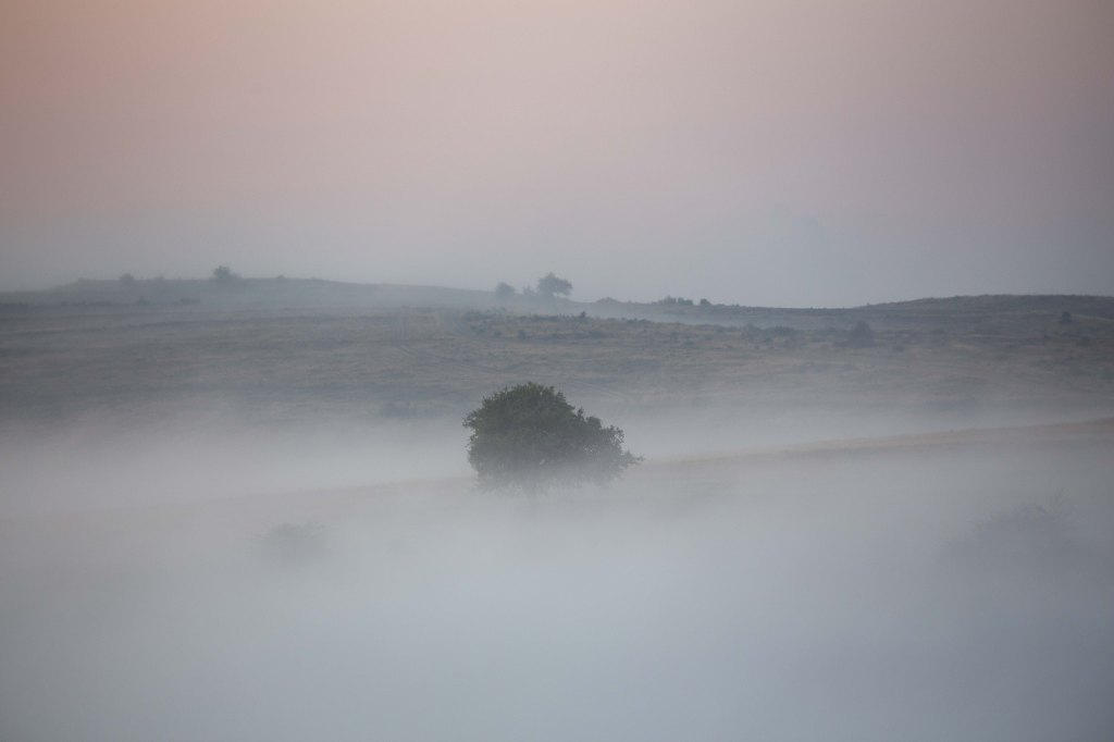
The big day! Got up early as I had made plans to meet up with a friend in Emona (the last village before Cape Emine) and didn’t want to be late. It was a very misty morning and actually finding my way was a challenge, almost no markings / signs at this stage. Not sure how people do it without some form of GPS tracking, to be honest.
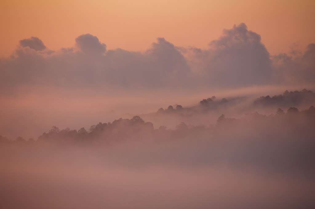
But all of a sudden, just at dawn, the mist started clearing away and I began to recognize shapes.
A few minutes later the sun really turned it up a notch.
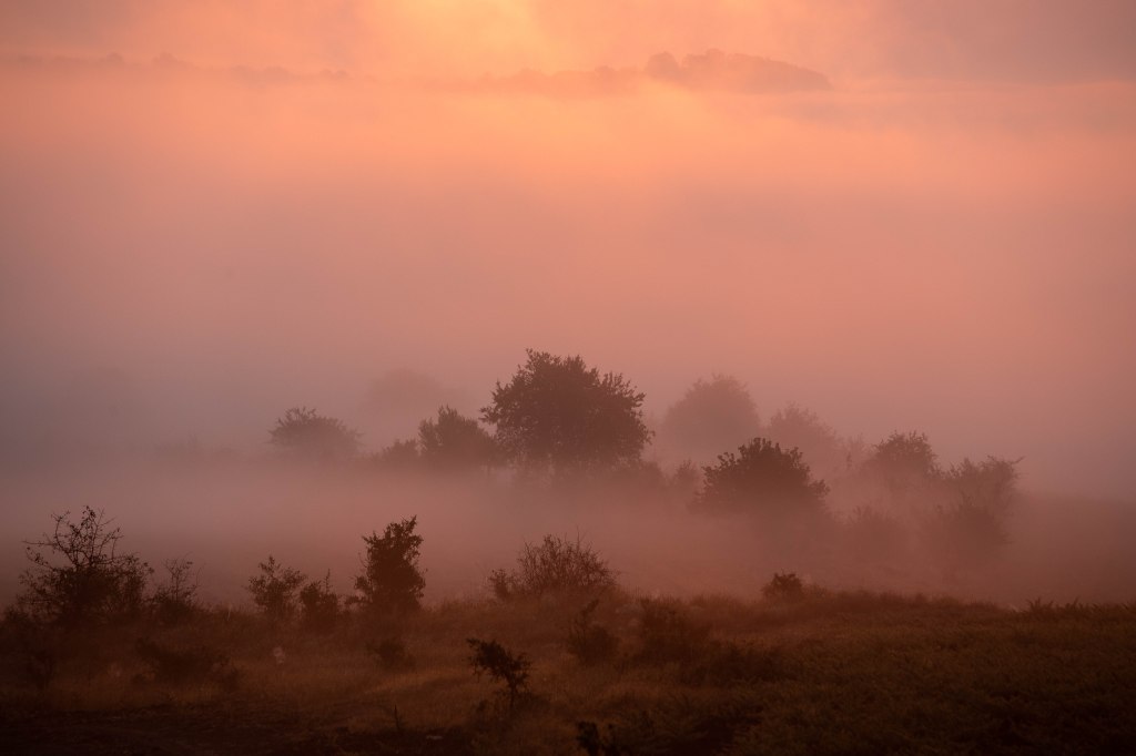
Not a bad way to start the last day of Kom-Emine, I have to say 🙂
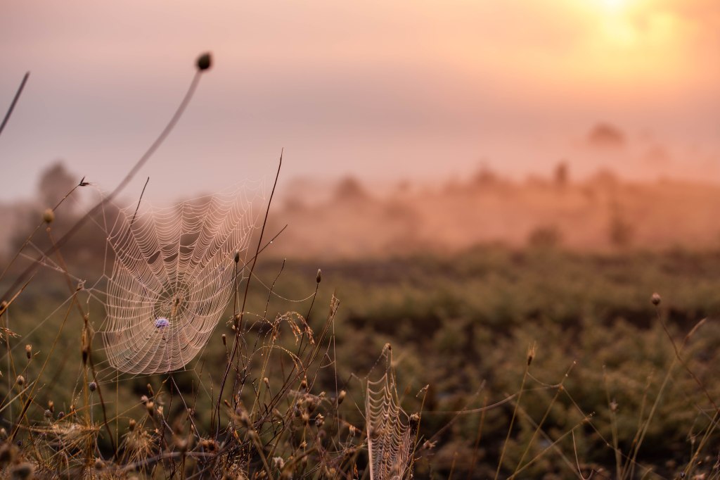
The itsy bitsy spider was nowhere to be seen, but her webbing made for an interesting shot 😉
After that great start of the day, I tucked my camera away and continued marching on. There’s almost no shade that day and I wanted to cover some ground before the inevitable heat at noon (made worse by the humidity). The below photo is still relatively early in the day, maybe 2 hours / almost 10km in, but it was worth showing how I was no practically in line with the sea and descending.

A couple of hours later you cross the main road between Varna and Burgas, the two largest cities on the coast — it’s always jam packed with cars, especially in summer. Just to show you what stepping just 10m away from it looks like. Sure, you’d say this is biodegradable paper, but it was the same story everywhere near roads I crossed with plastics, tires, metal. Sometimes I think we deserve what’s coming for us ![]()

A short while after crossing the road, you’re on the home stretch — almost a straight line dash to the seaside. But what looked like a path in the trees on the map ended up being a 13-14km trek entirely in the open, under the now blistering August sun at noon. To add to the fun, all 3 or 4 water fountains that were supposed to be working had dried up and my water was critically low. I gotta tell you, those were the most annoying 3 hours of the whole thing. If I had written this that same day, the above wording would have been far far more colorful 😅
It was so hot that even the bugs couldn’t handle it! There’s a beautiful Bulgarian expression that goes “махнал главата”, which directly translates to “removed my head” (it sounds far better in Bulgarian, I know) — well, there you go.

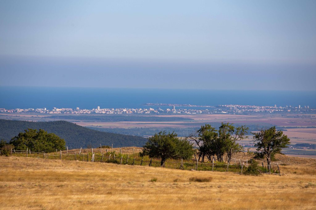
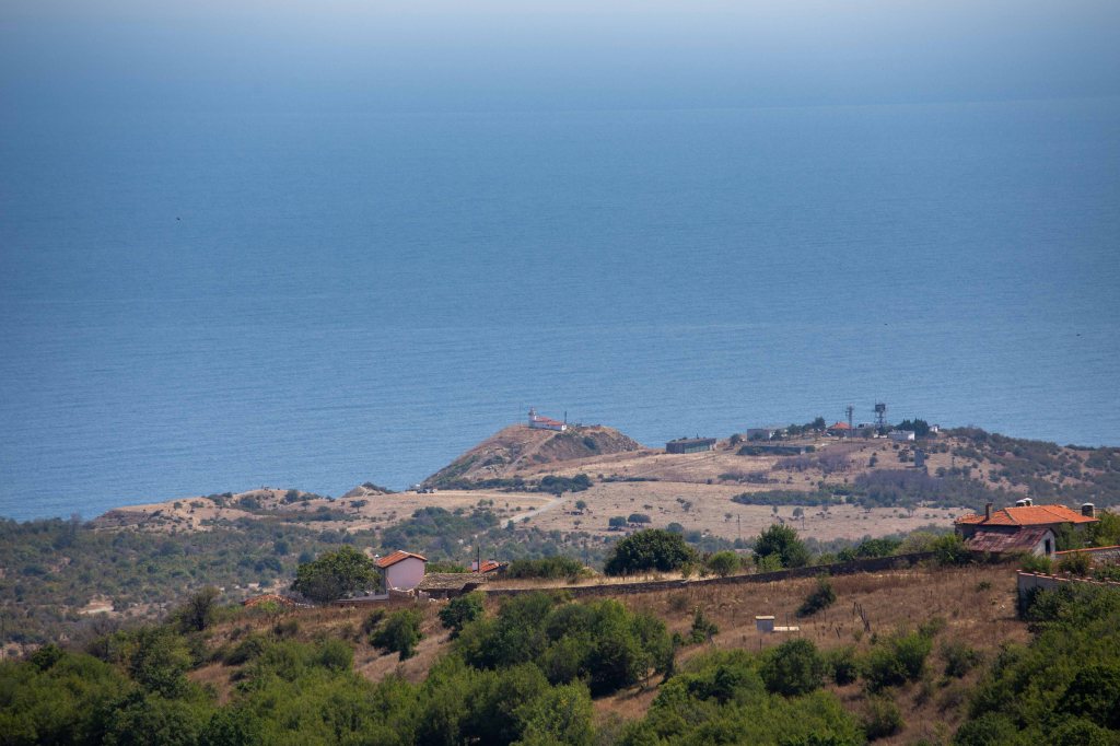
And then all of a sudden, just when you’d almost given up hope this thing is ever happening, the blue fills the horizon. WHAT. A. VIEW. The photo doesn’t do it justice, believe me. And it’s not even how picturesque it is, but rather that you’ve been waiting to see this for a LONG time.
Soon after I found myself on the shores of the Black Sea, tossing the rock you take with you from Kom and trying to make sense of the fact you’re actually here 😃 I tend to prefer sticking behind the camera, but some proof was needed I suppose.
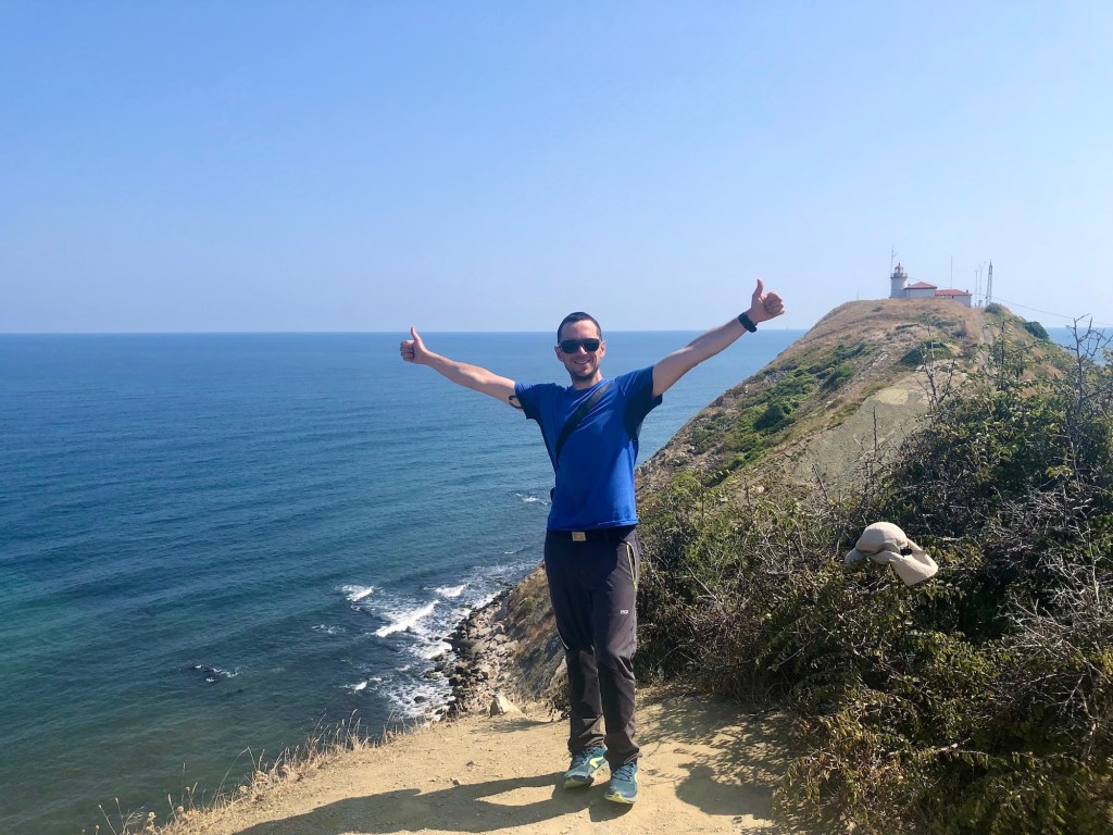
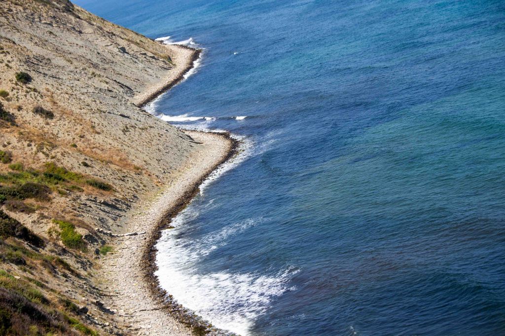
And there it is from up close, the Black Sea. What a trip indeed.
With that, the Kom-Emine challenge was successfully completed. Would I do it again? Never say never, but it’s definitely low on my list. I came away with some wonderful memories, a few lessons, and experienced a wide range of emotions — isn’t that what life is about? I feel pretty good about it.
Now, onto the next challenge 😉

Such an inspiration. I hope to do it soon too, trekking. The photos transported me to this place more than I can imagine with your written words. All the more your post feels fresh and how I miss the nature more. Wishes to your next challenge.
Let’s hope you do indeed get to go out in nature soon 🙂
The camera was worth its weight in gold this time. The world is beautiful. Thank you for sharing it. love, in lak’ech, Debra
Very kind words, thank you, Debra!
Thank you for sharing your walk notes. I really enjoyed reading them. Planning to do the trek in 2024, so I’m slowly putting together all the info. Thanks again for this read.
Wonderful, enjoy! Should you need tips, feel free to reach out 🙂