Let me start with the end — I didn’t make the summit. I reached 5,900-something meters, around a couple of hours or so from the top. And turned back, despite having plenty of fuel in the tank. Do I have regrets? Perhaps. Mostly because I’m positive I would have made it on the next attempt. But I chose not to try, for reasons I’ll get into at the end. Nevertheless, it was a valuable experience with a few lessons learned along the way.
But before I get ahead of the story, a few facts about Denali. Located in the Alaskan Range, it’s the tallest mountain in North America with its 6,190m or 20,310 feet. Moreover, it’s the 3rd most prominent and 3rd most isolated peak on Earth, following Everest and Aconcagua. Although not as high as the latter, it’s a much tougher climb for a few reasons — it’s colder (on certain days it can be worse than many 8,000m peaks), more technical and thus requires more gear, more unpredictable in terms of weather (as I learned first hand), and you carry all your equipment and food throughout the expedition. But most importantly, because of its greater distance from the equator, the effects of altitude are more pronounced so in reality the 6,190m feel like a lot more. Fun.
For me personally it was the next logical step up after solo climbing Aconcagua in late 2017. This time I decided to attempt with a partner though — falling in a crevasse or taking a wrong step and tumbling down are real dangers so having someone to rope up with certainly helps. Plus, it’s nice to have a friend to chat to and strategize with. We chose the most popular West Buttress route and decided on using snowshoes rather than skis, a debate I won’t get into here, but an important question that every person faces on Denali.
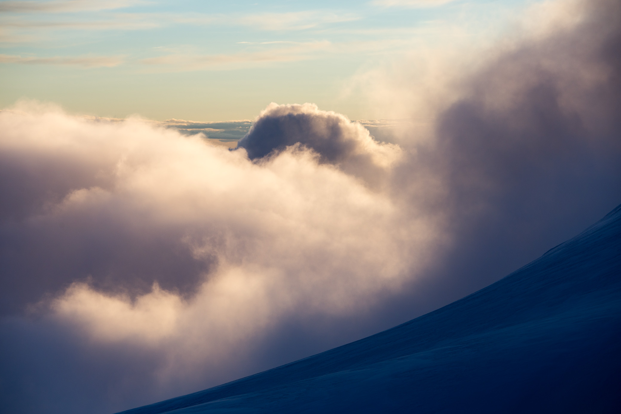
Before you get the impression this is some ominously dangerous peak, let me tell you that Denali is not… just that 😉 It’s an incredibly beautiful place. I hope the photos do it justice, though trust me in person it’s even more spectacular. The crisp atmosphere, huge crevasses and rivers of ice, the stunning views all around, the feeling of being above the clouds for days on end… they do take your breath away. Plus, it never gets dark at the height of the climbing season (May – early July) and sunsets last for quite a while, a photographer’s dream. I’ve never had an affinity for climbing in the dark so this was a welcome change — which does come with its drawbacks, makes sleeping a tad more difficult 🙂
A couple of housekeeping items on preparation before we go on, for those who are interested. Otherwise, jump ahead.
Physical training
Obviously coming prepared physically (and mentally) helps. Carrying and pulling 40-50-60kg worth of stuff up a mountain is no joke. To be in the best shape possible, one has to commit to months of training, usually 4-6 minimum. There are plenty of good resources online for this (one example here), but just to give you some perspective, my workout schedule in the last 6 weeks involved 6 workouts a week, twice a day, with a combination of strength, cardio, flexibility, endurance and volume training sessions. By the end, I was a lean mean climbing machine (and also tired of having to get up early). This comes with eating good food and getting enough sleep to recover. If you do it right, it’s very taxing on your normal work-life balance, to say the least.
Gear
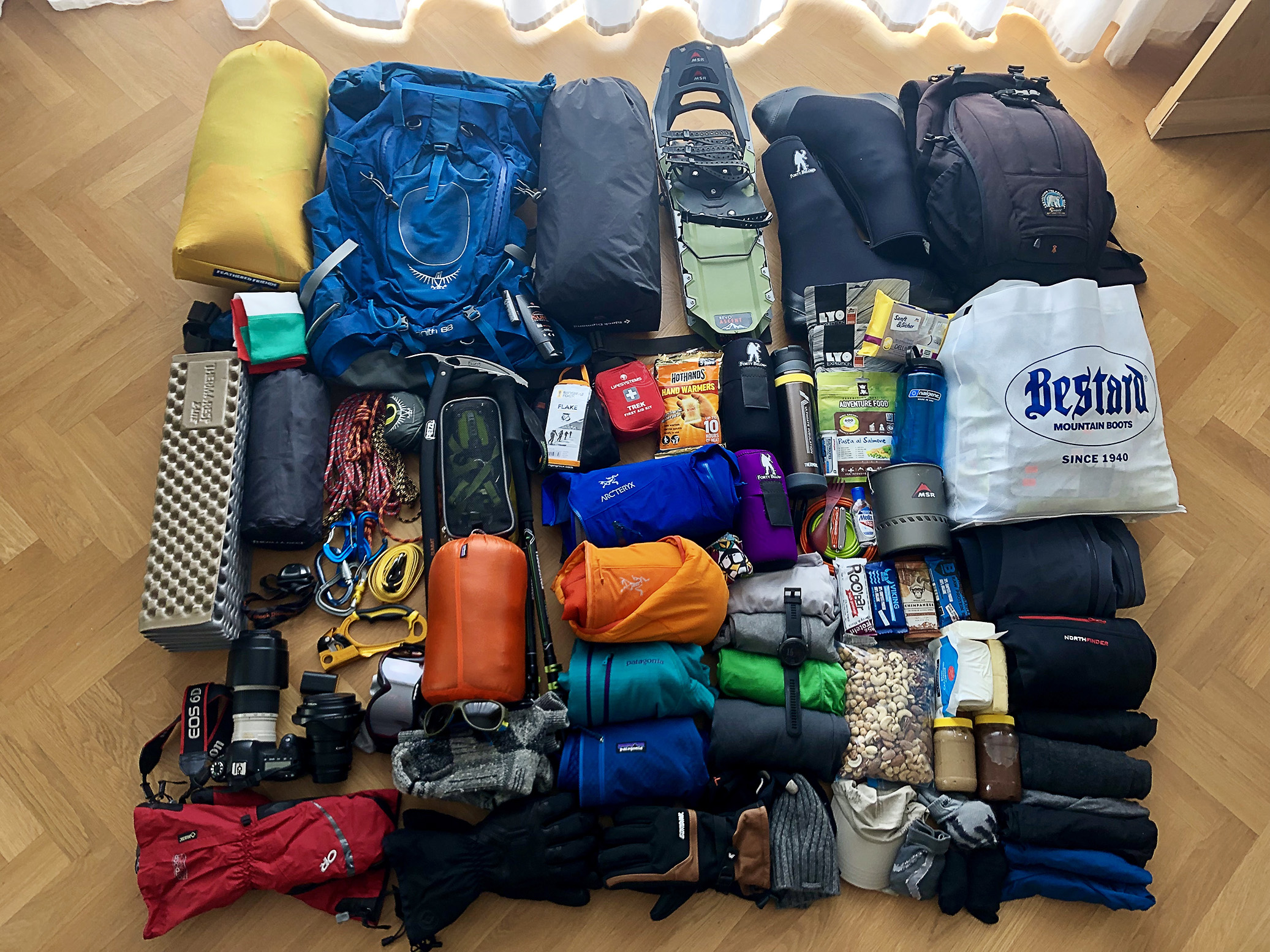
If you were wondering what one needs for an expedition like this, there you go. Close to 43kg (~95lbs) of stuff, including 11-12kg of food (my freeze dried meals are in the white bag). I’m missing a couple of items like the big duffel bag, a shovel, an ice saw, etc., which I got later. Generally most people take more it seems, we planned for just around 2 weeks. I can definitely save a bit of weight by not bringing the big camera next time, not taking a couple of unnecessary items of clothing, and bringing fewer freeze dried packets (you lose appetite at altitude and eat less than you imagine). But overall I was still on the lighter side, there were people with a LOT more. If you need a detailed packing list, let me know, though again you can find all of this online.
Map
Here’s a useful map of the West Buttress route with the camps. Note some of the lower altitude ones are missing here. Just for some perspective, I believe the distance from Camp 14k back to Base camp (which I took in one go, overnight, on the way back) is around 23-25km. It’s a long expedition so the name of the game is — preserve energy by going slow, try to keep your oxygen saturation high and pulse low (this is where a watch with a heart rate monitor is very useful). Drink plenty of fluids (4-5l per day), eat regularly with as high-calorie foods as possible. All of the above will help you sleep better which in turn helps the stats and you to stay healthy, which is super super important. Getting sick at altitude is no fun and can ruin your chances of reaching the summit.

And finally, the climb itself! I’ve broken down the post into days to make it easier to follow.
*****
Day 1, May 28 — Final preparations, drop off & first trek day
Base camp (2,190m / 7,200ft) – Camp 1 (2,380m / 7,800ft) – Camp 2 (2,960m / 9,700ft) — 3.30h to Camp 1 and 2.30h to Camp 2
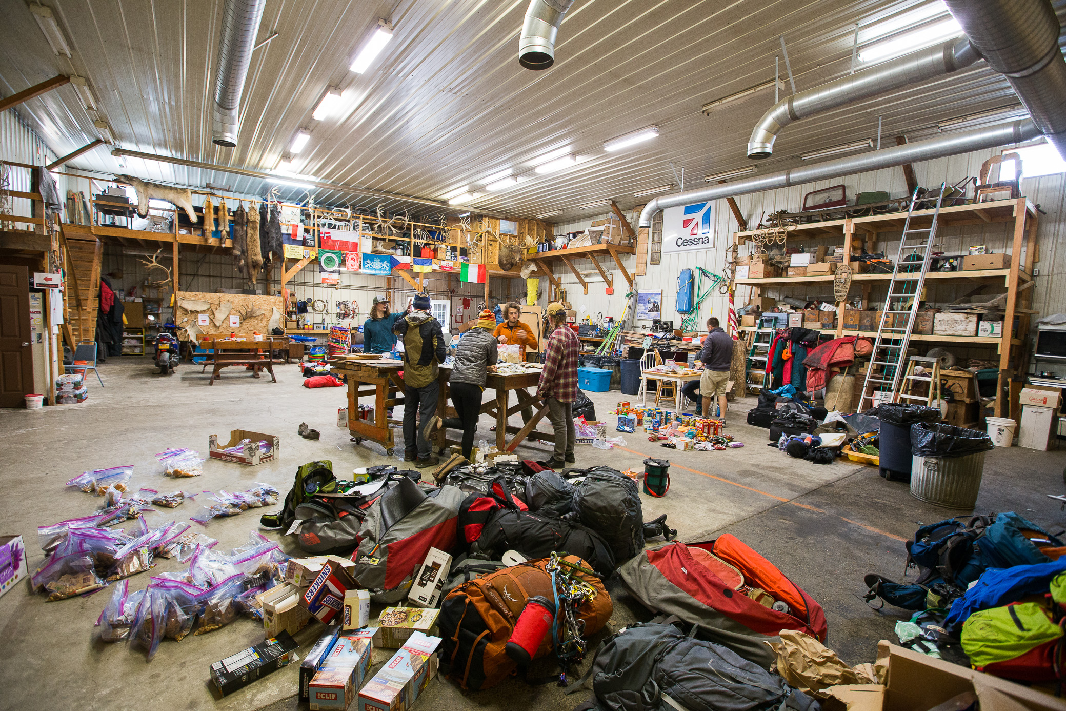
Final preparations in the hangar in the tiny village of Talkeetna. It can get messy. By the way, packing and re-packing becomes second nature during the expedition. I can’t recount how many times I had to take out all my stuff and pack them, only to have to repeat the next day… patience is key.
This is what you fly in. It’s an experience on its own 🙂

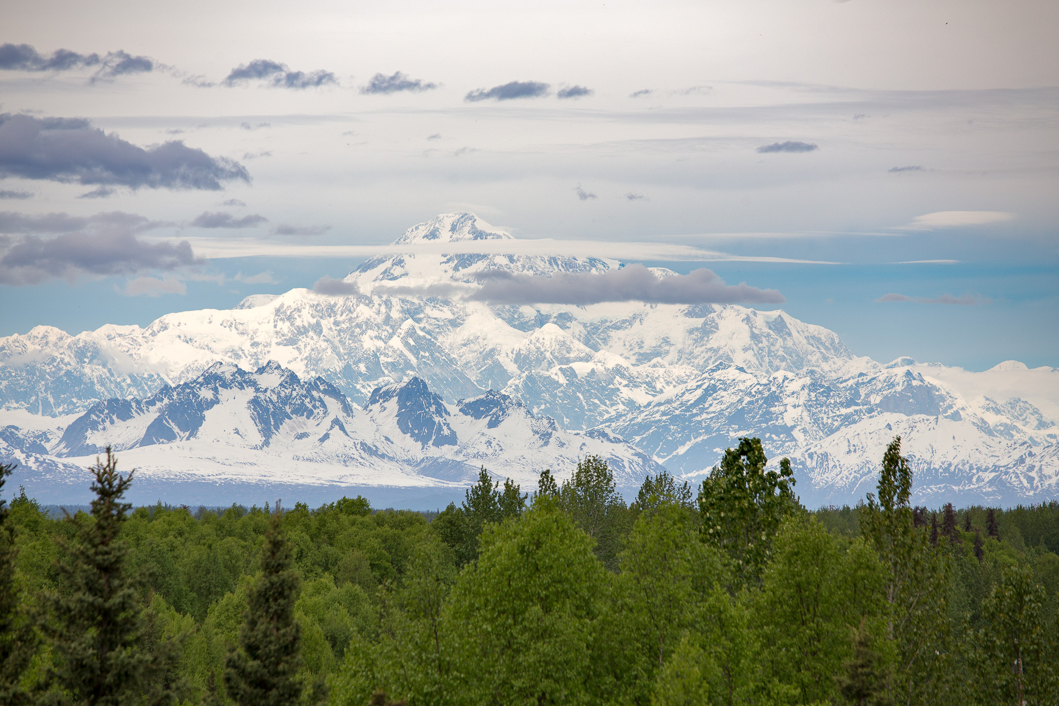
Denali from a distance. The picture doesn’t show you that, but it really stands out from the adjacent peaks, nothing even comes close to it. No wonder it’s the third most prominent peak in the world.
The lowlands of the national park before you get to the kingdom of ice.

Base camp. Didn’t take a photo of the landing strip, sadly. From here you load up your sled, put on your pack and start the journey. Figuring out the logistics of pulling a sled (or following it on downhill sections) takes a bit of time and getting used to. Soft snow makes pulling much tougher.
The scale of things in Alaska…

Day 1 in a single image. We started somewhere in the distance 5-6 hours earlier and plowed through the glacier, skipping Camp 1 (you can see it at the bottom left-ish of the photo). Didn’t take a lot of photos on the way in as we were trying to keep a slow and steady pace. Temps got up to 30°C/86°F probably. You must put on tons of sunscreen and cover all your body parts, hands included. I left the side vents on my pants open for a bit as it was too hot and got a great little burn on each thigh 🙂

But there were some rewarding views.

After skipping Camp 1, we walked until we felt we shouldn’t push ourselves too much and stopped to set up our tents at what was formerly Camp 2. I think nowadays most people don’t stay here (only one other tent) and refer to the 11k Camp as Camp 2. No photos as it was… well, not sure if foggy is the correct term here, but we couldn’t see much around us so let’s stick with that 🙂
Day 2, May 29 — Move up
Camp 2 – Camp 3 (3,400m / 11,000ft) — 2.15h
Waking up on the first morning in the mountain, you realize this will be a cold experience 🙂 It was snowing lightly the whole day so I couldn’t take any photos. We got up, melted water, ate, packed up and were on our way. Surprisingly and much like the first day, it took us quite a bit less time than expected to reach the next camp even though we were going slowly. Training helps I guess. But so does the harder snow, the sled was much easier to pull than in the heat of the previous day.
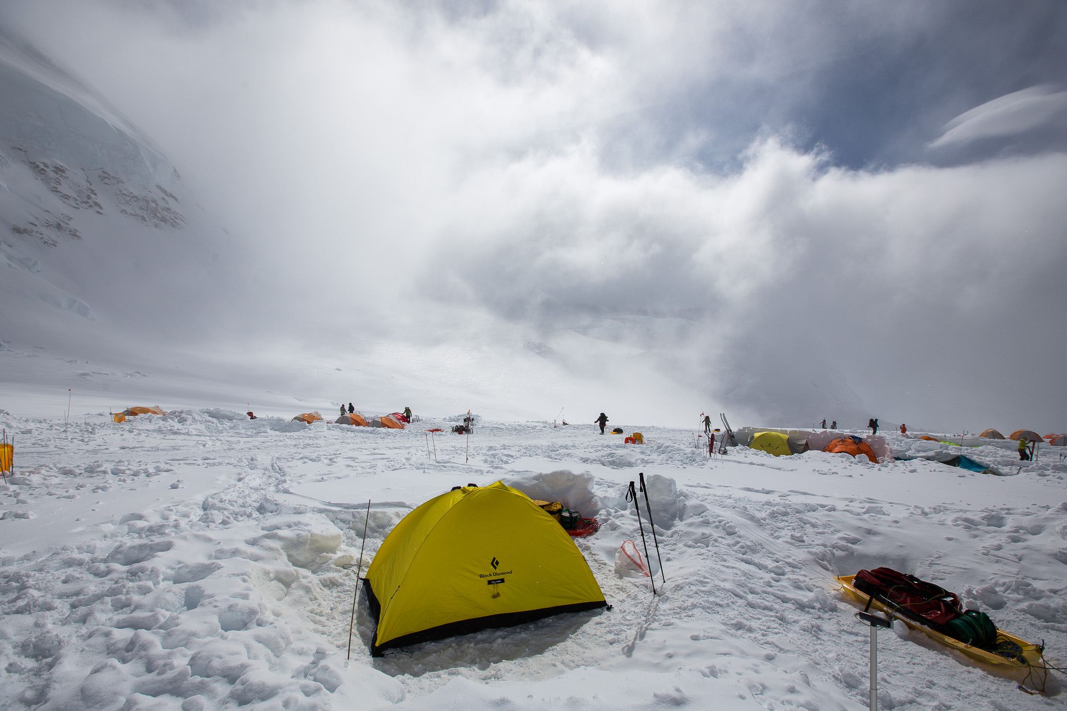
This is the 11,000ft Camp. Ahead is a really nasty section called Motorcycle Hill, which doesn’t look steep because of the wide angle lens but trust me, it’s no picnic. What you see in the snow are caches — people leave food and other items here, either as a way to carry loads up the mountain in two goes rather than one or as a backup, on the way back. We did the same, also leaving our snowshoes here — only crampons going up.

My tent set up at camp.
In the evening the clouds cleared up and we had a great light show.
Love the snow patterns here.

This was literally the view outside my tent entrance. Not too shabby.

Day 3, May 30 — Cache day
Carry cache up to Windy Corner (from 3,400m / 11,000ft to 4,050m / 13,200ft) — 3.30h return
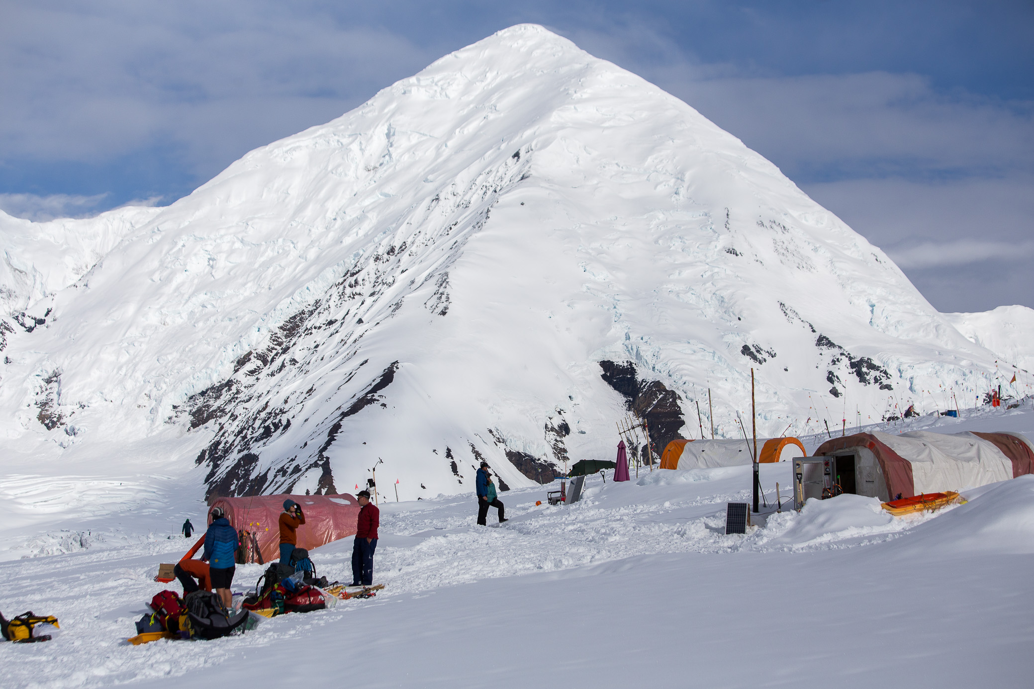
The next day was supposed to be a rest day. We decided to take it easy and carry some supplies midway through to the next camp, cache them and return to sleep low at 3,400m. That also helps you acclimatize. In the photo below is the 11k Camp, as seen from atop Motorcycle Hill.

The Father and Sons Wall, a super technical ice and rock face. Just as a reference, a person would probably be little more than a dot here. And people do actually climb this thing, crazy.

Looking up from Motorcycle Hill, next to climb is Squirrel Hill. As soon as a given feature has a name, you just know joyous moments await 🙂 The tricky bit here is that the steep hill is also at an angle so the sled is pulling you sideways as well — even more pleasant on the way back.

At the top of Squirrel Hill, looking down.

That at the end is Windy Corner — the name certainly comes for a reason. It was relatively calm here, but as soon as we stepped there, it was howling.

Views around from atop Windy Corner. We quickly dug out a hole, cached and started down.
Day 4, May 31 — Move up
Move up to Camp 4 (4,330m / 14,200ft) — 4.30h
The first song should have ended by now, here’s another good one.
My partner didn’t feel too well so he decided to take a rest day and stay put. I was feeling great so we both agreed it was wiser for me to go up and start acclimatizing. By the time I got ready, a couple of hours had passed (doing your morning duties, melting water, eating and packing up takes a lot of time!). Despite snowing on and off, there was no wind and it was getting a bit hot already, which is not ideal. The sun can really beat down on you at this altitude. Sweating is not good so you have to go slowly and wear thin layers
I still kept an ok pace and made my way up. I got to Windy Corner within a reasonable time, but unlike the previous day, it was not windy at all. Dug out my cache, added it to the sled and kept moving. Shortly after, the snowfall picked up and visibility dropped to no more than 15-20m. Somehow beyond that point 40-50cm (15-20in) of new snow had accumulated — I guess on this temperamental mountain it can snow a ton just around the corner, literally. All that new snow is not fun to plow through when you’re pulling a sled and have a total weight of maybe 30-35kg between backpack and the sled. Gruelling last section of the day. And hard to know which is the right direction, tracks were completely covered and you couldn’t see the markers. Just 20m off the main path and you could find yourself at the bottom of a huge crevasse… Luckily a couple of Argentinians were just ahead of me so we teamed up and slowly found our way.
Didn’t take any photos that day besides this one. It clearly shows how pleasant the sled game is, keeping in mind mine probably had 20-22kg in it at this point 🙂

Day 5, June 1 — Rest day
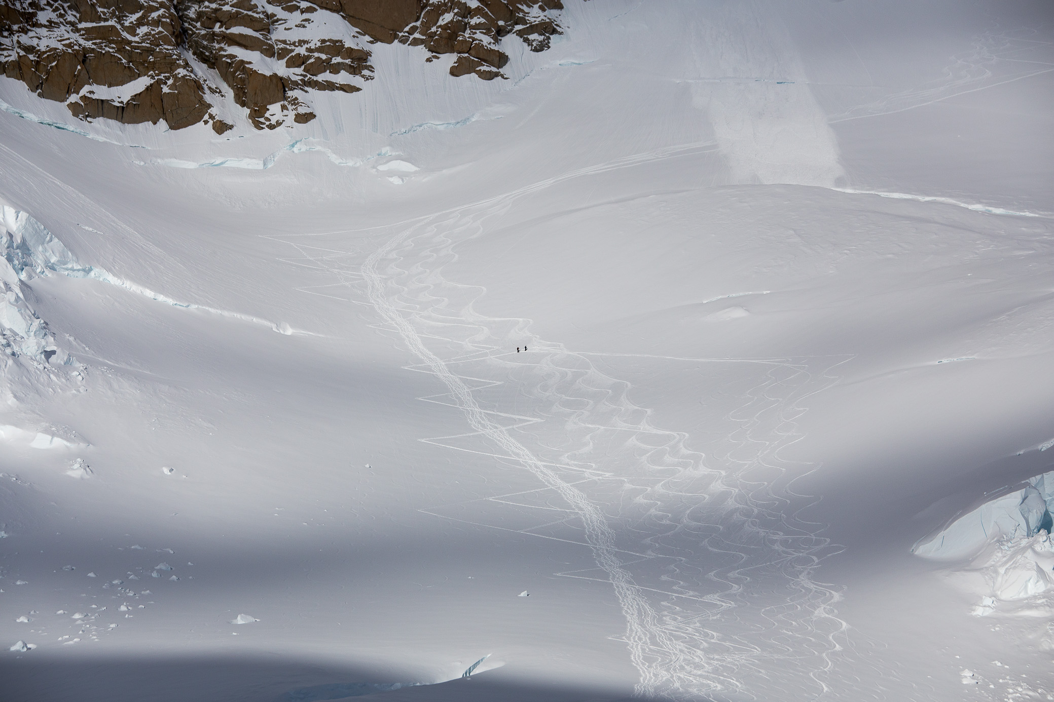
A true rest day for me. Chill around Camp 14k, eat, drink, and sleep. No sign of my partner all day. Below was the view from my tent up towards the summit, which is a bit beyond the center ridge there. Seems close, doesn’t it? To give you a sense of scale, it’s almost a 2,000m difference in altitude. The next image should make it even clearer.

Yep, those are people — two dots on what’s already a very zoomed in photo. The mountain is massive.
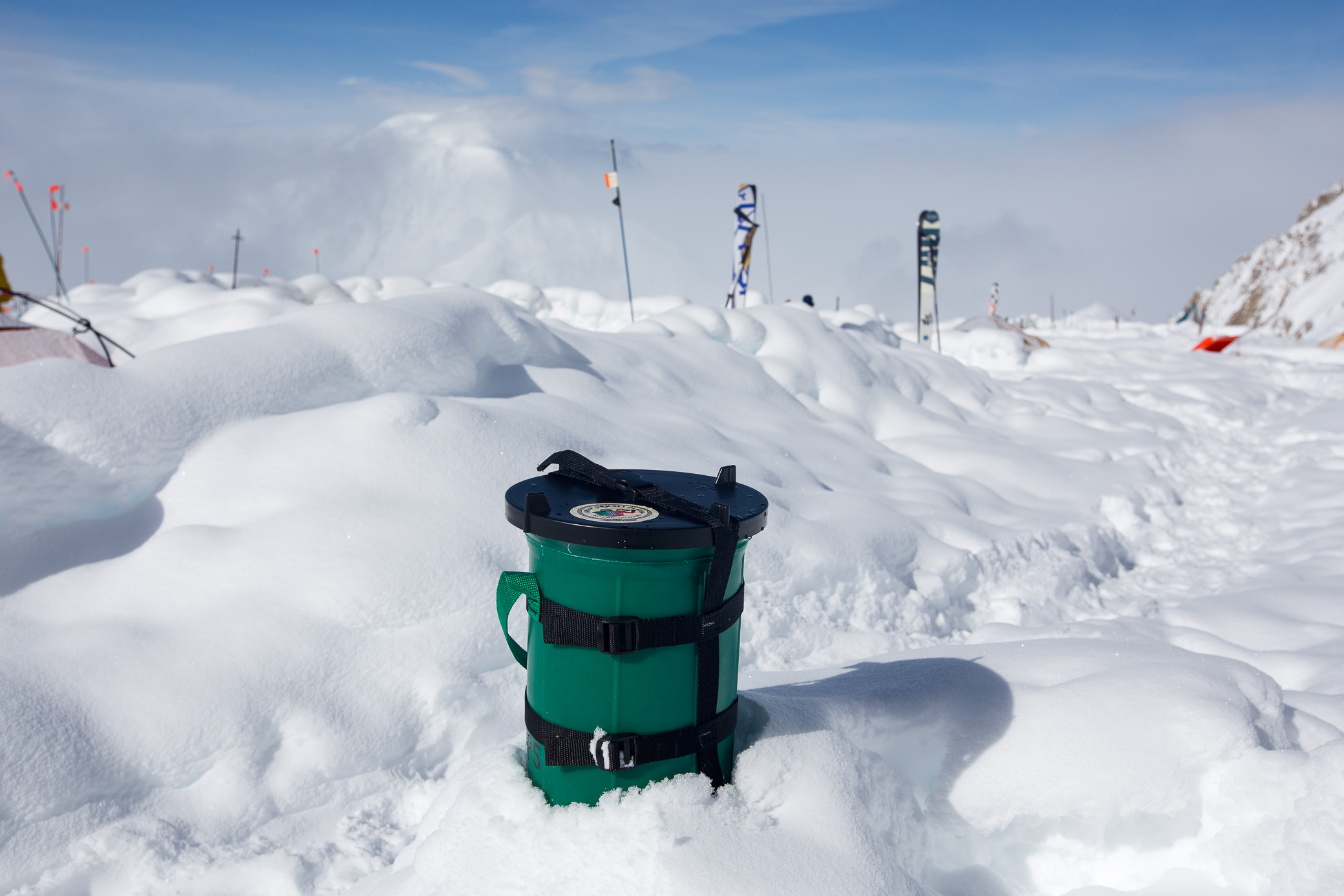
By the way, a bit of amusing trivia. This is your standard issue CMC, the clean mountain can. In other words, your poop bucket 🙂 You get to carry this thing everywhere with you, alongside a few plastic bags to be used with it. You are not allowed to camp anywhere on Denali without one and have to return in to the ranger station in Talkeetna when you check out. They encourage you to return it in full, so to say, though at Camp 14k you can toss your bag of goodness in a specially designated crevasse. Most people do that because otherwise on the way down the can gets tossed up and down quite a bit when strapped to your sled which is just too disturbing. But, jokes aside, the CMCs are super handy (at Aconcagua they just give you plastic bags) and really do keep Denali clean — so good work mountain rangers!
Day 6, June 2 — Acclimatization day
Carry cache up to Washburn’s Thumb (from 4,330m / 14,200ft to ~5,000m / 16,400ft) — 4.30h return
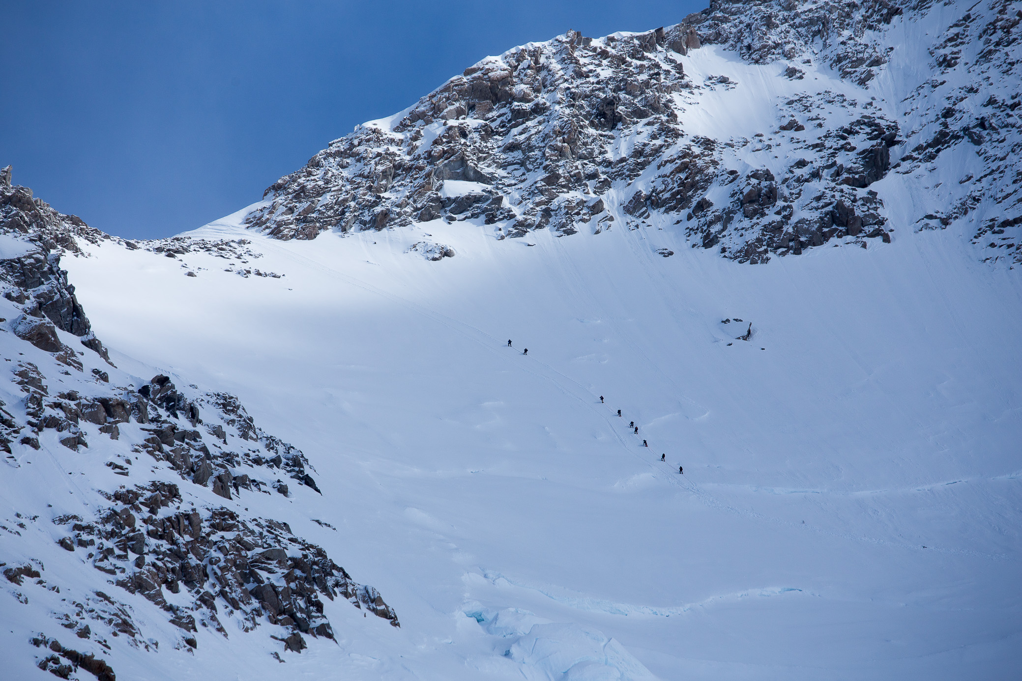
It was time to do some acclimatization by caching food/gas higher and once again sleeping at the same altitude. Decided to go up to the highest Camp 17k. This is the way ahead — doesn’t look too bad probably, but it’s steeper than it appears. 600m of elevation gain to the ridge. You can clearly see the dot sized people at the end there.

Just to zoom in a bit, this is the final and most technical section of this face called the Headwall. There are fixed lines that you can use, both as protection and to make your ascent a bit easier on this otherwise quite vertical section.
I kept a decent pace and within an hour and a half was just underneath the fixed lines. This image I think most clearly shows you how steep it is. You can’t overtake people so sometimes you get stuck behind a slow climber and have to wait for hours — this is just a part of life when tackling popular peaks where you come across people who are not physically prepared at all.

I’m over the crest on the Headwall and as it was becoming typical on Denali, the weather turned quickly. Wind picked up quite a bit and the clouds rolled it. But it did make for a great photo so it wasn’t all bad. One of my favorites from the trip.
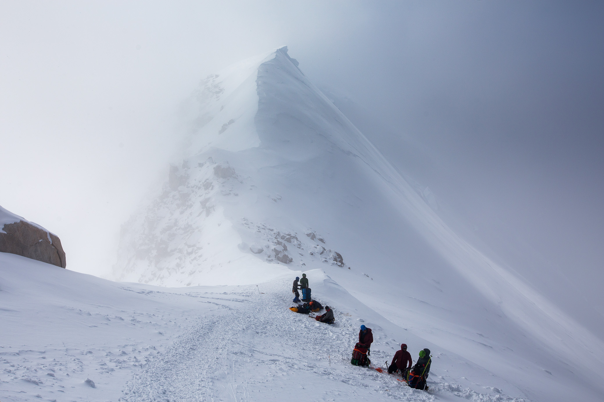
It would normally take you an hour or two to reach Camp 17k from that point (just 200m/660ft of vertical elevation left), but the section is a bit more technical which means slow when you have a ton of people ahead of you. Just gaining the 40-ish meters you see in the photo below took me probably a good 30 mins. There were simply too many climbers on the fixed lines and I didn’t see a point in trekking for another 2 hours in the wind to gain that little of extra altitude. So I dug a hole, cached and marked it (with the flags you see), and went down.
Some really breathtaking views up from the knife ridge — with a several hundred meter drop on each side 🙂
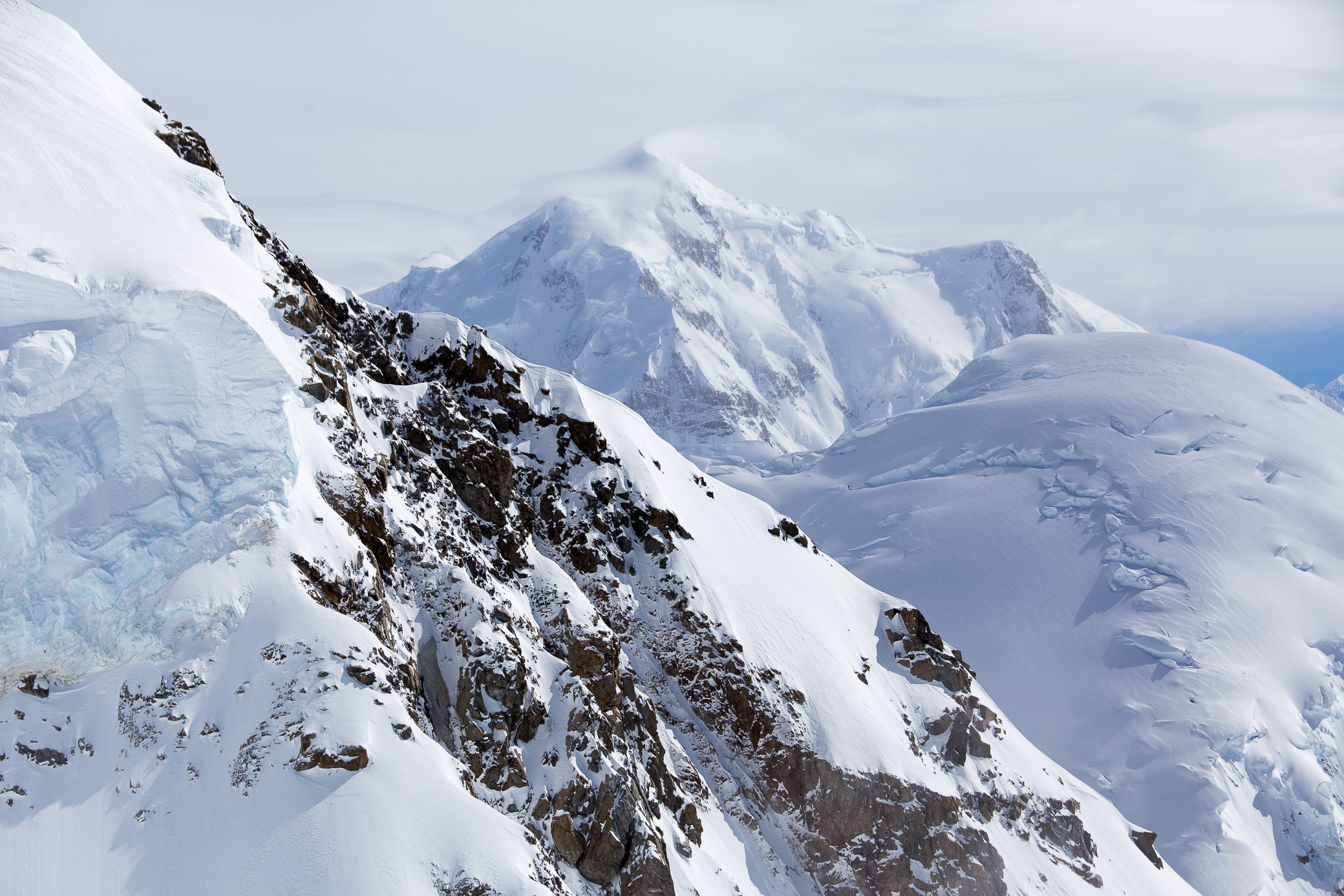
The mighty Alaska Range in all its beauty. It reminded me of Antarctica with how crisp and pristine the atmosphere was and how far you can see, easily over a 100km out.

By the time I got back down to Camp 14k, my buddy had luckily arrived.
Day 7, June 3 — Rest day
Rest day for both of us. The forecast seemed favorable for just a day (though at this point we learned not to trust it extensively, it changes too damn quickly) so we made plans of trying to summit from this camp the following day rather than moving to the higher one. Sure, it would be a long push with 2,000m of elevation gain, but we both felt ready and we’d need just 1 day of good weather vs 3 that are normally needed to move to Camp 17k — one each to move up, reach the top, and come back down.
After dinner at 7pm we were just about to part ways for a 4am wake up call when we saw two fellow climbers from the US who had started the expedition on the same day as us. They were just coming back down from an attempt on summit, having only reached Camp 17k. Despite the good forecast, above it the winds were close to 60kmh (40mph) with a cold windchill — no one had even attempted getting to the top that day. The forecast (they give a new one at 8pm each night) was the same for the following day so rather than an early wake up and summit push, we decided to talk to the rangers in the morning and decide on a strategy then.
I did wake up at 4am (you sleep very lightly at this altitude) as my tent was shaking from the gusts of wind. We probably wouldn’t have gone up even if we hadn’t talked to those guys.
Day 8, June 4 – Rest day
Yet another rest day. One has to be patient with big mountains, as frustrating as it can be to just sit and wait. Here’s a good song to help.
The winds I felt at 4am persisted until maybe 10-11am. And then they suddenly died down and what proceeded was the calmest day I’d seen on the mountain. Boy were we annoyed at this! It would have been the perfect opportunity to attempt the summit, but starting this late in the day for what would have been a 16-20 hour up and down journey did not seem like a good idea. In hindsight, we should have probably gone for it..
Rather than sitting around all day, we decided to go to the nearby “end of the world” — perhaps the most incredible viewpoint on the mountain. As I mentioned, by then the weather had calmed down and offered us this amazing vista.

Mount Hunter (4,442m / 14,573ft) which we’re pretty much level with.

At 8pm we huddled anxiously around the radio and heard what we were hoping for — a decent forecast, can’t ask for much more. The next day it was.
Day 9, June 5 — Summit attempt day
Camp 14k (4,330m / 14,200ft) – ~5,940m/19,500ft — 17h return
The four of us (the two American guys joined in) started early, leaving camp around 4.50am. It was -18C, a crisp morning and good for climbing so you don’t overheat. We found a decent pace and within 2.5hrs had climbed the Headwall. This was taken at 6am with my iPhone, at the bottom of the fixed lines on the Headwall.

As soon as we got over the ridge, it got windy and much colder. We put on layers and proceeded up. This is a water and snack break at around 5,100m (16,700ft).

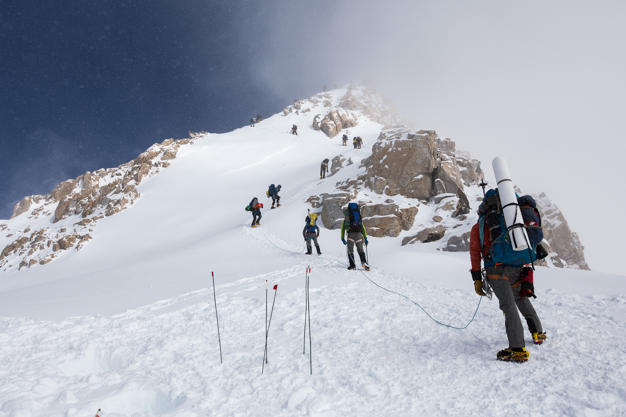
We got to Camp 17k (5,200m) around 9.20am, but already saw a bunch of groups getting ready for what seemed like a good day. We needed to melt some water though (and add some layers and foot/hand warmers as wind was picking up) which at this altitude took an hour or so. By the time we left camp to head up the Autobahn it was already crowded — just what we were hoping to avoid.

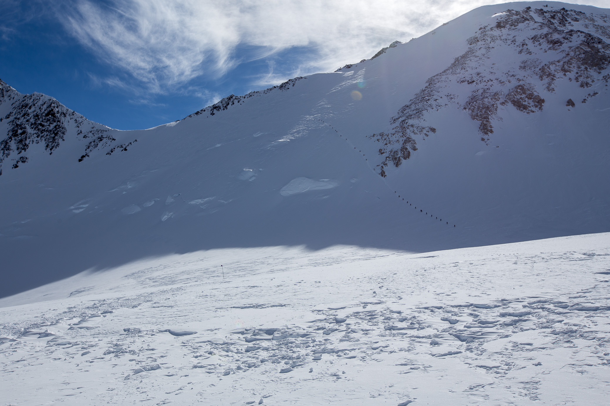
This is what’s known as the Autobahn — perhaps the last big semi-technical challenge before the summit with around 300m of elevation gain. Once you get over the ridge at the Denali pass it’s mostly just walking, the summit is off frame towards the right. As you can see, it’s a single-line climb up and people are roped up — safer, but also slower. Not sure if you can quite tell, but it can get steep, people fall here each year and there have been fatalities. At this point we were slightly frustrated with losing over an hour with the water melting so my partner did not want to rope up and we proceeded up. This meant we can be slightly faster than most climbers and within maybe an hour, we were mid way through the Autobahn.
The above was the last image I took that day. Despite looking promising there (and having had a good forecast), just as we got to the midway point all of a sudden clouds rolled in and it started snowing, with visibility dropping to maybe 20m at most. On top of that, there were reports for an electrical storm near the top (a couple of people from groups ahead had felt it, radioing in) and all guided parties started coming down. You can imagine the logistics of groups passing each other on this very narrow “path” took a lot of time. We kept hearing it’s too unpredictable from guides moving down. We were faced with a choice — go down with the 95% of people or move up. I felt uncertain about this and suggested going down together (we had roped up as the snow hit us), but he was determined to try so he proceeded to move up on his own.
I waited for all groups to pass me in the hopes that the weather will turn for the better, but in the end began following the last guys down. Using their footsteps was helpful as snow was covering the tracks quickly. About maybe an hour / hour and a half after the initial snow, yet again the conditions changed and showed signs of clearing up. Visibility had increased and the sun was peeking through the clouds. I looked up towards the ridge and there were maybe 15-20 guys still there. After some deliberation I decided to go back up again, wishing that the weather would remain stable for a change.
Within an hour I reached Denali pass (5,550m / 18,200ft) where I asked a couple of guides how long it normally takes groups to summit from here. They said 6 hours one-way which I knew I could do faster as I was still feeling quite strong. I quickly overtook all groups and not long after caught up with my partner. At around 5pm and 5,900-something meters though the weather turned again. Clouds covered the sun and I could see the snow being blown off the summit (which was so tantalizingly close!) — a sure sign that winds were strong over there. A person coming down from the top told me it was another at least 2 hours from that point and that it wasn’t nice up there. I waited for my partner who was a little ways behind and urged him for us to go down again. A 15min argument ensued as he was determined to try again, but my gut feeling was that this wasn’t the day. Moreover, I was afraid for him as we’d already been walking for 12 hours, he had little water left, and his hands were cold (I gave him my remaining hand warmers, it was at least -20°C/-4°F). Despite my best attempts to go down together, he climbed on and I set down on my own.
It took me maybe 5 hours to go back down to Camp 14k. It was not pleasant — winds did pick up as I thought, reaching maybe 80km/h, which made my solo descent on the Autobahn and the technical section between Camp 17k and the Headwall super tricky. Visibility was low and my mask kept freezing up so I couldn’t see well, getting my footing right in these conditions was a challenge. And with no protection, I had to be extra careful. There were a couple of instances where I slipped and had to arrest myself with the ice axe, now that gets your heart going… On top of that, I kept thinking about my friend and what I thought could be a fatal decision if the weather was even worse up towards the top. I was back at camp around 9.30pm and managed to just melt some water before crashing in my tent.
Around 2am, I heard my partner’s voice outside. He was ok, though he hadn’t reached the top…
Days 10-11, June 6-7 — Rest day & go back down overnight
Camp 14k (4,330m / 14,200ft) – Base Camp (2,190m / 7,200ft) — 9h
I woke up the next morning with the distinct feeling my expedition was done. Despite the others’ (the guys from the US hadn’t gone past the Autobahn the day before) attempts to convince me to try again, I decided it was time to head back out. The prospect of another potential solo descent and the emotional drain of the previous day took their toll. I rested during the day, packed my bags and headed overnight (safer when it comes to crossing a glacier unroped) back to Base Camp where I got a fight back to Talkeetna.
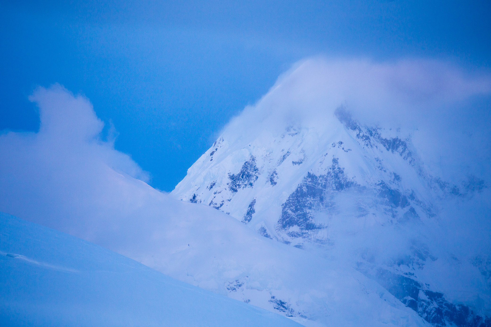
I was rewarded with the calmest and best conditions yet — literally no wind, firm snow (safer and easier to walk on), not too cold or too warm. It was almost completely silent and I was alone for most of the night (I use the term loosely here as it never gets dark, as mentioned), which is an incredible feeling. I remember thinking it was payoff for the unstable conditions on the previous days — shame we couldn’t get those on our summit attempt 🙂 The photo below was taken around 11pm.

Just below Camp 11k, the last rays were hitting the surround peaks.

I was once again reminded of Antarctica.

Crevasses and seracs.

Kingdom of ice and fire.
Quite the night.
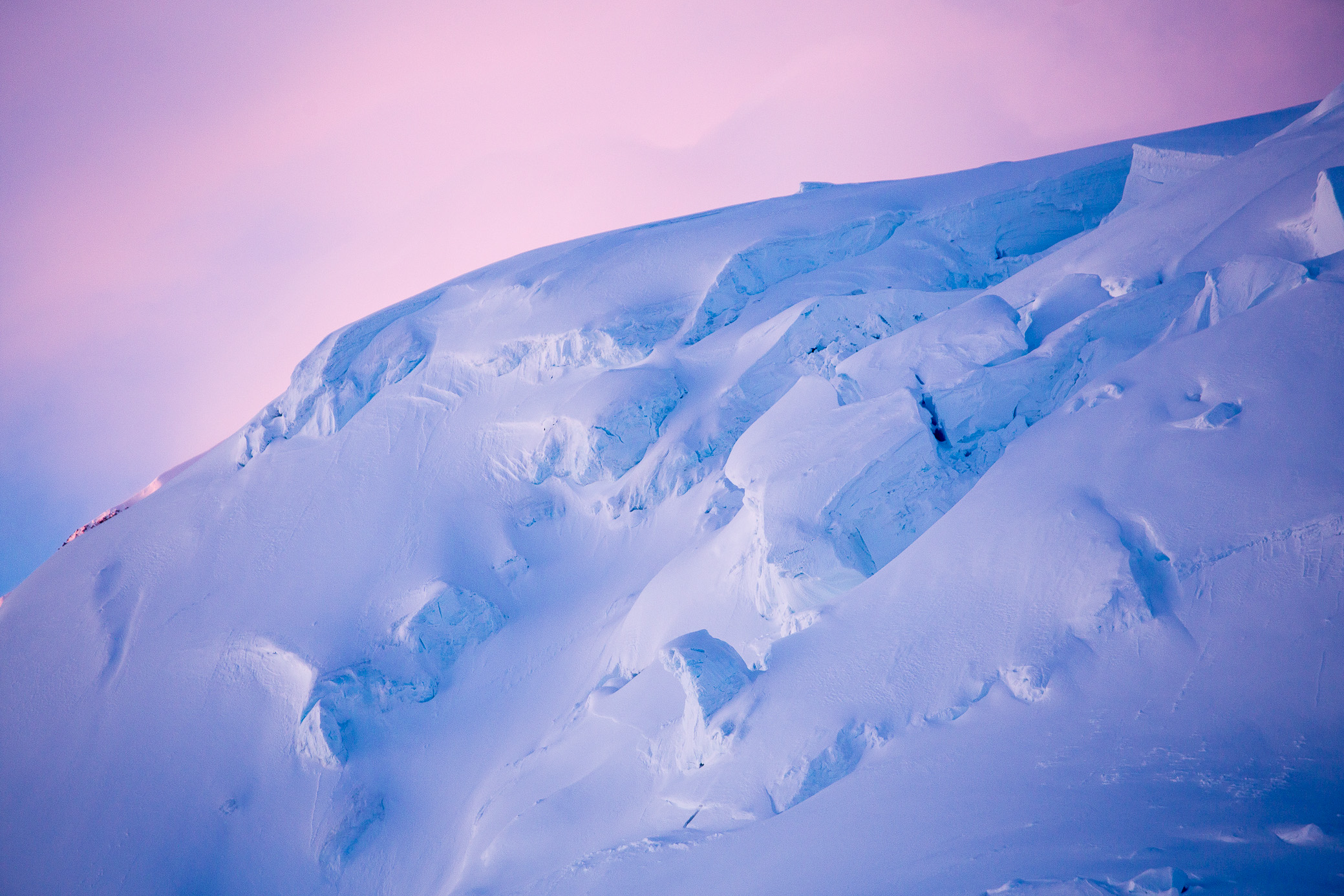
At around 4am, this happened.

The sky was somehow even more colorful than the night before.

The pink/purple-ish colors were just what I needed to keep going after not having slept for over 20 hours at this point.

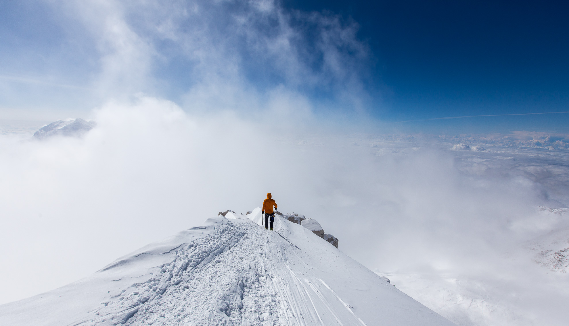
One final look at Denali in all its glory. Look at it, so irritatingly calm! 🙂 I had reached the ridge almost dead center in the photo, just at those rocks to the left of the long stretch of snow before the summit. So close, yet not quite there.

*****
So you’d be right to think why didn’t I try again? I was certainly physically ready, had enough energy, food and fuel. I was faster and stronger than most climbers around. The forecast was promising for the coming days and moving to the higher camp to start early and avoid the crowds would have given us good odds, as good as anyone can ask in this fickle mountain. I could have made it.
But I was mentally done after genuinely believing for 10 hours that my climbing partner was gone. That’s what my mind was predominantly preoccupied with on my way down and while laying in my tent until he came down at 2am. It might sound strange (it does even to me, writing this now a week later), but I’d even started dreadfully considering how I’d need to deliver the news to his family and friends. It was not a pleasant state of mind to be in and I felt drained.
Ultimately I learned more from this unsuccessful summit attempt than had I gone back and climbed it. Reaching the top would have been great indeed, but potentially it would have come at the cost of significant risks. And there’s a limit to those that I’m willing to take it seems — I pushed my luck one too many times, without being given the choice to do so on my own terms. Summiting is optional, but getting back down is mandatory.
Will I try it again one day? No idea. Time will tell, I suppose.
ps. My partner went back and tried again 2 days later in much better conditions. He made it, along with the two American guys.

Great post 🙂
Quite intriguing, thanks for this virtual trip 🙂
You are most welcome.
I enjoyed reading your account of the trip. You are a very talented photographer. It was great to meet you up on the mountain – you have a place to stay if your travels ever bring you to Colorado.
Same for you in Bulgaria, Eric. Congrats on making it to the summit! 🙂
The photos you captured here are wonderful. They are absolutely breathtaking! I really do hope you try to summit again. It seems like you’re determined and more than capable of doing so. The second time around will be easier, too, I imagine. You already know what it will take. Best of luck to you and your travels. Thanks for sharing!
Thanks for the words of encouragement, Taylor! 🙂
Hey Hristo, great that you are back coz you were wise enough to know (and admit/respect) your human limits in this particular moment! It takes courage to be so true to yourself, to your gut feeling and to the draining emotional experience related to your partner. As Thomas Huber and other wise climbers and mountaineers say: You need to know when to go down in order to climb up. I strongly recommend you the chapter that Thomas Huber has written in Messner’s book: The Murder of the Impossible – we have the Bulgarian edition dedicated to Boyan Petrov. An excellent read. Keep up the spirit, the fitness and the wisdom! (while the next right moment comes 🙂 – it sure will! Just keep on listening to your intuition and carefully read the signs along the way). It was a pleasure to read your honest, humble and sunny post. Thank you!
Appreciate the kind words and thoughtful advice, Mariya! 🙂
Hey,
I really enjoyed reading your adventures especially climbing mountains.
Very nice blog and pictures!